Ingleside in San Patricio County, Texas — The American South (West South Central)
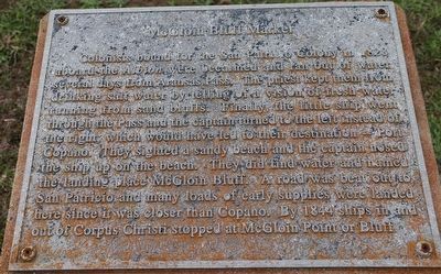
McGloin Bluff Marker
Colonists bound for the San Patricio Colony in 1828 aboard the Albion were becalmed and ran out of water several days from Aransas Pass. The priest kept them from drinking salt water by telling of a vision of fresh water running from sand bluffs. Finally, the little ship went through the Pass and the captain turned to the left instead of the right, which would have led to their destination Port Copano. They sighted a sandy beach and the captain nosed the ship up on the beach. They did find water and named the landing place McGloin Bluff. A road was beat out to San Patricio and many loads of early supplies were landed here since it was closer than Copano. By 1844 ships in and out of Corpus Christi stopped at McGloin Point or Bluff.
Topics. This historical marker is listed in these topic lists: Settlements & Settlers • Waterways & Vessels. A significant historical year for this entry is 1828.
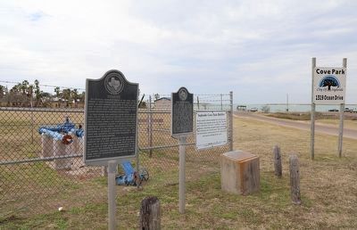
Location. 27° 50.258′ N, 97° 13.15′ W. Marker is in Ingleside, Texas, in San Patricio County. Marker is on South Main Street. Touch for map. Marker is at or near this postal address: 1297 S Main St, Ingleside TX 78362, United States of America. Touch for directions.
Other nearby markers. At least 8 other markers are within 7 miles of this marker, measured as the crow flies. Early Ingleside Schools (here, next to this marker); Ingleside (here, next to this marker); Late Pleistocene Ingleside Fauna (approx. 2.7 miles away); First United Methodist Church (approx. 6.1 miles away); Aransas Pass First Baptist Church (approx. 6.2 miles away); Terminal Railroad (approx. 6.4 miles away); Great Land Lottery of Aransas Pass (approx. 6.6 miles away); VFW (approx. 6.6 miles away). Touch for a list and map of all markers in Ingleside.
Credits. This page was last revised on December 21, 2022. It was originally submitted on December 13, 2022, by Dave W of Co, Colorado. This page has been viewed 112 times since then and 28 times this year. Photos: 1, 2. submitted on December 13, 2022, by Dave W of Co, Colorado. • J. Makali Bruton was the editor who published this page.

