Lloydminster, Alberta — Canada’s Prairie Region (North America)
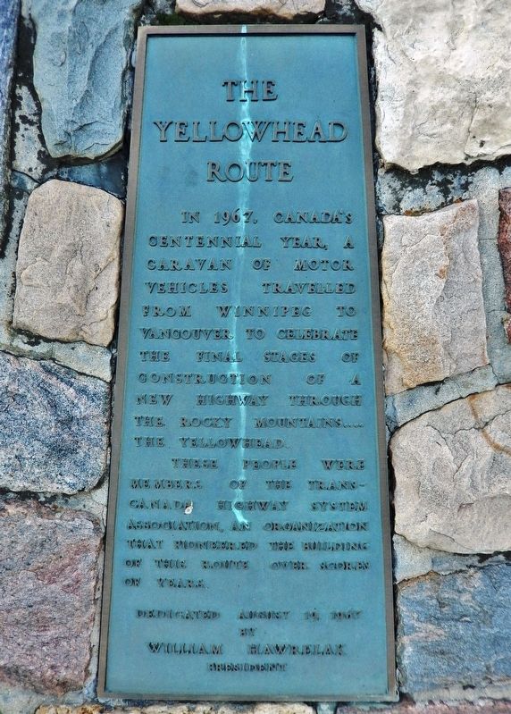
The Yellowhead Route
In 1967, Canada’s centennial year, a caravan of motor vehicles travelled from Winnipeg to Vancouver to celebrate the final stages of construction of a new highway through the Rocky Mountains… the Yellowhead.
These people were members of the Trans-Canada Highway System Association, an organization that pioneered the building of this route over scores of years.
by
William Hawrelak
President
Erected 1967 by Trans-Canada Highway System Association.
Topics. This historical marker is listed in this topic list: Roads & Vehicles. A significant historical date for this entry is August 19, 1967.
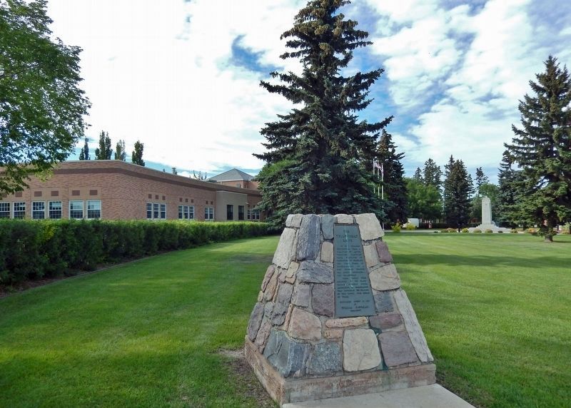
Location. 53° 16.702′ N, 110° 0.358′ W. Marker is in Lloydminster, Alberta. Marker is at the intersection of Meridian Avenue (50 Avenue) (Provincial Highway 17) and Yellowhead Highway (Ray Nelson Drive) (Provincial Highway 16), on the right when traveling south on Meridian Avenue (50 Avenue). Marker is located near the southeast corner of the Lloydminster City Hall grounds. Touch for map. Marker is at or near this postal address: 4420 50 Avenue, Lloydminster AB T9V 0W2, Canada. Touch for directions.
Other nearby markers. At least 1 other marker is within walking distance of this marker. City Hall (within shouting distance of this marker).
More about this marker. Meridian Avenue (50 Avenue) (Provincial Highway 17) marks the east/west provincial boundary between Alberta and Saskatchewan at this latitude. The boundary line bisects the city of Lloydminster, which is incorporated by both provinces as a single city with a single municipal administration. This marker is located about 20 yards into the Alberta side the provincial boundary.
Also see . . .
1. Yellowhead Highway.
The Yellowhead Highway is a major interprovincial highway in Western Canada that runs from Winnipeg to Graham Island off the coast of British Columbia via Saskatoon and Edmonton. It stretches across the four western Canadian provinces of British Columbia, Alberta, Saskatchewan, and Manitoba and is part of the Trans-Canada Highway system and the larger National Highway System.(Submitted on December 13, 2022, by Cosmos Mariner of Cape Canaveral, Florida.)The highway is named for the Yellowhead Pass, the route chosen to cross the Canadian Rockies. The pass and the highway are named after a fur trader and explorer named Pierre Bostonais. He had yellow streaks in his hair and was nicknamed "Tęte Jaune" (Yellowhead). Almost the entire length of the highway is numbered as 16, except for the section in Manitoba that is concurrent with Trans-Canada Highway 1.
2. Welcome to the TransCanada Yellowhead Highway Association
.
What was originally a fur traders route for the Hudson's Bay Company in the early 1800’s has grown to be a significant trade corridor. With the advent of motorized transportation the visionaries of the time began a journey and organization that for over 60 years has remained committed to its mandate and its members. The Trans Canada Yellowhead Highway Association is a four province, non profit association established in 1947 to advocate for the development, maintenance, use and prosperity of the Yellowhead Corridor.(Submitted on December 13, 2022, by Cosmos Mariner of Cape Canaveral, Florida.)
3. Lloydminster History and Heritage.
The Lloydminster area was first settled in 1903 – situated astride the fourth Meridian. When the provinces of Alberta and Saskatchewan were created in 1905 and the fourth Meridian selected as the inter-provincial boundary, the Village of Lloydminster was split in two. The Alberta portion of the divided community was incorporated as a Village in Alberta on July 6, 1906, while the Saskatchewan portion was incorporated as a Town in Saskatchewan in April, 1907. The two communities were amalgamated into a single municipality – the Town of Lloydminster – on May 20, 1930.(Submitted on December 13, 2022, by Cosmos Mariner of Cape Canaveral, Florida.)
Credits. This page was last revised on December 13, 2022. It was originally submitted on December 13, 2022, by Cosmos Mariner of Cape Canaveral, Florida. This page has been viewed 111 times since then and 29 times this year. Photos: 1, 2. submitted on December 13, 2022, by Cosmos Mariner of Cape Canaveral, Florida.

