Near Mineola in Montgomery County, Missouri — The American Midwest (Upper Plains)
Archaeology of the Cave
Excavations
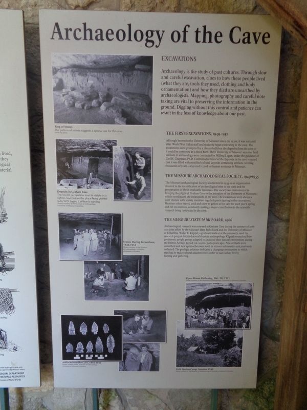
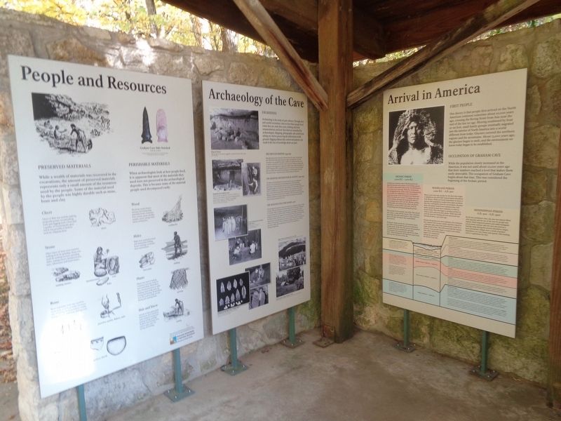
Archaeology is the study of past cultures. Through slow and careful excavation, clues to how these people lived (what they ate, tools they used, clothing and body ornamentation) and how they died are unearthed by archaeologists. Mapping, photography and careful note taking are vital to preserving the information in the ground. Digging without this control and patience can result in the loss of knowledge about our past.
The First Excavations, 1949-1951
Although known to the University of Missouri since the 1930s, it was not until after World War II that staff and students began excavating in the cave. The excavations were prompted by a plan to bulldoze the deposits from the cave so it could be converted to a stock barn. Three University of Missouri summer field sessions in archaeology were conducted by Wilfred Logan, under the guidance of Carl H. Chapman, Ph.D. Controlled removal of the deposits in the cave revealed that it was filled with stratified cultural deposits containing artifacts covering thousands of years - a layered record on human existence in Missouri.
The Missouri Archaeological Society, 1949-1955
The Missouri Archaeological Society was formed in 1935 as an organization devoted to the identification of archaeological sites in the state and the preservation of these invaluable resources. The society was instrumental in bringing the plight of Graham Cave to the attention of the University of Missouri, which coordinated the excavations in the cave. The excavations were always a joint venture with society members regularly participating in the excavations. Members often braved cold and snow to gather at the cave for each year's spring and fall excavations, constantly making a major contribution to the scientific research being conduced in the cave.
The Missouri State Park Board, 1966
Archaeological research was renewed at Graham Cave during the summer of 1966 as a joint effort by the Missouri State Park Board and the University of Missouri at Columbia. Walter E. Klippel, a graduate student at the university, used the research project for his doctoral thesis in anthropology. Klippel researched how prehistoric people groups adapted to and used their natural environment during the Dalton-Archaic period (ca. 10,000-3,000 years ago). New artifacts were unearthed and new approaches were used to recover information not previously collected. The geological evidence indicated a changing environment to which man had to make cultural adjustments in order to successfully live by hunting and gathering.
Topics. This historical marker is listed in this topic list: Anthropology & Archaeology. A significant historical year for this entry is 1935.
Location. 38° 54.259′ N, 91° 34.483′ W. Marker is near Mineola, Missouri, in Montgomery County. Marker can be reached from Missouri Route TT. Marker can be found at a shelter located next to a large parking lot at the south end of Graham Cave State Park grounds. Touch for map. Marker is in this post office area: Montgomery City MO 63361, United States of America. Touch for directions.
Other nearby markers. At least 8 other markers are within 10 miles of this marker, measured as the crow flies. Exploring the Past (here, next to this marker); Danville Female Academy (approx. 2.2 miles away); The Historic Boonslick Region (approx. 2.2 miles away); Montgomery City Veterans Memorial (approx. 5.8 miles away); Montgomery County War Memorial (approx. 6.4 miles away); Davault Tavern - 1828 (approx. 6.6 miles away); Gateway to the Boone's Lick (approx. 6.9 miles away); Lewiston - 1826 (approx. 9.4 miles away).
Credits. This page was last revised on December 21, 2022. It was originally submitted on December 20, 2022, by Jason Voigt of Glen Carbon, Illinois. This page has been viewed 125 times since then and 21 times this year. Photos: 1, 2, 3. submitted on December 20, 2022, by Jason Voigt of Glen Carbon, Illinois.


