New Richmond in St. Croix County, Wisconsin — The American Midwest (Great Lakes)
New Richmond Cyclone
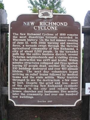
Photographed by Keith L, July 21, 2009
1. New Richmond Cyclone Marker
Erected 1997 by the Wisconsin Historical Society. (Marker Number 357.)
Topics and series. This historical marker is listed in this topic list: Disasters.
this page online
Location. 45° 6.509′ N, 92° 32.292′ W. Marker is in New Richmond, Wisconsin, in St. Croix County. It is on Campus Drive 0.1 miles south of Homestead Drive, on the left when traveling south. Touch for map. Marker is in this post office area: New Richmond WI 54017, United States of America. Touch for directions.

Regionally, this marker is in the Twin Cities Metropolitan Area and in Western Wisconsin. It is also in the American Midwest and in the Corn Belt. Globally, it is in North America, the Western Hemisphere, the Western World, and the Anglosphere. Historically, it finds itself in what was once the territory of the Mississippian Culture and also the Northwest Territory.
Other nearby markers. At least 8 other markers are within walking distance of this marker: New Richmond Heritage Center (approx. 0.2 miles away); Bell-Tierney Farmhouse (approx. 0.2 miles away); Heritage Cemetery (approx. 0.2 miles away); Heritage Church (approx. 0.2 miles away); Northside House (approx. 0.2 miles away); Paperjack Creek
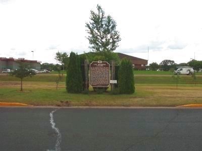
Photographed by Keith L, July 21, 2009
2. New Richmond Cyclone Marker
Also see . . . 1899 New Richmond tornado. (Submitted on July 31, 2009.)
Credits. This page was last revised on October 27, 2020. It was originally submitted on July 31, 2009, by Keith L of Wisconsin Rapids, Wisconsin. This page has been viewed 3,143 times since then and 109 times this year. Photos: 1, 2. submitted on July 31, 2009, by Keith L of Wisconsin Rapids, Wisconsin. • Craig Swain was the editor who published this page.
