Kirkwood in Alpine County, California — The American West (Pacific Coastal)
Naming of Carson Pass
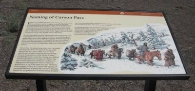
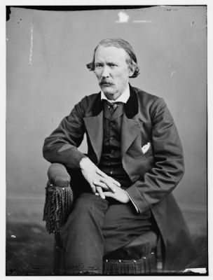
On this expedition, Fremont was charged with mapping the land, recording the flora and fauna, the elevations and evaluating the quality of land. Along with the mapping, Fremont would give names to plants and rivers. He changed the name of the Mary’s River to Humbolt River and named the river flowing east out of the mountains through Hope Valley for his friend Kit Carson.
Carson Pass was named many years later – probably due to the fact that a tree stood in the pass with the carving “Kit Carson 1844”. It is not likely that Carson carved his name on that tree during Fremont’s Expedition in 1844. Weeks of heavy snowfall that winter made the crossing very difficult and the expedition was running out of food. Any man in those desperate conditions would not be digging down through 20 or 30 feet of snow to ground level to carve his name on a tree. However, in the summer of 1853, Kit Carson with a group of men and 6500 head of sheep did come over this pass headed for the gold fields to sell their sheep. Could it have been then that Carson took the time to carve his name on the tree but dated it back to 1844 when he was first here?
An American Indian directed the Fremont group to cross the mountains at this location. This had been a major Indian trading route for 5,000 to 10,000 years. Today, Carson Pass carries hundreds of cars on a daily trek over the mountain.
Erected by Oregon & California Trails Association CA/NV Chapter, El Dorado National Forest and National Park Service.
Topics and series. This historical marker is listed in these topic lists: Exploration • Notable Places • Roads & Vehicles. In addition, it is included in the California Trail series list. A significant historical month for this entry is February 1844.
Location. 38° 41.58′ N, 119° 59.28′ W. Marker is in Kirkwood, California, in Alpine County. Marker is at the intersection of The "Additional Parking" Road and Carson Pass Scenic Byway (California Highway 88) on The "Additional Parking" Road. Touch for map. Marker is in this post office area: Kit Carson CA 95644, United States of America. Touch for directions.
Other nearby markers. At least 8 other markers are within 4 miles of this marker, measured as the crow flies. Memorial to Pioneer Odd Fellows (about 300 feet away, measured in a direct line); Carson Trail - Ascent to Carson Pass (about 300 feet away); Snowshoe Thom(p)son (about 400 feet away); Kit Carson (about 400 feet away); First Summit (about 700 feet away); The Emigrant Trail (approx. 0.2 miles away); Summer Retreat (approx. 3.1 miles away); Caples Lake (approx. 3.7 miles away). Touch for a list and map of all markers in Kirkwood.
Also see . . . Carson Pass History. Eldorado National Forest Interpretive Association entry (Submitted on September 27, 2020, by Larry Gertner of New York, New York.)
Additional commentary.
1. Frémont's Final Assault
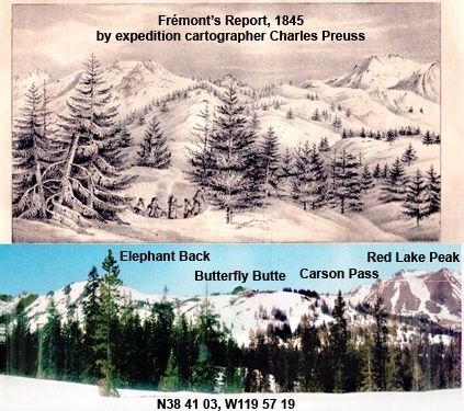
Frémont's final assault on the pass on February 20, 1844 was up the flanks of Red Lake Peak to the 9,000' level, which put him on the contour level of Little Roundtop Ridge. Three days of travel along that almost due north route brought him to a descent to the South Fork of the American River near today's Strawberry. He crossed the pass south to north; not east to west as the 1848 Mormon Route which later became called "Carson Pass."
— Submitted March 21, 2011, by Bob Graham of Sacramento, California.
Credits. This page was last revised on September 27, 2020. It was originally submitted on July 31, 2009, by Syd Whittle of Mesa, Arizona. This page has been viewed 2,306 times since then and 45 times this year. Photos: 1, 2, 3. submitted on July 31, 2009, by Syd Whittle of Mesa, Arizona. 4. submitted on March 21, 2011, by Bob Graham of Sacramento, California. 5. submitted on July 31, 2009, by Syd Whittle of Mesa, Arizona.
