Schuylkill Banks in Philadelphia in Philadelphia County, Pennsylvania — The American Northeast (Mid-Atlantic)
Wharves
along the Schuylkill
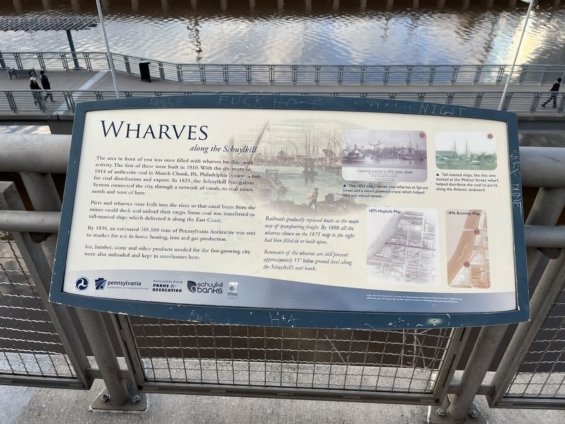
In the area in front of you was once filled with wharves bustling with activity. The first of these were built in 1810. With the discovery in 1814 of anthracite coal in Mauch Chunk, PA, Philadelphia became a hub for coal distribution and export. In 1825, the Schuylkill Navigation System connected the city, through a network of canals, to coal mines north and west of here.
Piers and wharves were built into the river so that canal boats from the mines could dock and unload their cargo. Some coal was transferred to tall-masted ships which delivered it along the East Coast.
By 1838, an estimated 300,000 tons of Pennsylvania Anthracite was sent to market for use in home heating, iron and gas production.
Ice, lumber, stone and other products needed for the fast-growing city were also unloaded and kept in storehouses here.
Railroads gradually replaced boats as the way of transporting freight. By 1896 all the wharves shown on the 1875 map to the right had been filled-in or built upon.
Remnants of the wharves are still present approximately 15' below ground level along the Schuylkill's east bank.
[Captions:]
This 1853 image shows coal wharves at Spruce Street and a steam powered crane which helped load and unload vessles.
Tall-masted ships, like this one docked at the Walnut Street wharf, helped distribute the coal to ports along the Atlantic seaboard.
Erected by U.S. Department of Transportation; Pennsylvania Department of Transportation; Philadelphia Parks & Recreation; Schuylkill Banks; Friends of Schuylkill River Park.
Topics. This historical marker is listed in these topic lists: Industry & Commerce • Natural Resources • Waterways & Vessels. A significant historical year for this entry is 1810.
Location. 39° 56.969′ N, 75° 10.956′ W. Marker is in Philadelphia, Pennsylvania, in Philadelphia County. It is in Schuylkill Banks. Marker is on Schuylkill River Trail south of Locust Street, on the right when traveling south. Touch for map. Marker is in this post office area: Philadelphia PA 19103, United States of America. Touch for directions.
Other nearby markers. At least 8 other markers are within walking distance of this marker. Industry (within shouting distance of this marker); Schuylkill Expressway (within shouting distance of this marker); Schuylkill River Park (about 400 feet away, measured in a direct line); a different marker also named Schuylkill River Park (about 400 feet away); Creating the Greenway (about 600 feet away); Schuylkill Veterans Memorial (about 600 feet away); Schuylkill Pocket Veterans Memorial Field
Credits. This page was last revised on February 2, 2023. It was originally submitted on December 22, 2022, by Devry Becker Jones of Washington, District of Columbia. This page has been viewed 64 times since then and 12 times this year. Photos: 1, 2. submitted on December 22, 2022, by Devry Becker Jones of Washington, District of Columbia.

