Ocracoke in Hyde County, North Carolina — The American South (South Atlantic)
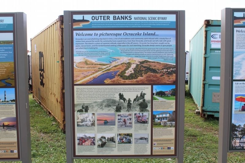
Welcome to picturesque Ocracoke Island…
— Outer Banks National Scenic Byway —
Ocracoke is an overwhelming step back in time, a mix of old traditions and community spirit infused with a steady flow of visitors from around the world. No community loves a good story more than Ocracoke, and locals can tell a tale with great expression. The island is a place of supreme solitude, especially in the off-season. Ocracoke has long been sought out by poets, nature lovers, and the tenderhearted seeking a little space for soul-searching. Ocracoke always seems to give people just what they are looking for.
Ocracoke can only be reached by ferry, private plane or private boat. The entire island, except for the village, is part of the Cape Hatteras National Seashore and remains as an undeveloped barrier island.
Ocracoke was originally called Pilot Town for good reason. The south end of the island, along with the north end of Portsmouth Island, was the gateway to Ocracoke Inlet, a key shipping point in colonial history. The earliest colonial inhabitants were mariners charged with piloting vessels en route to mainland ports or with “lighting” cargo from large schooners to smaller freight boats that could better navigate the shallow waters of Pamlico Sound.
Visitors can observe Ocracoke’s famous horses at the Pony Pen located about 6.5 miles from the Hatteras Inlet ferry terminal on the west side of Highway 12. These horses descended from Spanish mustangs washed ashore in shipwrecks of the 16th and 17th centuries. Many roamed wild, and islanders rounded up the herds in corrals every 4th of July for gelding, branding, and breaking. It was a beloved social event. For generations, the horses served as transportation for islanders and were used to pull cards and for beach patrol at lifesaving stations. In 1954, Ocracoke Boy Scout troop 290 began the nation’s only mounted scout troop. The National Park Service assumed care of the horses in 1959 after the island road was paved to protect them from traffic.
(captions)
Photo Source: Ocracoke Preservation society. Photo by Martha McMillan Roberts, Standard Oil (New Jersey) Collection SONJ 8076.3. Archives and Special Collection, University of Louisville, http://louisville.edu/library/archives
Guiding duck hunters and charter fishing the expansive Pamlico Sound and nearby Gulf Stream has been a way of life for generations on Ocracoke. Several islanders continue to serve as guides or captains for vacationers who seek the remote island location. Unknown photographer, courtesy Tradewinds
The Ocracoke Working Watermen’s Association (OWWA) hosts an Oyster Roast & Shrimp Steam Fundraiser each year in late December. Locals and visitors alike feast on steamed oysters
and shrimp, fried drum, ad homemade hush puppies. Founded in 2006, the OWWA works to raise awareness and preserve the livelihoods of fishermen, clammers, crabbers, and oystermen who call Ocracoke home. Dylan Ray
Islanders moved from subsistence fishing to commercialization fishing after World War II. In recent years, commercial fishing has become more regulated. This has shifted may fishermen away from full-time fishing. However, there are some local fishermen who continue their heritage and provide fresh, local fish to area restaurants and fish houses. Melinda Fodrie Sutton
The mailboat Aleta carried mail, passengers, and groceries between Ocracoke Island and Atlantic in Carteret County during the 1940s and ‘50s. It was a vital link in coastal communication and a round trip could take up to 10 hours. Photograph from the book “Ocracoke Album” by Jack Dudley
Poster featuring images of Ocracoke’s Mounted Boy Scout Troop 290 designed by Candice Cobb. Candice Cobb
During World War II, English ships and seamen helped patrol the American coast. In May 1942, the British HMT Bedfordshire was struck by a torpedo from a German U-boat. All sailors perished. The four bodies washed ashore were buried in a plot donated to Britain by the people of Ocracoke. A Memorial Ceremony is held each May to commemomte this loss. Lillie Chadwick Miller
The Ocracoke Independence Day Celebration is a treasured community event and represents the strong social connections forged on the island. Fireworks, bonfires, square dancing, fig cakes, a sand sculpture contest, and a parade featuring decorated golf carts, cars, and boats are highlights ot the festivities. Melinda Fodrie Sutton
The first Hatteras-Ocracoke ferry beqan in 1950 with Hatteras native Frazier Peele who built a wooden deck on a shad boat to accommodate a car. Later, he increased capacity to 3 or 4 vehicles at $5 each. Due to the shallow sound waters, often the ferry could not reach shore, so vehicles would disembark and drive through several inches of salt water to reach dry land. In 1957, the State of North Carolina purchased Peele's ferry and began a free ferry service. Ocracoke Preservation Society Dey Collection
Ocracoke Lighthouse
The main landmark and focal point for the island community is the stark white Ocracoke Lighthouse. Just seventy-five feet tall, the lighthouse has stood since 1823 and is the second-oldest operating lighthouse in the country. It burns a stationary, nonblinking beam. The 8,000-candlepower light, once fueled by oil, is now automated and lit by a bulb that can be held in one hand. The light station and grounds are accessible via Lighthouse Road and the lighthouse
is not open for climbing. Susan M. Mason
Past, present, and future
Ocracokers are deeply proud of the history of this little island which is preserved and shared at the Ocracoke Preservation Society Museum near the Cedar Island and Swan Quarter ferry terminal in the village. The Museum is located in the David Williams House. Williams was the first Chief of the US Lifesaving Station. The Museum provides information on cultural ties that bind the community together today, including an array of events throughout the tourist season. Ocracoke Preservation Society Dey Collection
The Outer Banks National Scenic Byway
The Outer Banks National Scenic Byway traverses one of the nation's great coastal landscapes. Tidal marshes, wind-swept dunes, lonesome beaches and beautiful sounds line the 138-mile route. Two national seashores are home to four lighthouses. Two national wildlife refuges highlight the region's rich biological diversity. You are invited to experience the maritime heritage of 21 traditional villages and communities.
Erected by Federal Highway Administration National Scenic Byways Program; Dare, Hyde, and Carteret Counties; Dare County Tourism Board.
Topics and series. This historical marker is listed in this topic list: Notable Places . In addition, it is included in the Outer Banks National Scenic Byway series list.
Location. 35° 6.981′ N, 75° 59.226′ W. Marker is in Ocracoke, North Carolina, in Hyde County. Marker is on Pilottown Circle north of State Highway 12, on the right when traveling south. Touch for map. Marker is at or near this postal address: 130 Pilottown Circle, Ocracoke NC 27960, United States of America. Touch for directions.
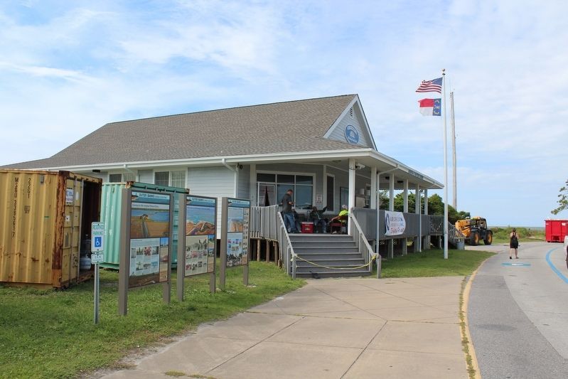
Other nearby markers. At least 8 other markers are within walking distance of this marker. Journey to the original Down East… (here, next to this marker); Harboring Change (about 400 feet away, measured in a direct line); Fort Ocracoke (about 500 feet away); Lt. Robert Maynard (about 500 feet away); USRC Mercury (about 600 feet away); Late 19th Century Cistern (about 700 feet away); Welcome to Ocracoke… (about 700 feet away); Ocracoke Windmills (about 700 feet away). Touch for a list and map of all markers in Ocracoke.
Credits. This page was last revised on December 25, 2022. It was originally submitted on December 10, 2022, by Tom Bosse of Jefferson City, Tennessee. This page has been viewed 126 times since then and 10 times this year. Last updated on December 25, 2022, by Tom Bosse of Jefferson City, Tennessee. Photos: 1, 2, 3, 4. submitted on December 10, 2022, by Tom Bosse of Jefferson City, Tennessee. • Andrew Ruppenstein was the editor who published this page.


