Marshallberg in Carteret County, North Carolina — The American South (South Atlantic)
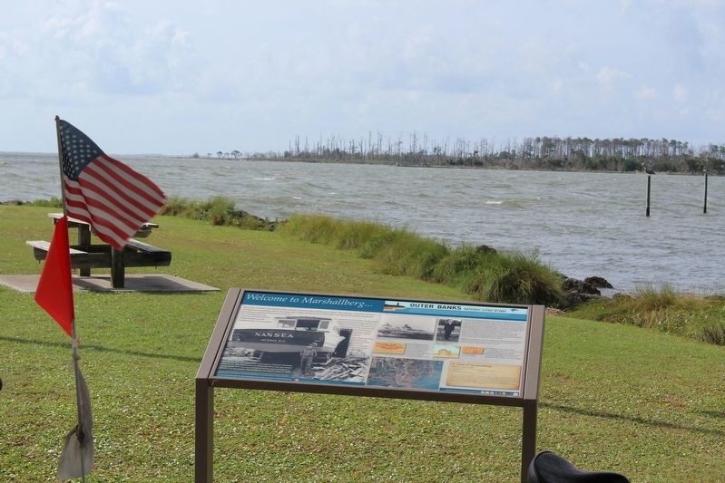
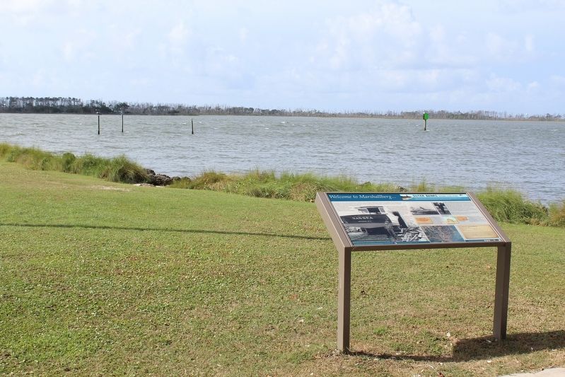
Welcome to Marshallberg…
| — | The Outer Banks National Scenic Byway | — |

Photographed by Tom Bosse, September 21, 2021
1. Welcome to Marshallberg… Marker
To support that fishing fleet, boatbuilding has been a longstanding tradition on Marshallberg. M.W. Willis & Sons at one time employed boatbuilders from across Down East to meet the demand for a growing number of finely crafted vessels.
“The Albatross” fleet of Hatteras are among their best known and most recognized Core Sound style watercraft.
The Straits was the most used waterway in Colonial maritime commerce. This importance to shipping led to the two oldest settlements (not towns) in Carteret County being located in Straits and Gloucester. Marshallberg was settled later in 1800.
Marshallberg’s history remains closely tied to the commercial fishing industry of Down East. Today Marshallberg Harbor is home port for a very active fleet of shrimpers and fishermen.
Captain
this page online
Captain Fred and his crew earned themselves a permanent place in history by performing the very first rescue operation of the newly formed United States Coast Guard.
Marshallberg, like many of the communities Down East, was home to a theater where young people gathered on weekends. Many came by boats, others by ox and cart, to enjoy the silent screen at Lyric Theater.
(captions)
Ray Davis was the patriarch of the fishing and boatbuilding Davis family who have built both commercial and recreational crafts for four generations | Davis Famiy Photo, CSWM&HC Collection
Cape Lookout Lifesaving and USCG Station, 1917 | US Coast Guard Archives
Century Fish Co. Tag | Gail Cannon Collection
US Coast Guard Captain Fred Gillikin, 100 years old | CSWM&HC Collection
Lyric Theater ticket | Gail Cannon Collection
A Taste of Marshallberg…
Stewed Hard Crabs
1 dozen large hard crabs (cleaned and halved)
4 strips fat back
1 cup scallions (chopped)
2 bay leaves
1 tbsp salt
2 heaping tbsp corn starch
Pick the meat from the crab claws and hold out for the gravy
Fry out the fat back in a large pot, then remove from pot. Saute scallions in the grease, stirring continually until they are wilted but not brown. Add about ½ gallon water, put in bay leaves and salt. Bring to a rolling boil. Add crabs and bring back to a boil. Cook for 5 minutes, no longer. Remove crabs to a large serving bowl. Make the gravy in the same pot. Put the 2 heaping tablespoons of corn starch in a small bowl and add just enough water to make a loose paste, so the mixture will pour. Add to the large pot while continually stirring. Add your picked claw meat to the gravy. Salt and pepper to taste. Will feed 14 ding batters or 2 Harkers islanders!
Jenny Williamson
The Outer Banks National Scenic Byway
The Outer Banks National Scenic Byway traverses one of the nation's great coastal landscapes. Tidal marshes, wind-swept dunes, lonesome beaches and beautiful sounds line the 138-mile route. Two national seashores are home to four lighthouses. Two national wildlife refuges highlight the region's rich biological diversity. You are invited to experience the maritime heritage of 21 traditional villages and communities.
Erected by Federal
Photographed by Tom Bosse, September 21, 2021
2. Welcome to Marshallberg… Marker
Topics and series. This historical marker is listed in this topic list: Notable Places. In addition, it is included in the Outer Banks National Scenic Byway series list. A significant historical date for this entry is January 28, 1915.
Location. 34° 43.144′ N, 76° 31.189′ W. Marker is in Marshallberg, North Carolina, in Carteret County. It can be reached from Marshallberg Road south of Woody Road, on the right when traveling south. Marker is located at the Marshallberg Picnic Area. Touch for map. Marker is at or near this postal address: 1295 Marshallberg Rd, Marshallberg NC 28553, United States of America. Touch for directions.

Regionally, this marker is in the Coastal Plain and on the Crystal Coast. It is also in the American South, specifically in the Upper South, in the Tidewater, and on the Eastern Seaboard. Globally, it is in the North Atlantic Region, North America, the Western Hemisphere, the Western World, and the Anglosphere. Historically, it finds itself in what was once the territory of the Mississippian Culture,
Photographed by Tom Bosse, September 21, 2021
3. Welcome to Marshallberg… Marker
Other nearby markers. At least 8 other markers are within 3 miles of this marker, measured as the crow flies: Marshallberg Harbor (about 800 feet away, measured in a direct line); Welcome to Gloucester… (approx. 1.3 miles away); Rain Gardens (approx. 2.2 miles away); Welcome to Straits… (approx. 2.2 miles away); Cisterns (approx. 2.3 miles away); Olive Thurlow Anchor (approx. 2.3 miles away); Harkers Island Visitor Center at Cape Lookout National Seashore (approx. 2.3 miles away); Horizon of Islands (approx. 2.4 miles away).
Credits. This page was last revised on November 7, 2024. It was originally submitted on December 25, 2022, by Tom Bosse of Jefferson City, Tennessee. This page has been viewed 1,220 times since then and 95 times this year. Photos: 1, 2, 3. submitted on December 25, 2022, by Tom Bosse of Jefferson City, Tennessee. • Bernard Fisher was the editor who published this page.
