Cape Lookout in Carteret County, North Carolina — The American South (South Atlantic)
Where Are We?
— Cape Lookout National Seashore —
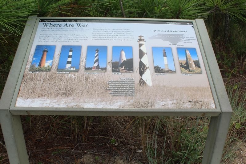
Knowing one’s position at sea is crucial. A lighthouse’s guiding light helps at night, but what about during the day? The appearance of the light—its shape, height, color, and paint pattern—can tell mariners where they are.
The paint pattern on a lighthouse is called its “daymark”. Daymarks distinguish one lighthouse from another. Compare the diamond daymark of Cape Lookout with North Carolina’s six other lights, especially Bodie Island and Cape Hatteras. If you see diamonds, you are at Cape Lookout.
(caption) Cape Lookout. The diamond-shaped daymark of Cape Lookout’s lighthouse is more functional than other daymarks. Not only does the pain pattern signify location, but the diamonds indicate direction too. White diamonds face east-west; black diamonds face north-south.
Erected by National Park Service, U.S. Department of the Interior.
Topics. This historical marker is listed in this topic list: Man-Made Features.
Location. 34° 37.39′ N, 76° 31.479′ W. Marker is in Cape Lookout, North Carolina, in Carteret County. Marker can be reached from South Core Back Road (unpaved), on the left when traveling north. Marker is located near the Lighthouse Keeper's Quarters at Cape Lookout National Seashore. Touch for map. Marker is in this post office area: Harkers Island NC 28531, United States of America. Touch for directions.
Other nearby markers. At least 8 other markers are within 5 miles of this marker, measured as the crow flies. Keep the Light Lit (a few steps from this marker); More Than a Lighthouse (about 400 feet away, measured in a direct line); Our Dilemma: Eroding Shore (about 500 feet away); Two Centuries Warning Ships (about 600 feet away); Fort Hancock (approx. 4.3 miles away); Horizon of Islands (approx. 4.3 miles away); Estuaries of the Sound (approx. 4.3 miles away); Protecting People and Ships (approx. 4.3 miles away). Touch for a list and map of all markers in Cape Lookout.
Credits. This page was last revised on December 29, 2022. It was originally submitted on December 28, 2022, by Tom Bosse of Jefferson City, Tennessee. This page has been viewed 70 times since then and 9 times this year. Photo 1. submitted on December 28, 2022, by Tom Bosse of Jefferson City, Tennessee. • Bernard Fisher was the editor who published this page.
