Phoenix in Baltimore County, Maryland — The American Northeast (Mid-Atlantic)
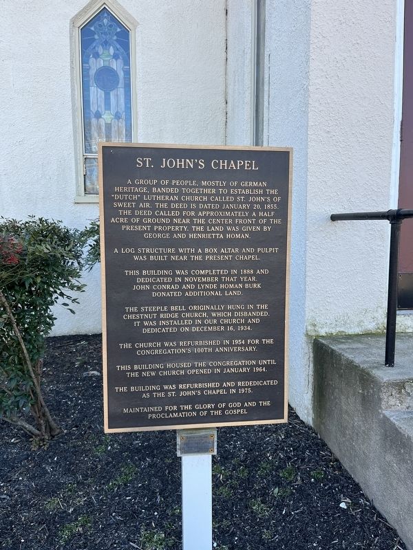
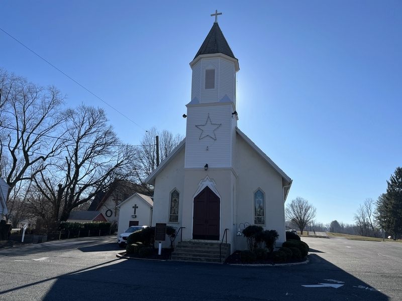
St. John's Chapel
A log structure with a box altar and pulpit was built near the present chapel.
This building was completed in 1888 and dedicated in November that year. John Conrad and Lynde Homan Burk donated additional land.
The steeple bell originally hung in the Chestnut Ridge Church, which disbanded. It was installed in our church and dedicated on December 16, 1934.
The church was refurbished in 1954 for the congregation's 100th anniversary.
This building housed the congregation until the new church opened in January 1964.
The building was refurbished and rededicated as the St. John's Chapel in 1975.
Maintained for the glory of God and the proclamation of the gospel
Topics. This historical marker is listed in these topic lists: Churches & Religion • Immigration • Settlements & Settlers. A significant historical date for this entry is January 20, 1855.
Location. 39° 30.745′ N, 76° 32.506′ W. Marker is in Phoenix, Maryland, in Baltimore County. Marker is on Sweet Air Road, on the right when traveling east. Touch for map. Marker is at or near this postal address: 3909 Sweet Air Rd, Phoenix MD 21131, United States of America. Touch for directions.
Other nearby markers. At least 8 other markers are within 4 miles of this marker, measured as the crow flies. “Quinn” (approx. 0.4 miles away); Maj. Gen. Isaac Ridgeway Trimble, C.S.A. (approx. 2.3 miles away); My Lady's Manor (approx. 3 miles away); Glen Ellen (approx. 3.1 miles away); a different marker also named My Lady’s Manor (approx. 3.3 miles away); “The Eagle’s Nest” (approx. 3.4 miles away); St. James’s (approx. 3.6 miles away); a different marker also named My Lady's Manor (approx. 3.6 miles away). Touch for a list and map of all markers in Phoenix.
Credits. This page was last revised on December 31, 2022. It was originally submitted on December 31, 2022, by Adam Margolis of Mission Viejo, California. This page has been viewed 197 times since then and 51 times this year. Photos: 1, 2, 3. submitted on December 31, 2022, by Adam Margolis of Mission Viejo, California. • Bill Pfingsten was the editor who published this page.


