Muscle Shoals in Colbert County, Alabama — The American South (East South Central)
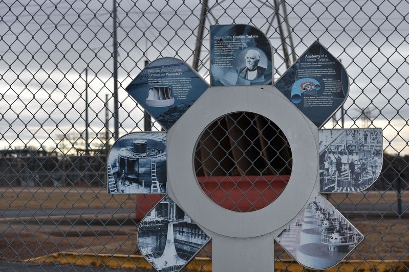
Origin of the Francis Turbine
The Francis Turbine is named for its inventor, James B. Francis, who developed the technology in 1848, while working as the head engineer of the locks and Canals Company in Lowell, Massachusetts.
Francis's design, which improved blade efficiency by 10 percent, is the most commonly used water turbine to this day.
Why are Wilson Dam's Turbines so Powerful?
Wilson Dam is the most powerful conventional dam in the TVA system. That is thanks in part to its 21 inward flow, or "Francis" turbines. These massive power-producers are masters of efficiency, able to reach up to 35,000 horsepower. And they help Wilson Dam earn the nickname "The Niagara of the South."
Anatomy of a Francis Turbine
Wilson Dam's Francis Turbines are made up of three main components:
Casing: The spiral casing around a Francis Turbine receives water flow from the dam's penstock, reducing water speed and increasing pressure as the fluid moves toward the turbine's runner blades.
Guide Vanes: Guide vanes convert the rushing water's pressure energy into momentum energy as they direct the flow of the water toward the runner blades at the proper angle.
Runner Blades: The runner blades are the most important part of any turbine. When water strikes the turbines, the force of impact causes the turbine to rotate, which is what allows the generator to produce electricity.
Topics. This historical marker is listed in these topic lists: Industry & Commerce • Waterways & Vessels. A significant historical year for this entry is 1848.
Location. 34° 47.632′ N, 87° 37.549′ W. Marker is in Muscle Shoals, Alabama, in Colbert County. Marker is on Wilson Overlook, 0.1 miles north of Reservation Road, on the left when traveling north. From the Wilson Dams Visitor Center at the Powers House, take the sidewalk behind the fence to end of the walkway. The sign is next to the fence facing the Tennessee River. Touch for map. Marker is at or near this postal address: 1062 Rock Pile Rd, Muscle Shoals AL 35661, United States of America. Touch for directions.
Other nearby markers. At least 8 other markers are within walking distance of this marker. How Does Wilson Dam Work? (a few steps from this marker); Wilson Dam and the TVA System (a few steps from this marker); TVA Goes to War (about 300 feet away, measured in a direct line); TVA: Our Enduring Mission/Powering Prosperity (about 300 feet away); TVA: A History of Progress and Innovation / A Valley of Hardships (about 300 feet away); Building a New Future (about 300 feet away); Natural and Cultural Preservation/Protecting Resources (about 300 feet away); Wilson Dam: Setting the Stage (about 300 feet away). Touch for a list and map of all markers in Muscle Shoals.
Credits. This page was last revised on January 3, 2023. It was originally submitted on January 2, 2023, by Sandra Hughes Tidwell of Killen, Alabama, USA. This page has been viewed 217 times since then and 59 times this year. Photo 1. submitted on January 2, 2023, by Sandra Hughes Tidwell of Killen, Alabama, USA. • Devry Becker Jones was the editor who published this page.
