Sulphur Springs in DeKalb County, Alabama — The American South (East South Central)
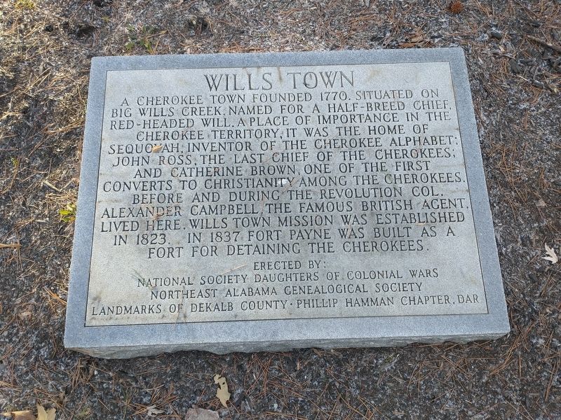
Wills Town
Erected by National Society Daughters Of Colonial Wars; Northeast Alabama Genealogical Society; Landmarks Of Dekalb County Phillip Hamman Chapter, DAR.
Topics and series. This historical marker is listed in these topic lists: Churches & Religion • Forts and Castles • Native Americans • Settlements & Settlers. In addition, it is included in the Daughters of Colonial Wars, and the Daughters of the American Revolution series lists. A significant historical year for this entry is 1770.
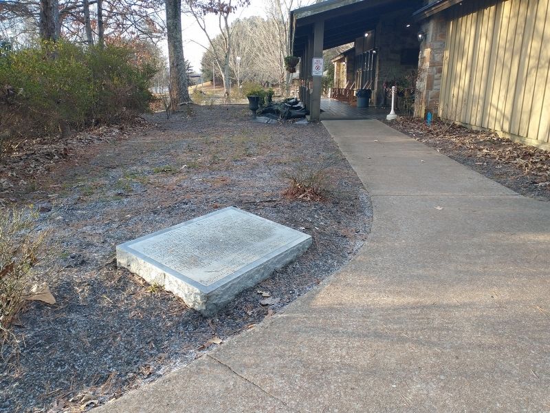
Location. 34° 42.476′ N, 85° 33.612′ W. Marker is in Sulphur Springs, Alabama, in DeKalb County. Marker can be reached from Interstate 59, one mile north of County Road 140, on the right when traveling south. Touch for map. Marker is in this post office area: Valley Head AL 35989, United States of America. Touch for directions.
Other nearby markers. At least 8 other markers are within 9 miles of this marker, measured as the crow flies. The De Soto Trail (within shouting distance of this marker); a different marker also named The De Soto Trail (within shouting distance of this marker); POW-MIA Memorial (within shouting distance of this marker); Veterans Memorial (within shouting distance of this marker); Nisbet Plantation (approx. 2.3 miles away in Georgia); The Road to Chickamauga (approx. 6.3 miles away); Cureton Plantation (approx. 6.4 miles away in Georgia); Flat Rock High School (approx. 8.7 miles away). Touch for a list and map of all markers in Sulphur Springs.
Additional commentary.
1. About the language use on the marker
The use of the offensive term for a person of multiple heritages (half-breed) is taken verbatim from the marker and does not necessarily reflect the views of the contributor nor the editor.
— Submitted January 4, 2023, by Devry Becker Jones of Washington, District of Columbia.
Credits. This page was last revised on March 21, 2023. It was originally submitted on January 3, 2023, by Craig Doda of Napoleon, Ohio. This page has been viewed 281 times since then and 95 times this year. Photos: 1, 2. submitted on January 3, 2023, by Craig Doda of Napoleon, Ohio. • Devry Becker Jones was the editor who published this page.

