Midtown in San Antonio in Bexar County, Texas — The American South (West South Central)
Polo Field
Captions
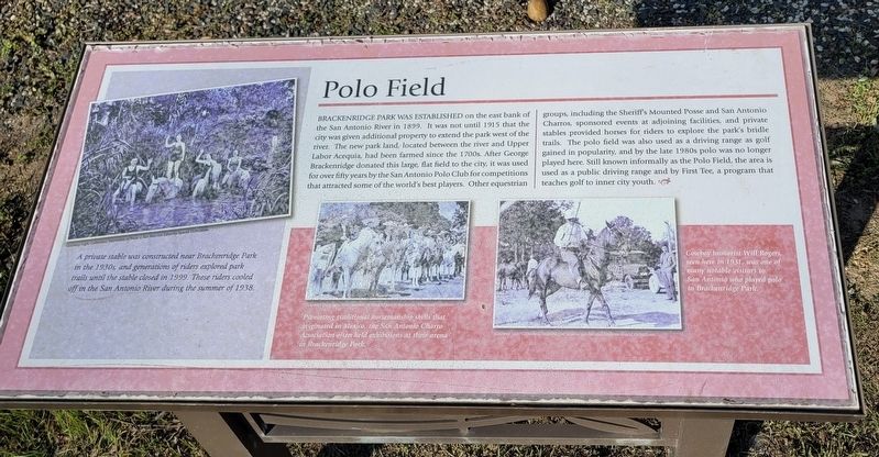
Left: A private stable was constructed near Brackenridge Park in the 1930s, and generations of riders explored park trails until the stable closed in 1999. These riders cooled off in the San Antonio River during the summer of 1938.
Lower Middle: Promoting traditional horsemanship skills that originated in Mexico, the San Antonio Charro Association often held exhibitions at their arena in Brackenridge Park.
Lower Right: Cowboy humorist Will Rogers, seen here in 1931, was one of many notable visitors to San Antonio who played polo in Brackenridge Park.
Courtesy: Light Collection, University of Texas at San Antonio Libraries Collections.
Erected by Brackenridge Park Conservancy.
Topics. This historical marker is listed in these topic lists: Parks & Recreational Areas • Sports. A significant historical year for this entry is 1899.
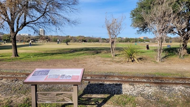
Location. 29° 27.387′ N, 98° 28.592′ W. Marker is in San Antonio, Texas, in Bexar County. It is in Midtown. Marker is at the intersection of East Mulberry Avenue and River Road, on the right when traveling west on East Mulberry Avenue. The marker is located at the First Tee of San Antonio which is in the west central section of Brackenridge Park at the golf driving range. Touch for map. Marker is at or near this postal address: 915 East Mulberry Avenue, San Antonio TX 78212, United States of America. Touch for directions.
Other nearby markers. At least 8 other markers are within walking distance of this marker. Archaeology in Brackenridge Park (about 500 feet away, measured in a direct line); Water Works Channel (about 800 feet away); Acequia de Arriba (approx. 0.2 miles away); Acequia Labor de Arriba (approx. 0.2 miles away); Upper Labor Acequia (approx. ¼ mile away); The Mexican Village (approx. ¼ mile away); Alamo Portland and Roman Cement Company (approx. 0.3 miles away); Japanese Tea Garden (approx. 0.3 miles away). Touch for a list and map of all markers in San Antonio.
Also see . . . History of the Park. Brackenridge Park Conservancy
The casual visitor to Brackenridge Park is totally unaware that the 349-acre park, with its picnic areas, ball fields, museum, zoo, and golf course, occupies some of the most historically rich land in the City of San Antonio. Traffic and pavement abound, urban congestion and noise intrude, and interpretation is virtually nil. Nothing tells the visitor that the park represents a long timeline reaching back at least 12,000 years. It is a rich tapestry of history linked by the San Antonio River that rises from springs above and in the park and flows through the park on its southerly course.(Submitted on January 4, 2023, by James Hulse of Medina, Texas.)
Credits. This page was last revised on February 2, 2023. It was originally submitted on January 3, 2023, by James Hulse of Medina, Texas. This page has been viewed 148 times since then and 59 times this year. Photos: 1, 2. submitted on January 4, 2023, by James Hulse of Medina, Texas.

