South Nashville in Davidson County, Tennessee — The American South (East South Central)
Into a Trap
A brave, and futile, attack
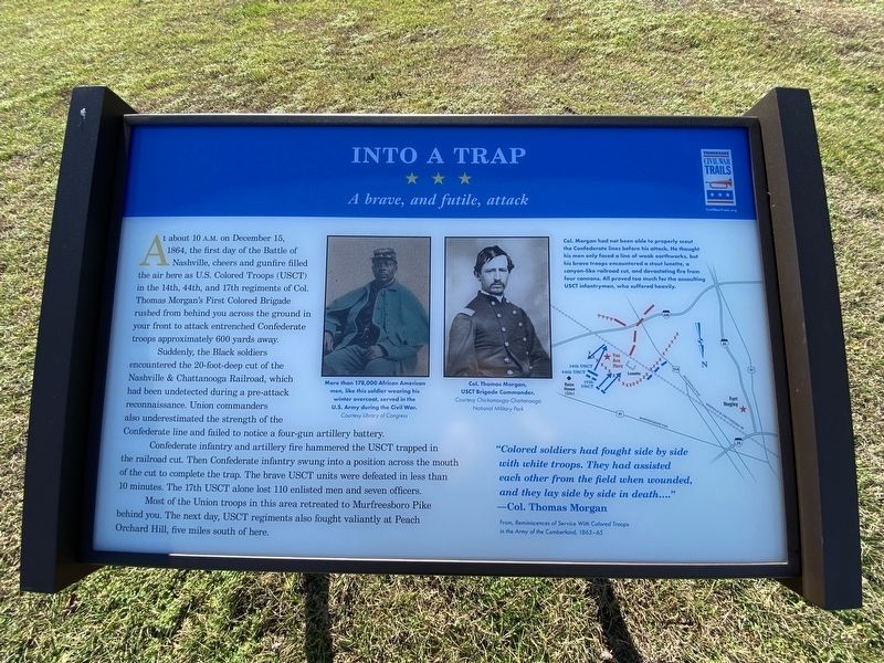
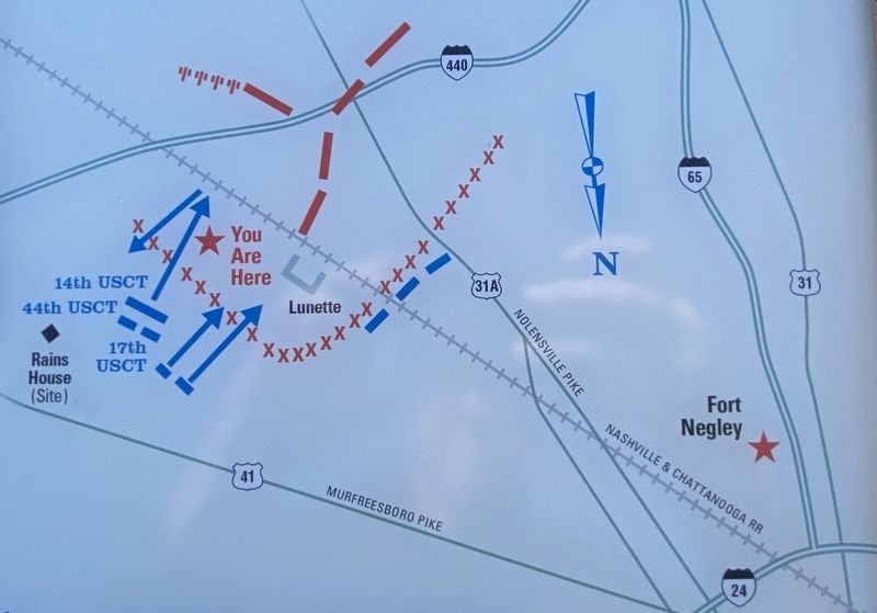
Suddenly, the Black soldiers encountered the 20-foot-deep cut of the Nashville & Chattanooga Railroad, which had been undetected during a pre-attack reconnaissance. Union commanders also underestimated the strength of the Confederate line and failed to notice a four-gun artillery battery.
Confederate infantry and artillery fire hammered the USCT trapped in the railroad cut. Then Confederate infantry swung into a position across the mouth of the cut to complete the trap. The brave USCT units were defeated in less than 10 minutes. The 17th USCT alone lost 110 enlisted men and seven officers.
Most of the Union troops in this area retreated to Murfreesboro Pike behind you. The next day, USCT regiments also fought valiantly at Peach Orchard Hill, five miles south of here.
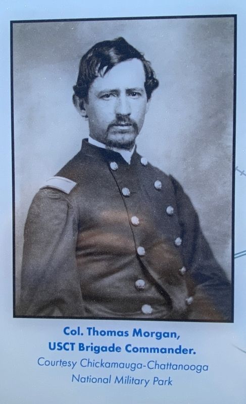
"Colored soldiers had fought side by side with white troops. They had assisted each other from the field when wounded, and they lay side by side in death..."
Col. Thomas Morgan
From, Reminiscences of Service With Colored Troops in the Army of the Cumberland, 1863-65
(captions)
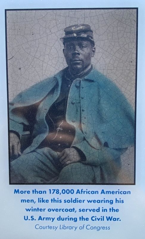
More than 178,000 African American men, like this soldier wearing his winter overcoat, served in the U.S. Army during the Civil War. Courtesy Library of Congress
Col. Thomas Morgan, USCT Brigade Commander. Courtesy Chickamauga-Chattanooga National Military Park
Col. Morgan had not been able to properly scout the Confederate lines before his attack. He thought his men only faced a line of weak earthworks, but his brave troops encountered a stout lunette, a canyon-like railroad cut and devastating fire from four cannons. All proved too much for the assaulting USCT infantrymen, who suffered heavily.
Erected by Tennessee Civil War Trails.
Topics and series. This historical marker is listed in these topic lists: African Americans • War, US Civil. In addition, it is included in the Tennessee Civil War Trails series list. A significant historical date for this entry is December 15, 1864.
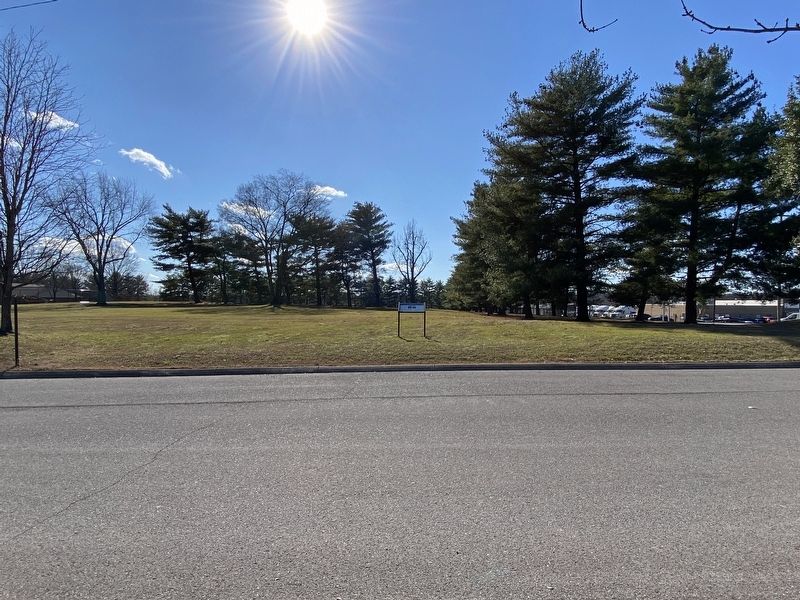
Location. 36° 7.823′ N, 86° 44.484′ W. Marker is in Nashville, Tennessee, in Davidson County. It is in South Nashville. Marker is on Foster Avenue north of Caden Drive, on the right when traveling north. Touch for map. Marker is at or near this postal address: 1252 Foster Ave, Nashville TN 37210, United States of America. Touch for directions.
Other nearby markers. At least 8 other markers are within 2 miles of this marker, measured as the crow flies. Granbury’s Lunette (approx. half a mile away); Battle of Nashville (approx. half a mile away); Cheatham’s Line (approx. 0.8 miles away); Walden College (approx. one mile away); Mount Ararat Cemetery (approx. 1.1 miles away); Woodbine (approx. 1.1 miles away); Mill Creek Baptist Church and Graveyard (approx. 1.1 miles away); Lt. Henry M. Doak (approx. 1.2 miles away). Touch for a list and map of all markers in Nashville.
Credits. This page was last revised on February 7, 2023. It was originally submitted on January 5, 2023, by Darren Jefferson Clay of Duluth, Georgia. This page has been viewed 166 times since then and 26 times this year. Photos: 1, 2, 3, 4, 5. submitted on January 5, 2023, by Darren Jefferson Clay of Duluth, Georgia. • Bernard Fisher was the editor who published this page.
