Sault Ste. Marie in Chippewa County, Michigan — The American Midwest (Great Lakes)
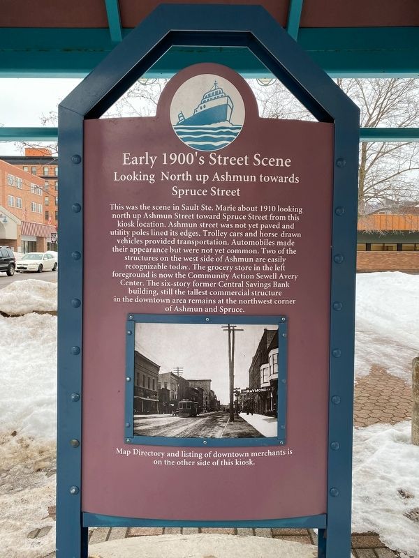
Early 1900's Street Scene
Looking North up Ashmun towards Spruce Street
Photographed by J.T. Lambrou, January 3, 2023
1. Early 1900's Street Scene Marker
Topics. This historical marker is listed in this topic list: Settlements & Settlers. A significant historical year for this entry is 1910.
Location. 46° 29.827′ N, 84° 20.889′ W. Marker is in Sault Ste. Marie, Michigan, in Chippewa County. It is on Ashmun Street (Business Route 75) near Spruce Street, on the right when traveling north. Touch for map. Marker is at or near this postal address: 523 Ashmun Street, Sault Sainte Marie MI 49783, United States of America. Touch for directions.

Regionally,
this page online
Other nearby markers. At least 8 other markers are within walking distance of this marker: Construction of the Power Canal (about 400 feet away, measured in a direct line); Central Methodist Church (about 400 feet away); War Memorial Hospital (about 500 feet away); Chippewa County Courthouse (about 600 feet away); Chippewa County Court House (approx. 0.2 miles away); Chippewa County World War II Memorial (approx. 0.2 miles away); "The Wolf of Rome" (approx. 0.2 miles away); Chippewa County Persian Gulf Memorial (approx. 0.2 miles away). Touch for a list and map of all markers in Sault Ste. Marie.

Photographed by J.T. Lambrou, January 3, 2023
2. Early 1900's Street Scene Marker

Photographed by J.T. Lambrou, January 3, 2023
3. A similar view as that described on the Marker

Photographed by J.T. Lambrou, January 3, 2023
4. Early 1900's Street Scene
Credits. This page was last revised on January 15, 2023. It was originally submitted on January 8, 2023, by J.T. Lambrou of New Boston, Michigan. This page has been viewed 227 times since then and 16 times this year. Photos: 1, 2, 3, 4. submitted on January 8, 2023, by J.T. Lambrou of New Boston, Michigan. • J. Makali Bruton was the editor who published this page.
