West Nyack in Rockland County, New York — The American Northeast (Mid-Atlantic)
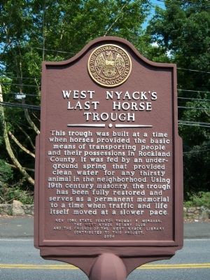
West Nyack's Last Horse Trough
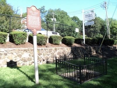
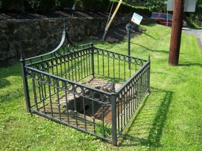
This trough was built at a time when horses provided the basic means of transporting people and their possessions in Rockland County. It was fed by an underground spring that provided clean water for any thirsty animal in the neighborhood. Using 19th Century masonry, the trough has been fully restored and serves as a permanent memorial to a time when traffic and life itself moved at a slower pace.
Erected 2004 by Historical Society of Rockland County, Sponsored by New York State Senator Thomas P. Morahan, the West Nyack Rotary Club and the Friends of the West Nyack Library.
Topics and series. This historical marker is listed in these topic lists: Animals • Man-Made Features. In addition, it is included in the Rotary International series list.
Location. 41° 5.887′ N, 73° 58.422′ W. Marker is in West Nyack, New York, in Rockland County. Marker is on Strawtown Road, on the right when traveling south. The marker is on the grounds of the West Nyack Library. Touch for map. Marker is at or near this postal address: 65 Strawtown Road, West Nyack NY 10994, United States of America. Touch for directions.
Other nearby markers. At least 8 other markers are within walking distance of this marker. The Old Parsonage (approx. ¼ mile away); West Nyack World War I Memorial (approx. ¼ mile away); Clarkstown Reformed Church (approx. ¼ mile away); Clarksville Inn (approx. 0.3 miles away); Clarksville (approx. 0.3 miles away); The Nyack Turnpike (approx. 0.4 miles away); Washington’s Encampment (approx. 0.4 miles away); Pye's Corner (approx. 0.4 miles away). Touch for a list and map of all markers in West Nyack.
Credits. This page was last revised on December 16, 2022. It was originally submitted on August 4, 2009, by Historical Society of Rockland County of New City, New York. This page has been viewed 3,375 times since then and 35 times this year. Photos: 1. submitted on August 4, 2009, by Historical Society of Rockland County of New City, New York. 2. submitted on July 5, 2011, by Bill Coughlin of Woodland Park, New Jersey. 3. submitted on August 4, 2009, by Historical Society of Rockland County of New City, New York. • Bill Pfingsten was the editor who published this page.


