Langdon in Cavalier County, North Dakota — The American Midwest (Upper Plains)
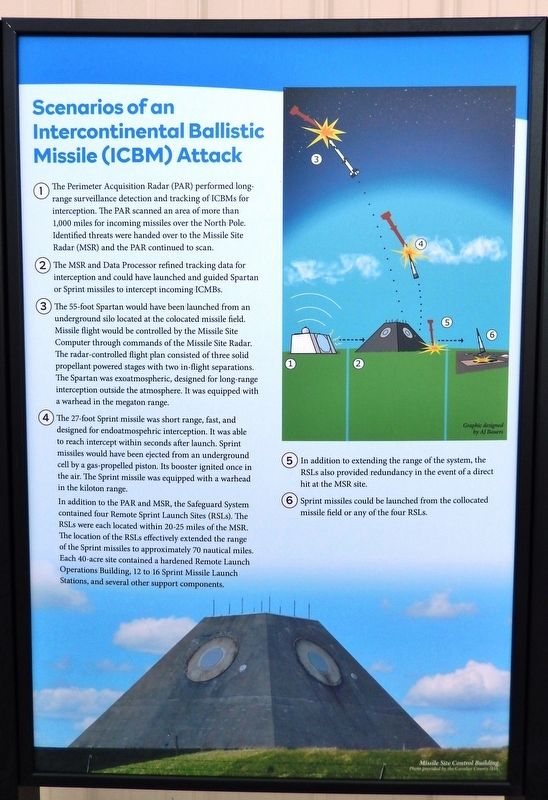
Scenarios of an Intercontinental Missile (ICBM) Attack
Pyramids on the Prairie
Inscription.
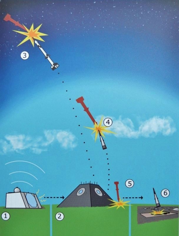
1 • The Perimeter Acquisition Radar (PAR) performed long-range surveillance detection and tracking of ICBMs for interception. The PAR scanned an area of more than 1,000 miles for incoming missiles over the North Pole. Identified threats were handed over to the Missile Site Radar (MSR) and the PAR continued to scan.
2 • The MSR and Data Processor refined tracking data for interception and could have launched and guided Spartan or Sprint missiles to intercept incoming ICBMs.
3 • The 55-foot Spartan would have been launched from an underground silo located at the co-located missile field. Missile flight would be controlled by the Missile Site Computer through commands of the Missile Site Radar. The radar-controlled flight plan consisted of three solid propellant powered stages with two in-flight separations. The Spartan was exoatmospheric, designed for long-range interception outside the atmosphere. It was equipped with a warhead in the megaton range.
4 • The 27-foot Sprint missile was short range, fast, and designed for endoatmospehric interception. It was able to reach intercept within seconds after launch. Sprint missiles would have been ejected from an underground cell by a gas-propelled piston. Its booster ignited once in the air. The Sprint missile was equipped with a warhead in the kiloton range.
In addition to the PAR and MSR, the Safeguard System contained four Remote Sprint Launch Sites (RSLs). The RSLs were each located within 20-25 miles of the MSR. The location of the RSLs effectively extended the range of the Sprint missiles to approximately 70 nautical miles. Each 40-acre site contained a hardened Remote Launch Operations Building, 12 to 16 Sprint Missile Launch Stations, and several other support components.
5 • In addition to extending the range of the system, the RSLs also provided redundancy in the event of a direct hit at the MSR site.
6 • Sprint missiles could be launched from the co-located missile field or any of the four RSLs.
Topics. This historical marker is listed in these topic lists: Air & Space • War, Cold.
Location. 48° 45.623′ N, 98° 22.071′ W. Marker is in Langdon, North Dakota, in Cavalier County. Marker is at the intersection of 8th Avenue and 3rd Street, on the right when traveling west on 8th Avenue. Marker is located in Boyd Block Plaza. Touch for map. Marker is at or near this postal address: 801 3rd Street, Langdon ND 58249, United States of America. Touch for directions.
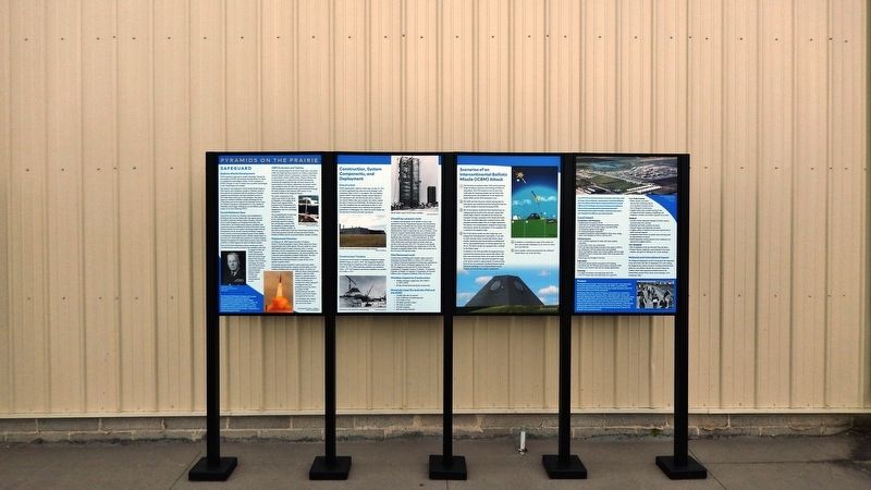
Other nearby markers. At least 8 other markers are within walking distance of this marker. Construction, System Components, and Deployment (here, next to this marker); Local Impact (here, next to this marker); Safeguard (here, next to this marker); Progress on the Prairie (here, next to this marker); Cavalier County Agriculture (here, next to this marker); Cavalier County Places (here, next to this marker); Early History (here, next to this marker); Cavalier County Timeline (here, next to this marker). Touch for a list and map of all markers in Langdon.
Related markers. Click here for a list of markers that are related to this marker.
Also see . . . Stanley R. Mickelsen Safeguard Complex (Library of Congress photo gallery).
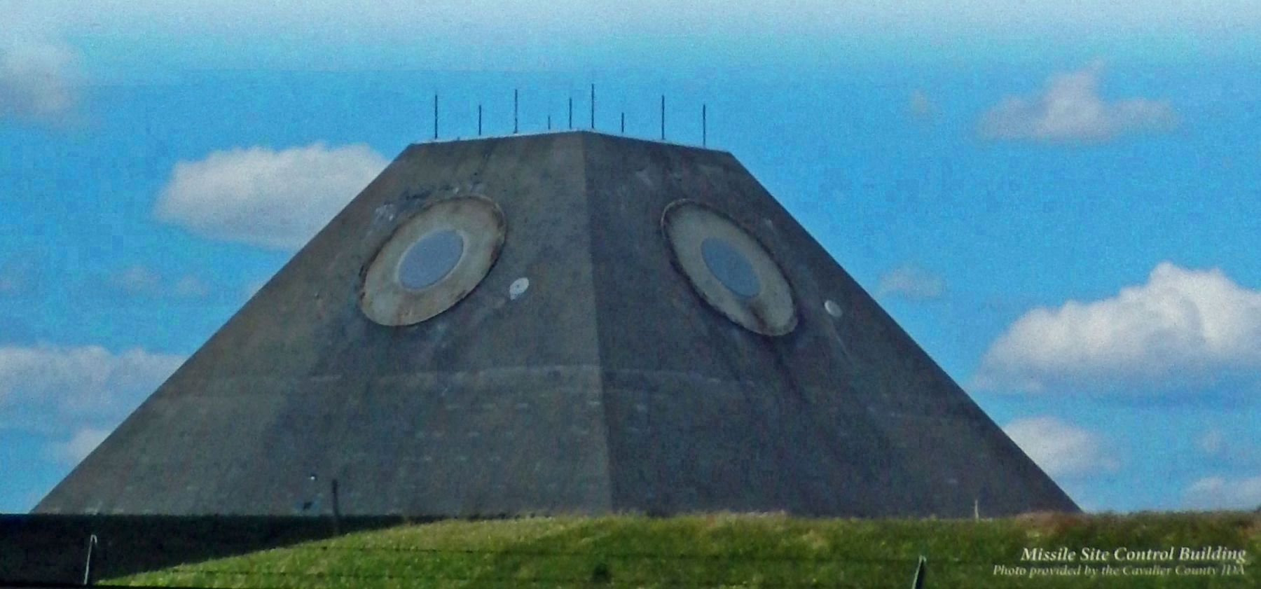
It is believed that the plans for deployment and initiation of construction of this facility were instrumental in obtaining Soviet agreement to the Anti-Ballistic Missile Treaty and a subsequent decline in Cold War hostilities between the Superpowers. This structure was nuclear hardened, that is, designed to withstand a nearby nuclear blast. Both the MSR with its data processing center and its power plant were nuclear hardened. The MSR was designed to be self-contained in case of attack. The MSR was a phased array radar, its beams were steered electronically instead of using heavy moving antennas. Rather than a large dish, this radar has thousands of small antenna built into each face. The MSR had a detection range of several hundred miles. It provided more precise, close-in target data than the PAR. The MSR was to ready interceptors (Spartan and Sprint missiles) for launch and than was to guide them to intercept. The MSR had four faces allowing it to operate against attackers from any direction.(Submitted on January 20, 2023, by Cosmos Mariner of Cape Canaveral, Florida.)
Credits. This page was last revised on January 20, 2023. It was originally submitted on January 16, 2023, by Cosmos Mariner of Cape Canaveral, Florida. This page has been viewed 86 times since then and 10 times this year. Photos: 1, 2, 3, 4, 5. submitted on January 20, 2023, by Cosmos Mariner of Cape Canaveral, Florida.
