Sault Ste. Marie in Chippewa County, Michigan — The American Midwest (Great Lakes)
Old Fort Brady

Photographed by J.T. Lambrou, January 3, 2023
1. Old Fort Brady Marker
On this site Old Fort Brady
First U.S. Army post in Michigan's upper peninsula was established in 1822
Colonel Hugh Brady, Second U.S. Infantry Commanding
Erected 1941 by City of Sault Ste. Marie, Four Citizens of Sault Ste. Marie.
Topics. This historical marker is listed in this topic list: Forts and Castles. A significant historical year for this entry is 1822.
Location. 46° 29.968′ N, 84° 20.583′ W. Marker is in Sault Ste. Marie, Michigan, in Chippewa County. It is at the intersection of East Water Street and Brady Street, on the right when traveling east on East Water Street. Touch for map. Marker is at or near this postal address: 298 East Water Street, Sault Sainte Marie MI 49783, United States of America. Touch for directions.

Regionally, this marker is on the Upper Peninsula. It is also in the American Midwest and on Lake Superior’s South Shore Region. Globally, it is in North America, in the Great North Woods, on the Great Lakes, in the Western Hemisphere, in the Western World, and in the Anglosphere. Historically, it finds itself in what was once the Viceroyalty of New France and also the Northwest
this page online
Other nearby markers. At least 8 other markers are within walking distance of this marker: Ancient Anishinaabek Burial Ground (within shouting distance of this marker); Statue of St. Mary (about 300 feet away, measured in a direct line); St. Mary's Church (about 300 feet away); Fort Brady 1850 (about 300 feet away); Fort Brady (about 400 feet away); a different marker also named Fort Brady (about 400 feet away); A Sampler of Vessels That Have Passed This Spot (about 400 feet away); "The Crane of the Sault" (about 600 feet away). Touch for a list and map of all markers in Sault Ste. Marie.
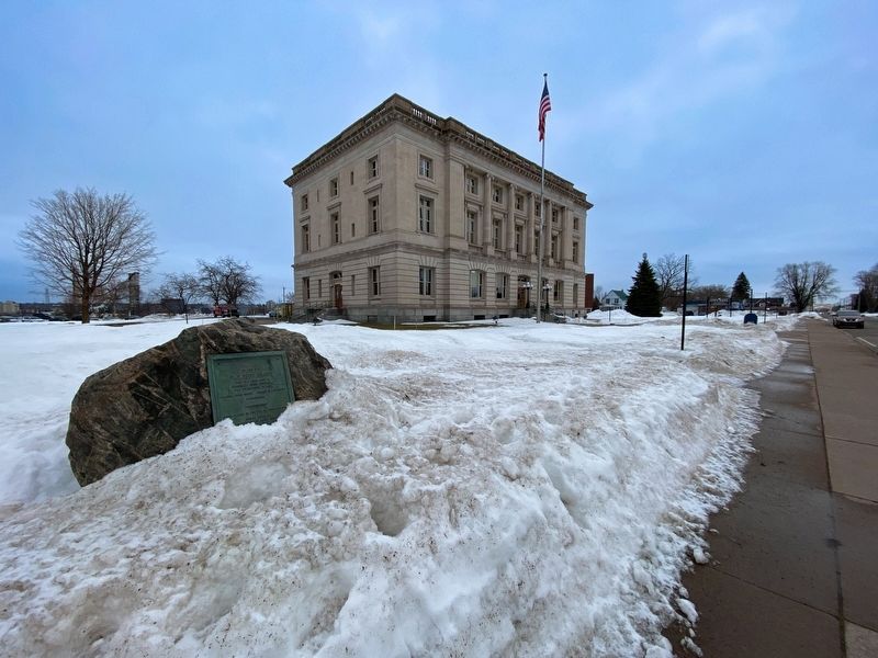
Photographed by J.T. Lambrou, January 3, 2023
2. Old Fort Brady Marker

Photographed by J.T. Lambrou, January 3, 2023
3. Old Fort Brady
This is a reconstruction of the western wall of the original fort at this location.
Credits. This page was last revised on January 21, 2023. It was originally submitted on January 17, 2023, by J.T. Lambrou of New Boston, Michigan. This page has been viewed 420 times since then and 42 times this year. Photos: 1, 2, 3. submitted on January 18, 2023, by J.T. Lambrou of New Boston, Michigan. • J. Makali Bruton was the editor who published this page.
