Near Wittenberg in Perry County, Missouri — The American Midwest (Upper Plains)
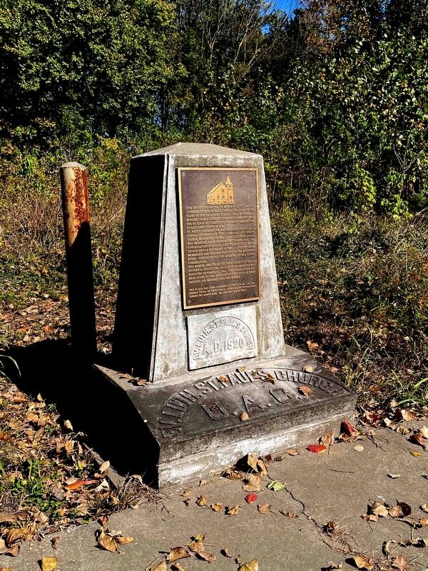
Ev. Luth. St. Paul's Church U.A.C.
Site of second house of worship of St. Paulís Lutheran Church (Missouri Synod), dedicated to the glory of God on Advent Sunday, 1920. Wittenberg, Missouri (named after Wittenberg in Germany), was one of seven settlements of the Saxon immigration to east Perry County in 1839.
St. Paulís congregation was organized in 1877 as a school-congregation (Schul-Gemeinde) of Trinity Church, Altenburg. In 1903 St. Paulís congregation was organized as an independent congregation. The congregation dissolved and its beautiful brick church edifice was razed in 1987, due to declining membership and frequent flooding of the Mississippi River. Subsequently the members joined sister congregations.
This marker, erected by the Perry County Lutheran Historical Society, Inc. of Altenburg, Missouri was dedicated November 27, 1994. The corner stone and head stone of the above mentioned edifice were salvaged and mortared into this marker.
This plaque was given in memory of the late Mr. and Mrs. Herman Thurm, by their family. Other major contributors toward this marker were: Mr. and Mrs. Gilbert Theiss.
Erected 1994 by Perry County Lutheran Historical Society, Inc. of Altenburg, Missouri.
Topics. This historical marker is listed in these topic lists: Churches & Religion • Education • Immigration • Settlements & Settlers. A significant historical year for this entry is 1920.
Location. 37° 39.483′ N, 89° 31.663′ W. Marker is near Wittenberg, Missouri, in Perry County. Marker is on Local Route 444, half a mile north of Missouri Highway A, on the right when traveling north. Touch for map. Marker is in this post office area: Frohna MO 63748, United States of America. Touch for directions.
Other nearby markers. At least 8 other markers are within 4 miles of this marker, measured as the crow flies. This Steam Locomotive (approx. 1.6 miles away in Illinois); Grand Tower (approx. 1.6 miles away in Illinois); In Memoriam (approx. 1.7 miles away in Illinois); a different marker also named The Grand Tower (approx. 2 miles away); Lewis and Clark in Illinois (approx. 2.2 miles away in Illinois); Mrs. Melissa (Mom) Hale (approx. 2.2 miles away in Illinois); World Wars Memorial (approx. 2.4 miles away in Illinois); Pastor Gotthold Heinrich Loeber (approx. 3.7 miles away).
Credits. This page was last revised on January 26, 2023. It was originally submitted on January 18, 2023, by Allen Gathman of Pocahontas, Missouri. This page has been viewed 82 times since then and 15 times this year. Photo 1. submitted on January 18, 2023, by Allen Gathman of Pocahontas, Missouri. • Devry Becker Jones was the editor who published this page.
