Tallulah in Madison Parish, Louisiana — The American South (West South Central)
Grant’s March

Photographed By Richard E. Miller, August 7, 2010
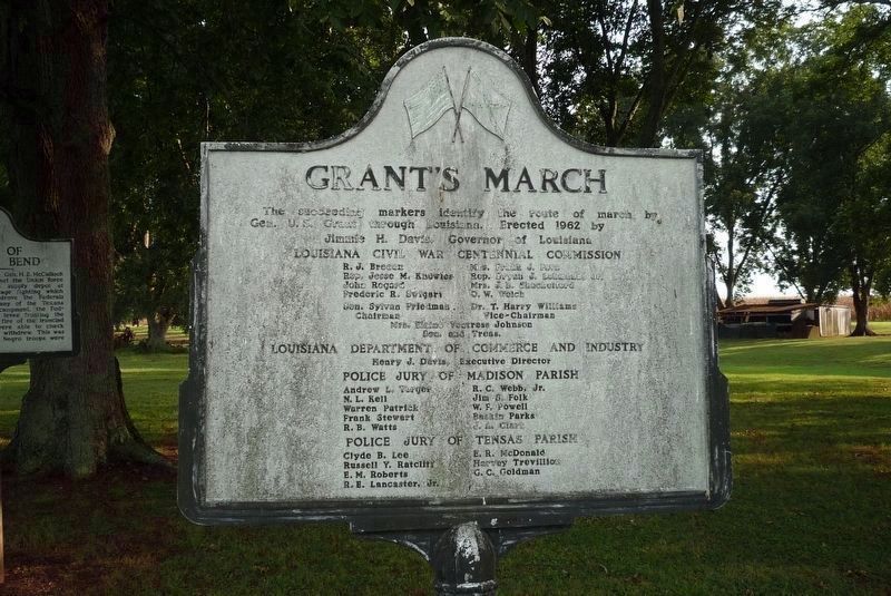
1. Grant’s March Marker
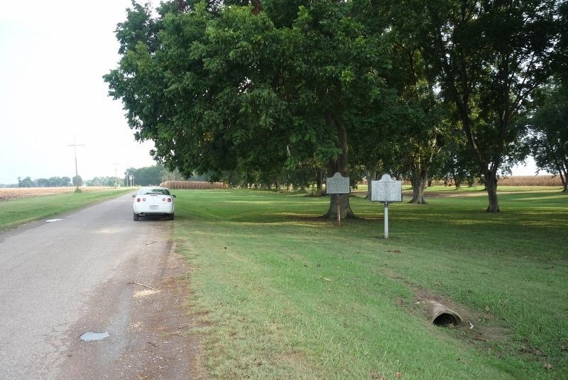
This marker announces a series of markers through Madison and Tensas Parishes that were cast in this style and erected in 1962. It was erected a few feet in front of a marker titled Battle of Milliken’s Bend.
Louisiana Civil War Centennial Commission. R. J. Breaux • Mrs. Frank J. Pava • Rep. Jesse M. Knowles • Rep. Bryan J. Lehmahn, Jr. • John Regard • Mrs. J. B. Shackelford • Frederic R. Swigart • O. W. Welch • Sen. Sylvan Friedman, Chairman • Dr. T. Harry Williams, Vice-Chairman • Mrs. Elaine Ventress Johnson, Secretary and Treasurer
Louisiana Department of Commerce and Industry. Henry J. Davis, Executive Director
Police Jury of Madison Parish. Andrew L. Yerger • R.C. Webb, Jr. • N. L. Kell • Jim B. Folk • Warren Patrick • W. F. Powell • Frank Stewart • Baskin Parks • R. B. Watts • J. A. Clark
Police Jury of Tensas Parish. Clyde B. Lee • E. R. McDonald • Russell Y. Ratcliff • Harvey Trevilliois • E. M. Roberts • G. C. Goldman • R. E. Lancaster, Jr.
Erected 1962 by Louisiana Civil War Centennial Commission.
Topics and series. This historical marker is listed in this topic list: War, US Civil. In addition, it is included in the Grant’s March Through Louisiana series list. A significant historical date for this entry is June 7, 1863.
Location. 32° 26.296′ N, 91° 7.396′ W. Marker is in Tallulah, Louisiana, in Madison Parish. Marker is at the intersection of Thomastown Road and Ashley Plantation Road, on the left when traveling north on Thomastown Road. Marker is north of I-20 and US Hwy 60 via the town of Tallulah and US 65 to Ashley Plantation Road — or via the town of Richmond and Airport Road to Thomastown Road. Touch for map. Marker is in this post office area: Tallulah LA 71282, United States of America. Touch for directions.
Other nearby markers. At least 8 other markers are within 7 miles of this marker, measured as the crow flies. Rufus "RIP" Wimberly (approx. 4.3 miles away); Madison Parish Confederate Monument (approx. 4.3 miles away); Tallulah (approx. 4.3 miles away); Schicker Mound (approx. 4.8 miles away); Scottland Plantation House (approx. 4.9 miles away); Crescent Plantation (approx. 5.3 miles away); Burning of Richmond (approx. 6.3 miles away); Skirmish at Richmond (approx. 6.3 miles away). Touch for a list and map of all markers in Tallulah.
Credits. This page was last revised on January 23, 2023. It was originally submitted on January 23, 2023, by Richard E. Miller of Oxon Hill, Maryland. This page has been viewed 135 times since then and 37 times this year. Photos: 1, 2. submitted on August 23, 2010, by Richard E. Miller of Oxon Hill, Maryland. • J. J. Prats was the editor who published this page.
