Near Ashland in Saunders County, Nebraska — The American Midwest (Upper Plains)
Native Americans in the Lower Platte Valley
Inscription.
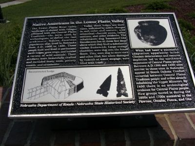
The Lower Platte River valley landscape is dotted with villages affiliated with the Central Plains Tradition—the term used by archaeologists to define the vast prehistoric Native American population that lived in Nebraska from A.D. 1000 to 1400. These people built and lived in permanent earth lodges, grew crops, and hunted a variety of wild animals. Their artifacts were beautifully crafted and included many tools, pottery vessels, and ornaments.
Today, these lodges are mere ruins, indicated by subtle changes in soil color and texture, with occasional charred posts, rafter sections, and other evidence. The inhabitants dug basement-like foundations one to three feet deep, above which they built a substantial timber framework. Large storage chambers were dug into the house floors. They were dug to store corn and other food, but when damaged by rodents or water seepage, were filled with trash.
What had been a successful adaptation apparently failed. Climatic deterioration and resource depletion led to the northward expansion of Central Plains people. Between A.D. 1300 and 1400, sites similar to those once in Nebraska appear in South Dakota. Conflict occurred between Central Plains Tradition people and tribes already inhabiting the Upper Missouri. By 1400 there is no archaeological evidence for Central Plains people. New groups moved in during the 1600s and 1700s ancestral to the Pawnee, Omaha, Ponca, and Oto.
Erected by Nebraska Department of Roads & Nebraska State Historical Society.
Topics. This historical marker is listed in this topic list: Native Americans.
Location. 41° 5.052′ N, 96° 16.526′ W. Marker is near Ashland, Nebraska, in Saunders County. Marker is on the Westbound Rest Stop (Interstate 80 at milepost 431), on the right when traveling west. Touch for map. Marker is in this post office area: Ashland NE 68003, United States of America. Touch for directions.
Other nearby markers. At least 8 other markers are within 15 miles of this marker, measured as the crow flies. Melia (a few steps from this marker); The Ox-Bow Trail (approx. 5.3 miles away); In Honor Of John McBride Belnap (approx. 5˝ miles away); Platte River (approx. 6.1 miles away); The Armour and Company Icehouse (approx. 8˝ miles away); Right Reverend Monsignor Edward J. Flanagan (approx. 14.3 miles away); Boys Town Veterans Memorial (approx. 14.3 miles away); Msgr. Edward Joseph Flanagan (approx. 14.3 miles away). Touch for a list and map of all markers in Ashland.
Additional commentary.
1.
For additional images of the area, see the related historic markers at this location. They are listed separately.
— Submitted August 23, 2007, by Christopher Light of Valparaiso, Indiana.
Credits. This page was last revised on June 16, 2016. It was originally submitted on August 23, 2007, by Christopher Light of Valparaiso, Indiana. This page has been viewed 4,817 times since then and 96 times this year. Photo 1. submitted on August 23, 2007, by Christopher Light of Valparaiso, Indiana. • J. J. Prats was the editor who published this page.
