Coloma in El Dorado County, California — The American West (Pacific Coastal)
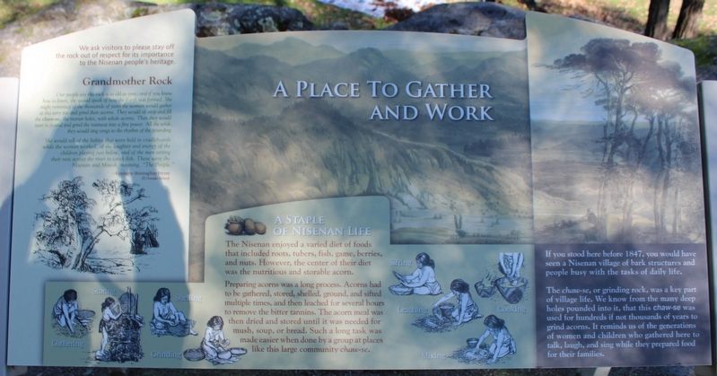
A Place to Gather and Work
Photographed by Joseph Alvarado
1. A Place to Gather and Work Marker
The chaws-se, or grinding rock, was a key part of village life. We know from the many deep holes pounded into it, that this chaw-se was used for hundreds if not thousands of years to grind acorns. It reminds us of the generations of women and children who gathered here to talk, laught, and sing while they prepared food for their families.
We ask visitors to please stay off the rock out of respect for its importance to the Nisenan people’s heritage.
Grandmother Rock
Our people say this rock is as old as time, and if you knew how to listen, she would speak of how the Earth was formed. She might reminisce of the thousands of years the women would gather at this very site and grind their acorns. They would sit atop and fill the chaw-se, the mortar holes, with whole acorns. Then they would start to pound and grind the nutmeat into a fine powder. All the while, they would sing songs to the rhythm of the pounding.
She would tell of the babies that were held in cradleboards while the women worked, of the laughter and energy of the children playing just below, and of the men setting their nets across the river to catch fish. These were the Nisenan and Miwok, meaning, “The People.”
- Kimberly ShiningStar Petree, El Dorado Miwok
A Staple of Nisenan Life
The
this page online
Preparing acorns was a long process. Acorns had to be gathered, stored, shelled, ground, and sifted multiple times, and then leached for several hours to remove the bitter tannins. The acorn meal was then dried and stored until it was needed for mush, soup, or bread. Such a long task was made easier when done by a group at places like this large community chaw-se.
Erected by California Department of Parks & Recreation.
Topics. This historical marker is listed in this topic list: Indigenous Peoples and Communities. A significant historical year for this entry is 1848.
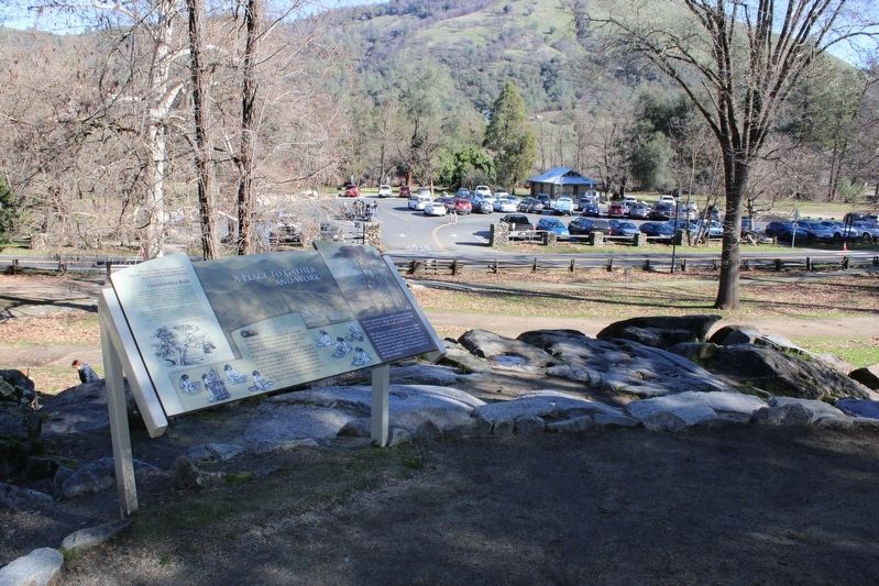
Location. 38° 48.1′ N, 120° 53.608′ W. Marker is in Coloma, California, in El Dorado County. It can be reached from Coloma Road (California Route 49) north of Mt Murphy Road. The resin panel is mounted to a metal stand atop the rock on the Gold Discovery Loop Trail. Touch for map. Marker is in this post office area: Coloma CA 95613, United States of America. Touch for directions.

Regionally, it is
Photographed by Joseph Alvarado, January 21, 2023
2. A Place to Gather and Work Marker
Other nearby markers. At least 8 other markers are within walking distance of this marker: Capt. William E. Shannon (within shouting distance of this marker); Chinese Miners of the Mother Lode (about 300 feet away); Marshall Gold Discovery State Historic Park (about 300 feet away); The Coloma Road (about 300 feet away); Mormon Workers Cabin (about 300 feet away); a different marker also named Chinese Stores (about 300 feet away); James W. Marshall (about 300 feet away); Where the Gold Rush Started (about 300 feet away). Touch for a list and map of all markers in Coloma.
Other markers no longer nearby. Chinese Stores (was within shouting distance of this marker but has been replaced with another marker now near it); Mormon Cabin (was about 300 feet away, measured in a direct line but has been replaced with another marker now near it); Sutter Mill Replica (was about 300 feet away but has been permanently removed).
Credits. This page was last revised on January 28, 2023. It was originally submitted on January 28, 2023, by Joseph Alvarado of Livermore, California. This page has been viewed 364 times since then and 25 times this year. Photos: 1, 2. submitted on January 28, 2023, by Joseph Alvarado of Livermore, California.
