Mechanicsville in Hanover County, Virginia — The American South (Mid-Atlantic)
Cold Harbor Crossroads
Cold Harbor, 1864
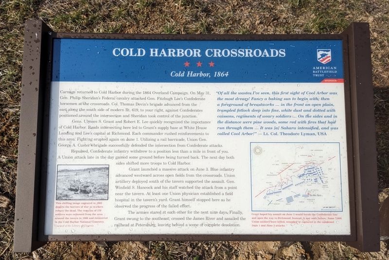
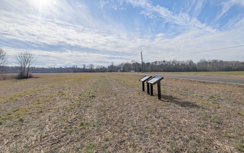
Carnage returned to Cold Harbor during the 1864 Overland Campaign. On May 31, Gen. Philip Sheridan's Federal cavalry attacked Gen. Fitzhugh Lee's Confederate horsemen at the crossroads. Col. Thomas Devin's brigade advanced from the east along the soutb side of modern Rt. 619, to your right, against Confederates positioned around the intersection and Sheridan took control of the junction.
Gens. Ulysses S. Grant and Robert E. Lee quickly recognized the importance of Cold Harbor. Roads intersecting here led to Grant's supply base at White House Landing and Lee's capital at Richmond. Each commander rushed reinforcernents to this area. Fighting erupted again on June 1. Utilizing a rail barricade, Union Gen. George A. Custer's brigade successfully defended the intersection from Confederate attacks.
Repulsed, Confederate infantry withdrew to a position less than a mile in front of you. A Union attack late in the day gained some ground before being turned back. The next day both sides shifted more troops to Cold Harbor.
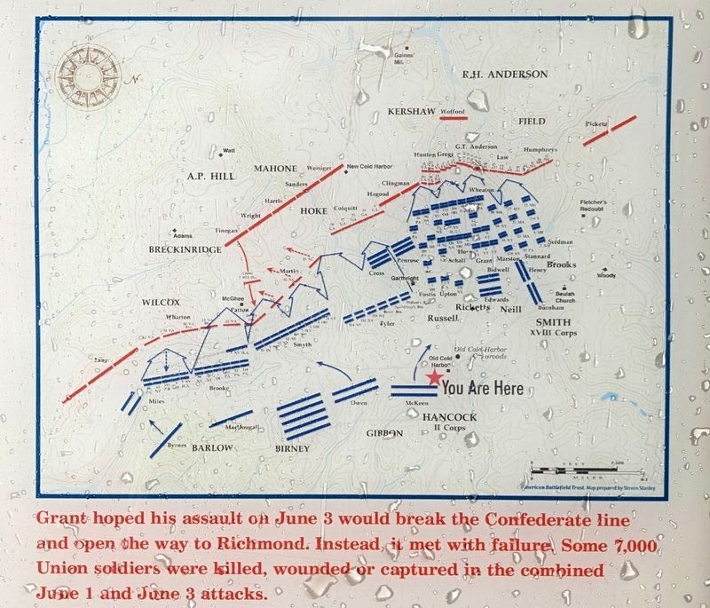
Grant launched a massive attack on June 3. Blue infantry advanced westward across open fields from the crossroads. Union artillery deployed south of the tavern supported the assault. Gen. Winfield S. Hancock and his staff watched the attack from a point near the tavern. At least one Union physician established a field hospital in the tavern's yard. Grant himself stopped here as he observed the progress of the failed effort.
The armies stared at each other for the next nine days. Finally, Grant swung to the southeast, crossed the James River and assailed the railhead at Petersburg, leaving behind a scene of complete desolation.
"Of all the wastes I've seen, this first sight of Cool Arbor was the most dreary! Fancy a baking sun to begin with; then a foreground of breastworks ... in the front an open plain, trampled fetlock deep into fine, white dust and dotted with caissons, regiments of weary soldiers ... On the sides and in the distance were pine woods, some red with fires that had run through them ... It was [a] Sahara intensified, and was called Cool Arbor!" — Lt. Col. Theodore Lyman, USA
(captions)
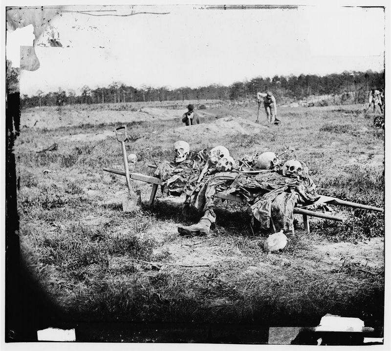
This chilling image captured in 1865 depicts the horrors of war as workers rebury the dead. The remains of 170 soldiers were exhumed from the area around the tavern in 1866 and reinterred in the Cold Harbor National Cemetery. Courtesy of the Library of Congress
Grant hoped his assault on June 3 would break the Confederate line and open the way to Richmond. Instead, it met with failure. Some 7,000 Union soldiers were killed, wounded or captured in the combined June 1 and June 3 attacks.
Erected 2023 by American Battlefield Trust.
Topics. This historical marker is listed in this topic list: War, US Civil. A significant historical date for this entry is May 31, 1864.
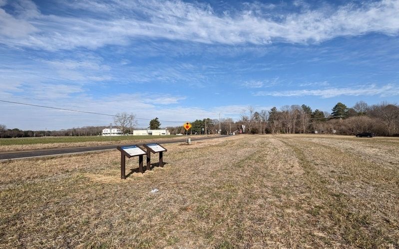
Location. 37° 35.41′ N, 77° 16.239′ W. Marker is in Mechanicsville, Virginia, in Hanover County. Marker is on Cold Harbor Road (Virginia Route 156) south of Rockhill Road (Virginia Route 619), on the left when traveling south. Touch for map. Marker is at or near this postal address: Rockhill Road, Mechanicsville VA 23111, United States of America. Touch for directions.
Other nearby markers. At least 8 other markers are within walking distance of this marker. A different marker also named Cold Harbor Crossroads (here, next to this marker); a different marker also named Cold Harbor Crossroads (about 300 feet away, measured in a direct line); Seven Days' Campaign (about 500 feet away); Seven Days Battles (about 500 feet away); a different marker also named Seven Days Battles (approx. 0.3 miles away); Cold Harbor Battlefield Walking Trail (approx. 0.4 miles away); The Battle Opens (approx. 0.4 miles away); From Farmland to Forest (approx. 0.4 miles away). Touch for a list and map of all markers in Mechanicsville.
Also see . . . Preserved Forever: 29 Acres at the Site of Cold Harbor Tavern. American Battlefield Trust (Submitted on January 30, 2023.)
Credits. This page was last revised on January 30, 2023. It was originally submitted on January 30, 2023, by Bernard Fisher of Richmond, Virginia. This page has been viewed 66 times since then and 15 times this year. Photos: 1, 2, 3, 4, 5, 6. submitted on January 30, 2023, by Bernard Fisher of Richmond, Virginia.
