Kennett Square in Chester County, Pennsylvania — The American Northeast (Mid-Atlantic)
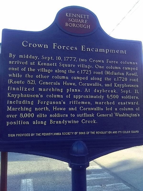
Crown Forces Encampment
Sign provided by the Pennsylvania Society of Sons of the Revolution and its color guard
Erected by Kennett Square Borough.
Topics. This historical marker is listed in this topic list: War, US Revolutionary. A significant historical date for this entry is September 10, 1777.
Location. 39° 50.84′ N, 75° 42.739′ W. Marker is in Kennett Square, Pennsylvania, in Chester County. Marker is at the intersection of N. Union Street (Pennsylvania Route 82) and W. Linden Street, on the right when traveling south on N. Union Street. Touch for map. Marker is at or near this postal address: 120 N Union Street, Kennett Square PA 19348, United States of America. Touch for directions.
Other nearby markers. At least 8 other markers are within 2 miles of this marker, measured as the crow flies. Isaac D. Johnson (a few steps from this marker); Wm. W. Fahey Post No. 491 (approx. 0.3 miles away); Kennett Square (approx. 0.4 miles away); State Fencibles of Philadelphia Campsite (approx. 0.4 miles away); The Manor of Steyning (approx. 0.8 miles away); Herb Pennock Park - A History (approx. 0.8 miles away); Historic Homestead (approx. 0.9 miles away); Battle of Brandywine (approx. 1.4 miles away). Touch for a list and map of all markers in Kennett Square.
Credits. This page was last revised on April 14, 2023. It was originally submitted on January 31, 2023, by Carl Gordon Moore Jr. of North East, Maryland. This page has been viewed 195 times since then and 54 times this year. Photos: 1. submitted on January 31, 2023, by Carl Gordon Moore Jr. of North East, Maryland. 2. submitted on February 2, 2023, by Carl Gordon Moore Jr. of North East, Maryland. • Bill Pfingsten was the editor who published this page.

