D Street / West Broadway in Boston in Suffolk County, Massachusetts — The American Northeast (New England)
Boston Harbor Islands
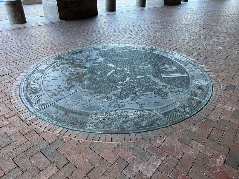
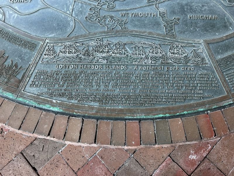
A national park area
Boston Harbor Islands offer opportunities for visitors to tour historical sites, observe wildlife, participate in recreational activities ranging from hiking and bird watching to swimming and fishing, or just enjoying a picnic and a day of quiet contemplation. The park is a system of some thirty islands and peninsulas with remarkable natural and historical resources, all within an urban setting. It is administered by a partnership of national, state and local representatives whose mission is to preserve and protect the island system and provide access for the enjoyment and education of this and future generations.
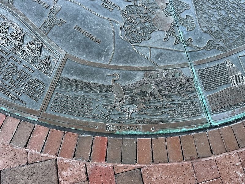
Renewal
Boston Harbor sustained a rich environment for thousands of years, before pollution caused problems. Now 12-egg shaped digesters on Deer Island help recycle sewage sludge from 43 communities into fertilizer. They are symbols of environmental stewardship.
Now with the cleanup of Boston Harbor, natural ecosystems have the opportunity to renew themselves. People are rediscovering the islands too, for recreation and personal renewal.
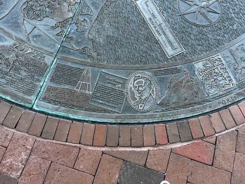
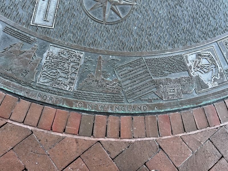
Portal to New England
Once a 12-acre island, Nix's Mate has eroded away and only a masonry pyramid remains to mark the setting of a famous tale. Legend states that Captain Nix was killed, either on the island or at sea, and that his mate was charged with the crime. It is said that the mate was executed on this island and, claiming his innocence, professed that the place would be washed away by the angry sea.
New England Prospects "It is a safe and pleasant Harbour within, having but one common and safe entrance, and… is made by a great company of Ilands, whose high cliffs shoulde out the boistrous seas, yet may easily decive my unskillful Pilote; presenting many faire openings and borad sounds…"
- New England Prospects, 1634
Donald McKay (1810-1880) built both clipper and steam ships at his East Boston shipyard on Boston Harbor, including the renown Flying Cloud.
Marking the maritime entry to New England, the Boston Harbor Islands have played an important role in European exploration, and subsequent navigation, commerce, and coastal defense.
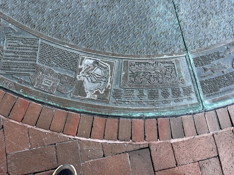
Soldiers on work details at Fort Warren on George's Island often sang songs in the spring of 1861 to help pass the time. New lyrics to the popular hymn, "Say, Brothers Will You Meet Us?" quickly spread through the ranks and caught on as a most stirring Union marching song. While visiting Washington a friend asked Julia Ward Howe to write "some good words for the stirring tune." Thus was born the famous Civil War song "The Battle Hymn of the Republic."
Revolutionary
War of 1812: Forts Warren (George's I.) & Independence (Castle I.) deter possible British assaults.
Civil War: Several Islands used as training camps for Union troops.
Spanish American War: Fort Warren on George's Island is chief point of harbor defense although enemy never appears.
World War I: U.S. Navy trains 13,000 men on Bumpkin Island by 1918.
World War II: Fort Andrews on Paddock's Island used as a prison camp for Italian prisoners of war.
Cold War: Former missile base on Long Island later used to store Boston's Library Books.
Home in the Harbor
Boston's Islands feature a classic maritime mixture of beaches, marshes, and cliffs, woodlands, fields, and fragile coastal habitats. A landscape mix for the most part now vanished from the mainland shore.
"After the colony granted Conant's Island to John Winthrop, the head of the Infant State, in 1632. It was called Governor's Island, and its annual rent was placed at a hogs-head of wine that should be made thereon; and afterwards two bushels of the best apples there growing… The governor planted here the first apple and pear trees in the Nation."
-- King's Handbook of Boston Harbor, 1888
In the1880s a half-dozen lobstermen and their families lived on Calf Island, "under the paternal and eccentric sway of Captain Turner. I do not imagine that old Turner ever smiles; his deep-lines visage is puckered with seriousness… He has been so saturated with salt-water for nearly fourscore years that he has a half-pickled appearance, and his beard and the curly locks which still flourish, though bleached by age and exposure, are always wet with brine."
-- King's Hnadbook of Boston Harbor, 188 (All King's Handbook quotes courtesy of the Friends of the Boston Harbor Islands, Inc.)
The islands have been home to a rich diversity of plant and animal life for millennia. People have lived on and around the Boston Harbor islands for thousands of years and have made a mark on the landscape.
Starting in the 1600s Europeans began living on the islands, some for weeks, others for years, some individually, others with their families.
The islands have been inhabited by humans for more than 8,000 years. Indian artifacts show that Native Americans used the harbor resources to the fullest. Bones and shells remain from the Cod and other fish they caught, and from the clams and oysters they collected. They hunted deer, waterfowl, and small animals. About 1,000 years ago, American Indians developed varieties of corn, beans, and squash that
"About thirty persons of Boston going out in a fair day to Spectacle Island to cut wood, (the town being in great want thereof,) the next night the wind rose so high at N.E. with snow.... and then it is frozen so hard, as the bay was all frozen up, save a little channel. In this twelve of them gate to the Governour's Garden, [Governor's Island] and seven more were carried in the ice in a small skiff out at Broad Sound, and kept among Brewster's Rocks, without food or fire, two days… Three of them gate home the next day over the ice, but their hands and feet frozen. Some lost their fingers and toes, and one died. The rest went from Spectacle Island to the main, but two of them fell into the ice yet recovered again."
--John Winthrop
Journal, January 18, 1660
Islands on the Edge
One of the bloodiest wars in American history, in proportion to the population, erupted in 1675. "King Philip" was the English name of Netacom, a leader of the Wampanoags, son of Massasoit. King Philip's War was a landmark effort by American Indians to rid their homeland of the English. "Christianized" Indians fared no better in the conflict than
The quarantine hospital at Rainsford Island doubled as a popular summer resort. The island keeper could only take in boarders when no communicable diseases were reported.
The cores of many of the harbor islands are drumlins glacier-formed hills that, in profile, look like upside down teaspoons. Geologists believe the islands illustrate two periods of glacial action during the past 100,000 years. Melting of the most recent glacier ice raised sea levels which isolated the hilltops as islands, about 15,000 years ago.
As a place where drumlins cross a coastline, the Boston Harbor islands provide a natural environment literally at the edge of a major city. Figuratively, the islands have been on the "edge" of society since the 1600's; places used to isolate people, institutions, and activities that citizens preferred not to see in their neighborhoods.
Garbage dumping on Spectacle Island over the years, increased its size by 36 acres, and nearly 70 feet in height.
"In 1857 Spectacle Islandwas bought for $15,000, by Nahum Ward, who founded here a large establishment for rendering dead horses… In 1872, the lucrative industry of rendering cattle bones was introduced and in 1874 came the rendering of tallow and suet… About 2,000 dead horses are received here yearly, from points within ten miles…"
- King's Handbook, 1888
Once the islands were bodies of foliage. Seen one against another and grouping with good headlands, they formed scenery of grace and amenity, cheerful, genial, and hospitable. But long ago they were despoiled for petty private gains, and the harbor made artificially bald, raw, bleak, prosaic, inhospitable."
- Frederick Law Olmsted, Century Magazine, 1886
Reconnection
Now that the water of Boston Harbor is being cleaned up through a major wastewater treatment facility, the human and natural populations of the harbor are responding to a changing environment. One response to the cleaner harbor is reconnection by residents of metropolitan Boston to the waterfront and the islands, aided by a wide variety of organizations and individuals. As part of that reconnection, the Boston Harbor Islands have been added to the national park system.
Erected 2000 by Gregg LeFevre and Jennifer Andrews, sculptors; assisted by James Owens and Mattie Paganelli.
Topics. This historical marker is listed in this topic list: Notable Events. A significant historical year for this entry is 1634.
Location. 42° 21.255′ N, 71° 2.885′ W. Marker is in Boston, Massachusetts, in Suffolk County. It is in D Street / West Broadway. Marker is at the intersection of Northern Avenue and Harborwalk, on the right when traveling west on Northern Avenue. Touch for map. Marker is at or near this postal address: 2 Northern Ave, Boston MA 02210, United States of America. Touch for directions.
Other nearby markers. At least 8 other markers are within walking distance of this marker. Fan Pier. (within shouting distance of this marker); a different marker also named Fan Pier. (about 400 feet away, measured in a direct line); a different marker also named Fan Pier. (about 600 feet away); The Way to a Cleaner Harbor (about 700 feet away); Captain John Foster Williams (approx. 0.2 miles away); Four Point Channel (approx. 0.2 miles away); InterContinental Boston Hotel (approx. 0.2 miles away); The Boston Tea Party (approx. 0.2 miles away). Touch for a list and map of all markers in Boston.
Credits. This page was last revised on May 10, 2023. It was originally submitted on February 3, 2023, by Devry Becker Jones of Washington, District of Columbia. This page has been viewed 115 times since then and 25 times this year. Photos: 1, 2, 3, 4, 5, 6. submitted on February 3, 2023, by Devry Becker Jones of Washington, District of Columbia.
