Fredericksburg, Virginia — The American South (Mid-Atlantic)
Field of Battle
The Battle of Fredericksburg
— Fredericksburg and Spotsylvania National Military Park —
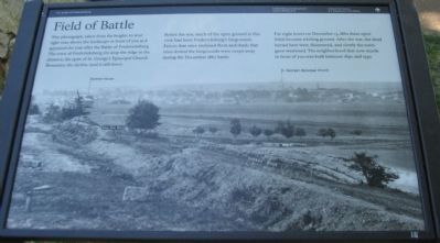
Before the war, much of the open ground in this view had been Fredericksburg's fairgrounds. Fences that once enclosed them and sheds that once dotted the fairgrounds were swept away during the December 1862 battle.
For eight hours on December 13, 1862 these open fields became a killing ground. After the war, the dead buried here were disinterred, and slowly the town grew westward. The neighborhood that now stands in front of you was built between 1890 and 1930.
Erected by National Park Service, U.S. Department of the Interior.
Topics. This historical marker is listed in this topic list: War, US Civil. A significant historical month for this entry is December 1862.
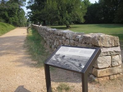
Location. 38° 17.692′ N, 77° 28.09′ W. Marker is in Fredericksburg, Virginia. Marker is on Sunken Road, 0.1 miles north of Lafayette Boulevard (Virginia Highway 1), on the right when traveling north. Located on the Sunken Road walking trail, which starts at the Fredericksburg battlefield visitor center. The Sunken Road is closed to vehicle traffic. Touch for map. Marker is in this post office area: Fredericksburg VA 22401, United States of America. Touch for directions.
Other nearby markers. At least 8 other markers are within walking distance of this marker. The Union Attacks Begin (a few steps from this marker); Sunken Road Walking Trail (within shouting distance of this marker); Confederate Artillery (within shouting distance of this marker); The Confederate Line (within shouting distance of this marker); Thomas R. R. Cobb (within shouting distance of this marker); Cobb (within shouting distance of this marker); Mrs. Martha Stevens (within shouting distance of this marker); The Stephens House (within shouting distance of this marker). Touch for a list and map of all markers in Fredericksburg.
More about this marker. On the marker is a wartime photograph looking from the Sunken Road across to Fredericksburg. The locations of Stratton House and St. George's Episcopal Church are indicated, along with the trace of the Sunken Road.
Also see . . . The Sunken Road. National Park Service (Submitted on July 5, 2008, by Craig Swain of Leesburg, Virginia.)
Photographed By Craig Swain, May 25, 2008
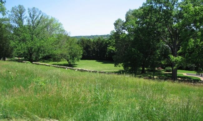
3. Similar View from Marye's Heights Today
Or more precisely from Willis Hill looking into Fredericksburg. The marker is under the oak tree on the right side of the photo, and it's face shows up as a white rectangle peaking above the grass line just right of center. The spire of the Episcopal Church sticks out of the trees in the distant center.
Photographed By Craig Swain
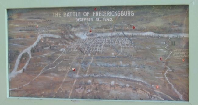
4. Fredericksburg Map Painting
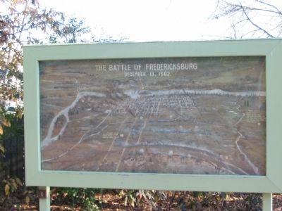
Located between the Visitor Center and Bookstore is this painted map indicating important events in the Fredericksburg Campaign. Since the narrative is difficult to read from a photograph, the key points are superimposed here by red numbers and letters:
(1). November 19, 1862 Burnside's Union Army arrives opposite Fredericksburg.
(2). December 11, Federal pontoon bridges are resisted by Confederate riflemen along the river bank.
(3). Shortly before the attacks on this end of the battlefield began, a Union assault against Stonewall Jackson's line (off this map to the south) was beaten back after a brief success.
(4). December 13. The main Union attacks against Marye's Heights are easily and bloodily repulsed.
(A). Phillips House. Burnsides headquarters. Burned after the battle.
(B). Washington's Boyhood Home.
(C). Richmond, Fredericksburg, and Potomac Railroad.
(D). "You are here."
Credits. This page was last revised on February 7, 2023. It was originally submitted on July 5, 2008, by Craig Swain of Leesburg, Virginia. This page has been viewed 2,220 times since then and 27 times this year. Last updated on February 4, 2023, by Bradley Owen of Morgantown, West Virginia. Photos: 1. submitted on July 5, 2008, by Craig Swain of Leesburg, Virginia. 2. submitted on August 31, 2008, by Bill Coughlin of Woodland Park, New Jersey. 3. submitted on July 5, 2008, by Craig Swain of Leesburg, Virginia. 4, 5. submitted on December 15, 2008, by Craig Swain of Leesburg, Virginia. • Bernard Fisher was the editor who published this page.
