Near Leland in Brunswick County, North Carolina — The American South (South Atlantic)
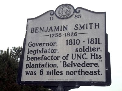
Benjamin Smith
1756-1826
Photographed by Jamie Abel, January 7, 2011
1. Benjamin Smith Marker
Governor, 1810-1811, legislator, soldier, benefactor of UNC. His plantation, “Belvedere,” was 6 miles northeast.
Erected 1986 by Division of Archives and History. (Marker Number D-85.)
Topics and series. This historical marker is listed in this topic list: Government & Politics. In addition, it is included in the North Carolina Division of Archives and History series list. A significant historical year for this entry is 1810.
Location. 34° 12.532′ N, 78° 1.862′ W. Marker is near Leland, North Carolina, in Brunswick County. It is on Ocean Highway East (U.S. 17) 0.2 miles west of West Gate Drive, on the right when traveling east. Touch for map. Marker is in this post office area: Leland NC 28451, United States of America. Touch for directions.

Regionally, this marker is in the Coastal Plain and on the Cape Fear Coast. It is also in the American South, specifically in the Upper South, in the Tidewater, and on the Eastern Seaboard. Globally, it is in the North Atlantic Region, North America, the Western Hemisphere, the Western World, and the Anglosphere. Historically, it finds itself in what was once the territory
this page online
Other nearby markers. At least 8 other markers are within 5 miles of this marker, measured as the crow flies: Robert Howe (approx. 2.7 miles away); Stamp Act (approx. 2.7 miles away); Alfred Moore (approx. 2.7 miles away); Orton (approx. 2.8 miles away); Fort Anderson (approx. 2.8 miles away); USS North Carolina (approx. 4.7 miles away); United States Army (approx. 4.7 miles away); a different marker also named United States Army (approx. 4.7 miles away).
Also see . . . Benjamin Smith (North Carolina politician). Wikipedia entry (Submitted on June 22, 2024, by Larry Gertner of New York, New York.)

via North Carolina History Project website entry, unknown
2. Benjamin Smith
North Carolina History Project website entry
Click for more information.
Click for more information.
Photographed by Jamie Abel, January 7, 2011
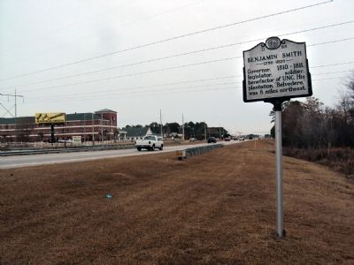
3. Benjamin Smith Marker
Marker with U.S. Route 17 heading north in the background.
Credits. This page was last revised on June 22, 2024. It was originally submitted on January 11, 2011, by Jamie Abel of Westerville, Ohio. This page has been viewed 1,087 times since then and 56 times this year. Last updated on February 5, 2023, by Michael Buckner of Durham, North Carolina. Photos: 1. submitted on January 11, 2011, by Jamie Abel of Westerville, Ohio. 2. submitted on March 5, 2024, by Larry Gertner of New York, New York. 3. submitted on January 11, 2011, by Jamie Abel of Westerville, Ohio. • Bernard Fisher was the editor who published this page.
