Ottawa in Putnam County, Ohio — The American Midwest (Great Lakes)
Native Americans in Ottawa
Ohio Historical Marker
Inscription.
[Front Side]:
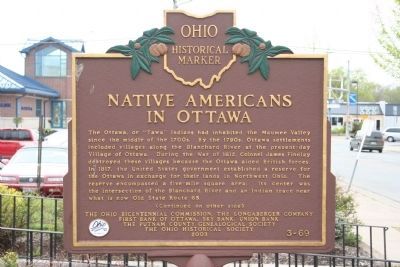
The Ottawa, or "Tawa" Indians had inhabited the Maumee Valley since the middle of the 1700s. By the 1790s, Ottawa settlements included villages along the Blanchard River at the present-day Village of Ottawa. During the War of 1812, Colonel James Findlay destroyed these villages because the Ottawa aided British forces. In 1817, the United States government established a reserve for the Ottawa in exchange for their lands in Northwest Ohio. The reserve encompassed a five-mile square area; its center was the intersection of the Blanchard River and an Indian trace near what is now Old State Route 65.
[Reverse Side]:
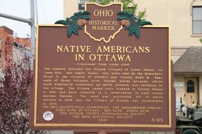
Erected 2003 by Ohio Bicentennial Commission, The Longaberger Company, First Bank of Ottawa, Sky Bank, Union Bank, The Putnam County Genealogical Society, and The Ohio Historical Society. (Marker Number 3-69.)
Topics and series. This historical marker is listed in these topic lists: Native Americans • Settlements & Settlers • War of 1812. In addition, it is included in the Ohio Historical Society / The Ohio History Connection series list. A significant historical year for this entry is 1812.
Location. 41° 1.143′ N, 84° 2.954′ W. Marker is in Ottawa, Ohio, in Putnam County. Marker is on West Main Street (U.S. 224) just west of South Walnut Street, on the left when traveling west. Touch for map. Marker is in this post office area: Ottawa OH 45875, United States of America. Touch for directions.
Other nearby markers. At least 8 other markers are within walking distance of this marker. Honor Their Sacrifice (within shouting distance of this marker); Honor Our Veterans (within shouting distance of this marker); This Plaque (within shouting distance of this marker); V.F.W. Post No. 9142 Veterans Memorial (within shouting distance of this marker); Welcome to Pizza Hut Classic (about 800 feet away, measured in a direct line); Putnam County World War Memorial Clock (approx. 0.2 miles away); Putnam County Veterans Memorial (approx. 0.2 miles away); Ottawa, Ohio (approx. ¼ mile away). Touch for a list and map of all markers in Ottawa.

Photographed By Dale K. Benington, May 3, 2009
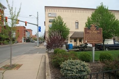
4. Native Americans in Ottawa Marker
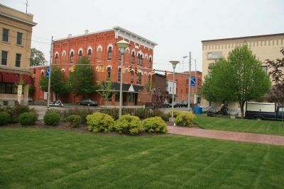
View of historical marker located in downtown park setting. Note that building to the right of the park as sandbags surrounding its outer perimeter to provide protection from the flood waters of the Blanchard River (located about two blocks to the south).
Credits. This page was last revised on June 16, 2016. It was originally submitted on August 12, 2009, by Dale K. Benington of Toledo, Ohio. This page has been viewed 1,676 times since then and 112 times this year. Photos: 1, 2, 3, 4. submitted on August 12, 2009, by Dale K. Benington of Toledo, Ohio. • Bill Pfingsten was the editor who published this page.


