Charlestown in Boston in Suffolk County, Massachusetts — The American Northeast (New England)
Building 10
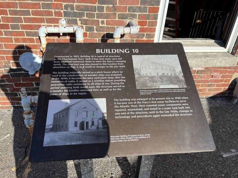
Constructed in 1853, Building 10 is typical of structures in the Charlestown Navy Yard: it has seen many uses and been modified numerous times to meet the Navy's changing needs. The structure was also moved to this location from elsewhere on Pier 1, as a result of changes to the pier itself.
The building originally served as a pitch house where tar used in the construction of wooden ships was prepared. In the 1890s it became the navy yard paint shop; after the invention of radio, it served as a wireless station providing peacetime radio assistance to all ships at sea. During the period spanning both world wars, the structure served as a laundry for families stationed here as well as for the crews of ships in for repair.
The building was enlarged to its present size in 1948 when it became one of the Navy's first sonar facilities to serve the Atlantic Fleet. Here essential sonar components were repaired, maintained, and tested in a water tank built into one end of the structure, until in the late 1950s, changes in technology and procedures again outmoded the structure.
[Captions:]
On timber jacks in August 1900, Building 10 is ready to be moved to its new location. Navy yard structures were often altered, but seldom moved.
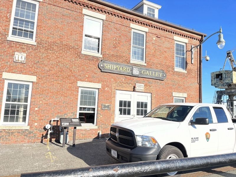
Relocated, Building 10 appears to have always been here. What changes in the building as it appears today can you identify?
Topics. This historical marker is listed in these topic lists: Industry & Commerce • War, World I • War, World II • Waterways & Vessels. A significant historical month for this entry is August 1900.
Location. 42° 22.362′ N, 71° 3.334′ W. Marker is in Boston, Massachusetts, in Suffolk County. It is in Charlestown. Marker is on 3rd Street south of 1st Avenue, on the right when traveling north. Touch for map. Marker is at or near this postal address: 10 3rd St, Charlestown MA 02129, United States of America. Touch for directions.
Other nearby markers. At least 8 other markers are within walking distance of this marker. Charlestown Navy Yard (within shouting distance of this marker); Boston, the Navy Yard, and the War of 1812 (about 300 feet away, measured in a direct line); Explore the Navy Yard (about 300 feet away); Dry Dock 1 (about 400 feet away); Serving the Fleet (about 400 feet away); "Old Ironsides" in Dry Dock 1 (about 400 feet away); The Changing Yard (about 400 feet away); The Battle of Bunker Hill (about 400 feet away). Touch for a list and map of all markers in Boston.
Credits. This page was last revised on February 5, 2023. It was originally submitted on February 5, 2023, by Devry Becker Jones of Washington, District of Columbia. This page has been viewed 45 times since then and 16 times this year. Photos: 1, 2. submitted on February 5, 2023, by Devry Becker Jones of Washington, District of Columbia.

