College Park in Prince George's County, Maryland — The American Northeast (Mid-Atlantic)
Paint Branch Bridge Mural: A Path Forward
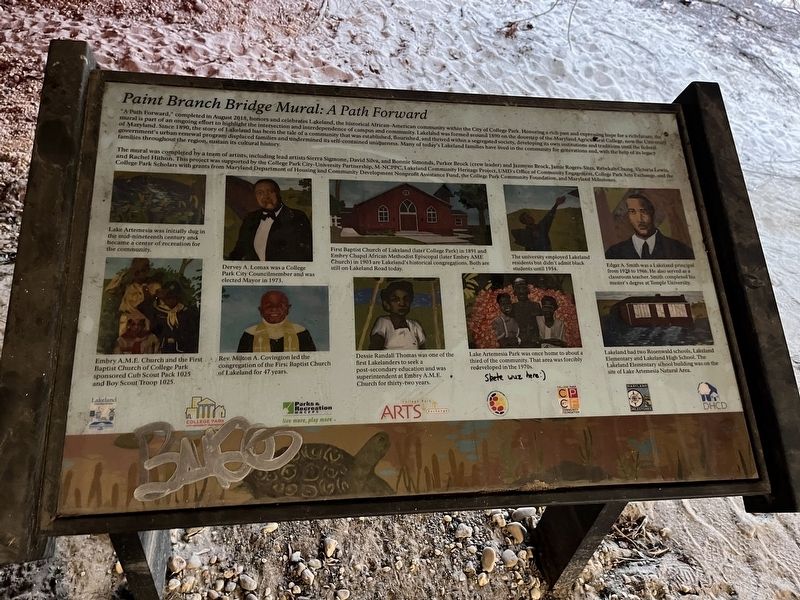
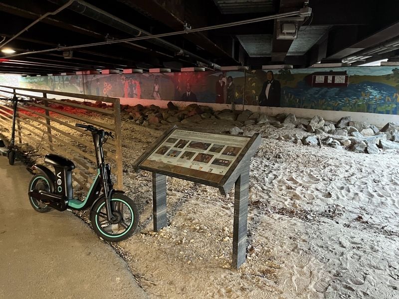
"A Path Forward," completed in August 2018, honors and celebrates Lakeland, the historical African-American community within the City of College Park. Honoring a rich past and expressing hope for a rich future, the mural is part of an ongoing effort to highlight the intersection and interdependence of campus and community. Lakeland was formed around 1890 on the doorstep of the Maryland Agricultural College, now the University of Maryland. Since 1890, the story of Lakeland has been the tale of a community that was established, flourished, and thrived within a segregated society, developing its own institutions and traditions until the federal government's urban renewal program displaced families and undermined its self-contained uniqueness. Many of today's Lakeland families have lived in the community for generations and, with the help of its legacy families throughout the region, sustain its cultural history.
The mural was completed by a team of artists, including lead artists Sierra Sigmone, David Silva, and Bonnie Simonds, Parker Brock (crew leader) and Jazmyne Brock, Jamie Rogers-Sites Rebekah Chung, Victoria Lewis, and Rachel Hithon. This project was supported by the College Park City-University Partnership, M-NCPPC, Lakeland Community Heritage Project, UMD's Office of Community Engagement, College Park Arts Exchange, and the College Park Scholars with grants from Maryland Department of Housing and Community Development Nonprofit Assistance Fund, the College Park Community Foundation, and Maryland Milestone.
[Captions:]
Lake Artemesia was initially dug in the mid-nineteenth century and became a center of recreation for the community.
Embry A.M.E. Church and the First Baptist Church of College Park sponsored Cub Scout Pack 1025 and Boy Scout Troop 1025.
Dervey A. Lomax was a College Park Councilmember and was elected Mayor in 1973.
Rev. Milton A. Covington led the congregation of the First Baptist Church of Lakeland for 47 years.
First Baptist Church of Lakeland (later College Park) in 1891 and Embry Chapel African Methodist Episcopal (later Embry AME Church) in 1903 and Lakeland's historical congregation. Both are still on Lakeland Road today.
Dessie Randall Thomas was one of the first Lakelanders to seek a post-secondary education and was superintendent at Embry A.M.E. Church for thirty-two years.
The university employed Lakeland residents but didn't admit black students until 1954.
Lake Artemesia Park was once home to about a third of the community. That area was forcibly redeveloped in the 1970s.
Edgar A. Smith was a Lakeland principal from 1928 to 1966. He also served as a classroom
Lakeland had two Rosenwald schools, Lakeland Elementary and Lakeland High School. The Lakeland Elementary school building was on the site of Lake Artemesia Natural Area.
Topics and series. This historical marker is listed in these topic lists: African Americans • Parks & Recreational Areas • Settlements & Settlers. In addition, it is included in the African Methodist Episcopal (AME) Church, and the Rosenwald Schools series lists. A significant historical month for this entry is August 2018.
Location. 38° 59.35′ N, 76° 56.086′ W. Marker is in College Park, Maryland, in Prince George's County. Marker can be reached from Baltimore Avenue (U.S. 1) north of Campus Drive, on the right when traveling north. The marker stands directly below Baltimore Boulevard on a bike trail. Touch for map. Marker is at or near this postal address: 8100 Baltimore Ave, College Park MD 20740, United States of America. Touch for directions.
Other nearby markers. At least 8 other markers are within walking distance of this marker. Lakeland (within shouting distance of this marker); Site of Maryland's First State Tree Nursery, 1914-1950 (about 300 feet away, measured in a direct line); Founders’ Gateway (about 300 feet away); Engineering 100 (approx. 0.2 miles away); Chemistry Courtyard (approx. ¼ mile away); Clarence Mitchell, Jr. (approx. 0.3 miles away); Agricultural Experiment Station (approx. 0.3 miles away); The Rossborough Inn (approx. 0.3 miles away). Touch for a list and map of all markers in College Park.
Credits. This page was last revised on September 18, 2023. It was originally submitted on February 6, 2023, by Devry Becker Jones of Washington, District of Columbia. This page has been viewed 67 times since then and 10 times this year. Photos: 1, 2. submitted on February 6, 2023, by Devry Becker Jones of Washington, District of Columbia.

