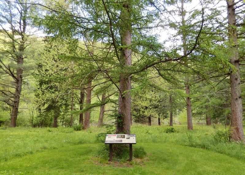
Cummings Township near Ramsey in Lycoming County, Pennsylvania — The American Northeast (Mid-Atlantic)
Camp Kline
Building Scout Skills for Life
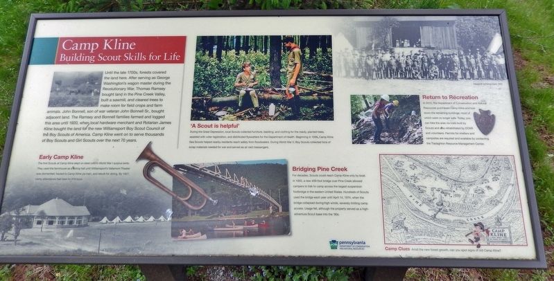
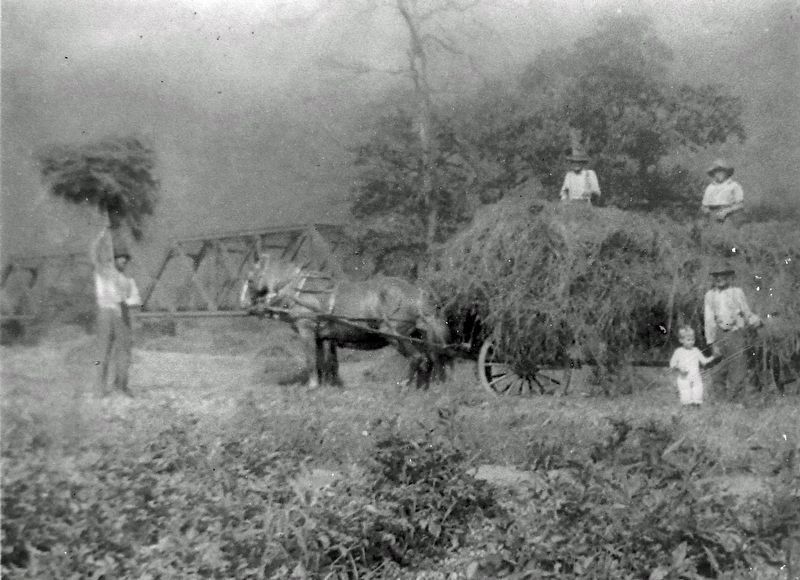
Until the late 1700s, forests covered the land here. After serving as George Washington's wagon master during the Revolutionary War, Thomas Ramsey bought land in the Pine Creek Valley, built a sawmill, and cleared trees to make room for field crops and farm animals. John Bonnell, son of war veteran John Bonnell Sr., bought adjacent land. The Ramsey and Bonnell families farmed and logged this area until 1920, when local hardware merchant and Rotarian James Kline bought the land for the new Williamsport Boy Scout Council of the Boy Scouts of America. Camp Kline went on to serve thousands of Boy Scouts and Girl Scouts over the next 70 years.
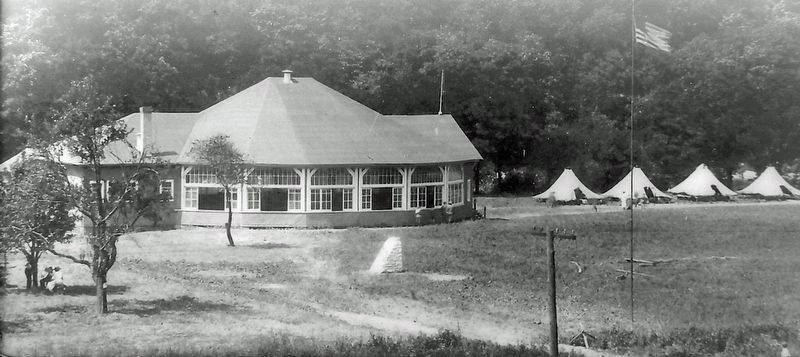
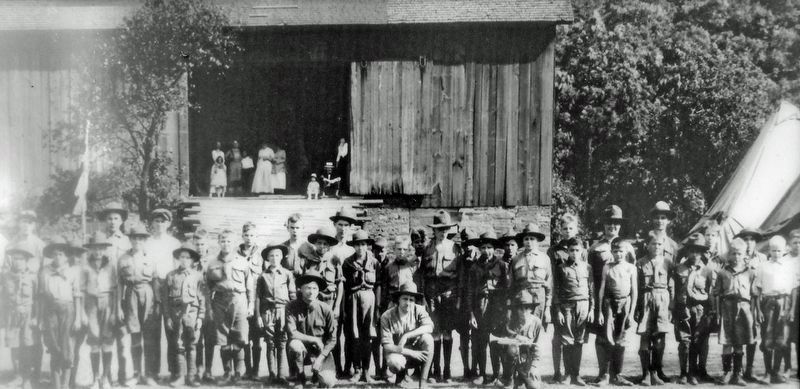
Early Camp KlineThe first Scouts at Camp Kline slept on steel cots in World War I surplus tents. They used the farmhouse as a dining hall until Williamsport's Vallamont Theater was dismantled, hauled to Camp Kline yia train, and rebuilt for dining. By 1927, camp attendance had risen to 379 boys.
'A Scout is helpful'
During the Great Depression, local Scouts collected furniture, bedding, and clothing for the needy, planted trees, assisted with voter registration, and distributed flyswatters for the Department of Health. Beginning in 1936, Camp Kline Sea Scouts helped nearby residents reach safety from floodwaters. During World War II, Boy Scouts collected tons of scrap materials needed for war and served as air raid messengers.
Bridging Pine Creek
For decades, Scouts could reach Camp Kline only by boat. In 1955, a new 409-foot bridge over Pine Creek allowed campers to trek to camp across the largest suspension footbridge in the eastern United States. Hundreds of Scouts used the bridge each year until April 14, 1974, when the bridge collapsed during high winds, severely limiting camp access. Usage fell, although the property served as a high-adventure Scout base into the '90s.
Return to Recreation
In 2015, the Department of Conservation and Natural Resources purchased Camp Kline and tore down the remaining buildings, most of which were no longer safe. Today, you can hike the area via trails built by Scouts and also rehabilitated by DCNR and volunteers. Permits for shelters and campsites are required and available by contacting the Tiadaghton Resource Management Center.
Erected by Pennsylvania Department of Conservation and Natural Resources.
Topics. This historical marker is listed in these topic lists: Charity & Public Work • Fraternal or Sororal Organizations • Parks & Recreational Areas • Settlements & Settlers. A significant historical year for this entry is 1920.
Location. 41° 16.476′ N, 77° 19.539′ W. Marker is near Ramsey, Pennsylvania, in Lycoming County. It is in Cummings Township. Marker is on Pine Creek Rail Trail, one mile south of State Highway 44, on the left when traveling south. Marker is located in a clearing on the east side of the Pine Creek Rail Trail. Nearest access is via bicycle or foot from the Ramsey Bridge Trailhead on Pennsylvania 44 in Ramsey. Touch for map. Marker is in this post office area: Jersey Shore PA 17740, United States of America. Touch for directions.
Other nearby markers. At least 8 other markers are within 7 miles of this marker, measured as the crow flies. The Waterville Bridge (approx. 3.1 miles away); Glacier to Gorge (approx. 3.7 miles away); Pine Creek's Path Through History (approx. 3.7 miles away); Tiadaghton Elm (approx. 5.7 miles away); Pine Creek Presbyterian Church (approx. 5.8 miles away); Jersey Shore Cemetery War Memorial (approx. 6.1 miles away); Fort Antes (approx. 6.2 miles away); War Memorial (approx. 6.2 miles away).
Also see . . .
1. Camp Kline Suspension Footbridge.
Patrick visited the site of the remnants of the Camp Kline suspension bridge on June 24th and June 26th of 2005. Patrick notes, "in the photos, you'll notice the site is a USGS Gauge Station on abutment of abandoned bridge. The Pine Creek water level is lower than the 2 feet marker at the bottom of one pillar. Nearly 33 years earlier to the day the water would have been a further 14 feet above my head while standing here. If the water didn't do away with the bridge, I'm sure the debris did."(Submitted on February 15, 2023, by Cosmos Mariner of Cape Canaveral, Florida.)
2. Abandoned Boy Scout Camp Kline. (video of abandoned Camp Kline circa 2016, before the buildings were removed)
This Boy Scout camp (Camp Kline) has been abandoned since the late 1970/early 1980's, after high flooding broke the bridge that went across the river from the highway. There weren't enough funds to rebuild the bridge so the camp was shut down indefinitely. As of 2016 the remaining buildings have been torn down and there is little to nothing left now.(Submitted on February 15, 2023, by Cosmos Mariner of Cape Canaveral, Florida.)
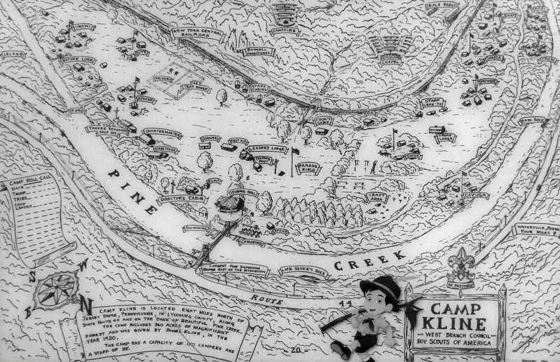
5. Marker detail: Vintage Camp Kline Map
Camp Kline is located eight miles north of Jersey Shore, Pennsylvania, in Lycoming County, along State Route 44 and on the bank of beautiful Pine Creek.
The camp includes 360 acres of magnificent forest and was given by James Kline, in the year 1920.
The camp has a capacity of 150 campers and a staff of 35.
Credits. This page was last revised on February 15, 2023. It was originally submitted on February 11, 2023, by Cosmos Mariner of Cape Canaveral, Florida. This page has been viewed 880 times since then and 198 times this year. Photos: 1, 2, 3, 4, 5, 6. submitted on February 15, 2023, by Cosmos Mariner of Cape Canaveral, Florida.
