Fort Wadsworth on Staten Island in Richmond County, New York — The American Northeast (Mid-Atlantic)
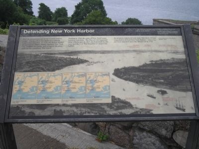
Defending New York Harbor
“ … [the Narrows are] the place pointed out by nature for the defense of the harbor … ”
Prussian General Friedrich von Steuben, Aide to General George Washington during the Revolutionary War
How do you protect one of the world’s busiest ports? This question has challenged military leaders for centuries. In 1776, the British landed unopposed on Staten Island, captured New York City, fortified this point, and occupied the area until the Revolutionary War ended.
Starting in 1794, the state of New York began building forts here. The War of 1812 hastened those efforts and, by 1817, ten forts built by the state and the U.S. War department ringed this harbor.
As weapons improved over time, this circle of forts expanded to defend New York Harbor – which has not been attacked since the British left in 1783.
Erected by National Park Service, U.S. Department of the Interior.
Topics. This historical marker is listed in this topic list: Forts and Castles. A significant historical year for this entry is 1776.
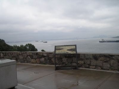
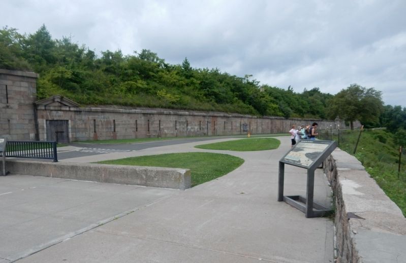
Location. 40° 36.29′ N, 74° 3.321′ W. Marker is on Staten Island, New York, in Richmond County. It is in Fort Wadsworth. Marker is on Hudson Road, on the right when traveling north . Marker is located in the Fort Wadsworth Unit of Gateway National Recreation Area. Touch for map. Marker is in this post office area: Staten Island NY 10305, United States of America. Touch for directions.
Other nearby markers. At least 8 other markers are within walking distance of this marker. Fort Tompkins (a few steps from this marker); Battery Weed (a few steps from this marker); Verrazano – Narrows Bridge (a few steps from this marker); Fort Wadsworth (within shouting distance of this marker); Battery Duane (within shouting distance of this marker); Torpedo Building (about 300 feet away, measured in a direct line); a different marker also named Battery Weed (about 300 feet away); Dry Moat and Counterscarp (about 300 feet away). Touch for a list and map of all markers in Staten Island.
More about this marker.
The background of the marker contains an 1854 lithograph of New York Harbor showing the location of forts, including Fort Wood on Bedloe’s Island (now called Liberty Island), Fort Gibson on Ellis Island, Castle Clinton on Manhattan, Castle Williams on Governors Island, Fort Columbus on Governors Island, First Fort Tompkins 1814 (site of second Fort Tompkins 1876 and site of the marker), Fort Richmond under construction (renamed Fort Wadsworth in 1865. Then Battery Weed 1902), Fort Lafayette (its rubble now forms the base for the west tower of the Verrazano-Narrows Bridge) and Fort Harrison.
Also on the marker are four maps showing the location of Harbor defense fortifications at various times. These include the First System Defenses 1794-1807, Second System Defenses 1807-1817, Third System Defenses 1817-1876 and Endicott Period Defenses 1890-1910.
Also see . . . Fort Wadsworth. Wikipedia entry. (Submitted on May 14, 2020, by Larry Gertner of New York, New York.)
Credits. This page was last revised on January 18, 2024. It was originally submitted on August 14, 2009, by Bill Coughlin of Woodland Park, New Jersey. This page has been viewed 1,156 times since then and 43 times this year. Photos: 1, 2. submitted on August 14, 2009, by Bill Coughlin of Woodland Park, New Jersey. 3. submitted on March 25, 2022, by Duane and Tracy Marsteller of Murfreesboro, Tennessee. 4. submitted on August 14, 2009, by Bill Coughlin of Woodland Park, New Jersey. 5. submitted on May 10, 2020, by Larry Gertner of New York, New York.
