Marquette Township in Marquette County, Michigan — The American Midwest (Great Lakes)
Lower Harbor Ore Dock
— Iron Ore Heritage Trail —
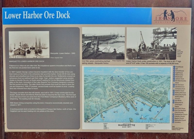
Patience is a virtue we are often told. But impatience spawns innovation and that's how the first iron ore pocket dock came to be.
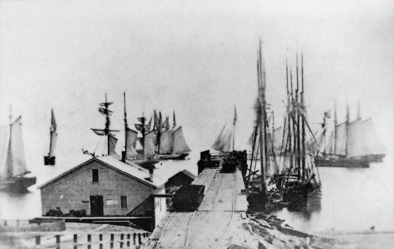
In 1857 Captain George Judson became impatient with the slow transfer of iron ore from trams on the dock to the schooners tied up at the harbor. It took 20-30 men using shovels and wheelbarrows three to six days to transfer the ore. Bottlenecks ensued as schooners lined up waiting to get their cargo. Capt. Judson suggested using wooden chutes to transfer the ore, so boats weren't waiting for it to be laboriously loaded from piles on the dock. Innovators of the Lake Superior Iron Company designed a solution: the first pocket ore dock. The taller docks had pockets that could be used to store the ore and dispense it. With 27 pockets, several boats could be loaded at once. Loading time was reduced from days to hours.
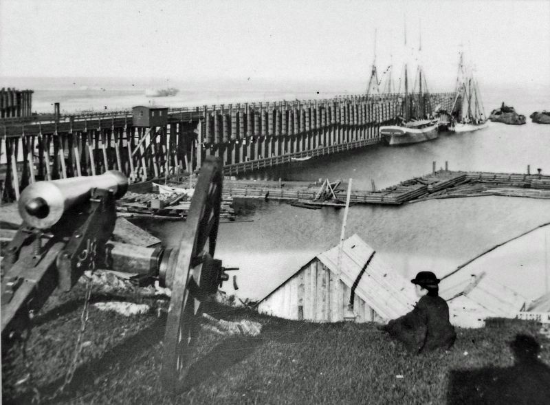
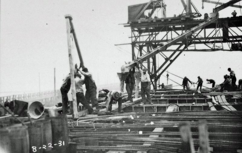
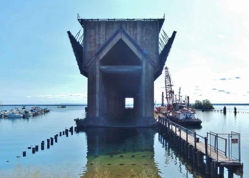
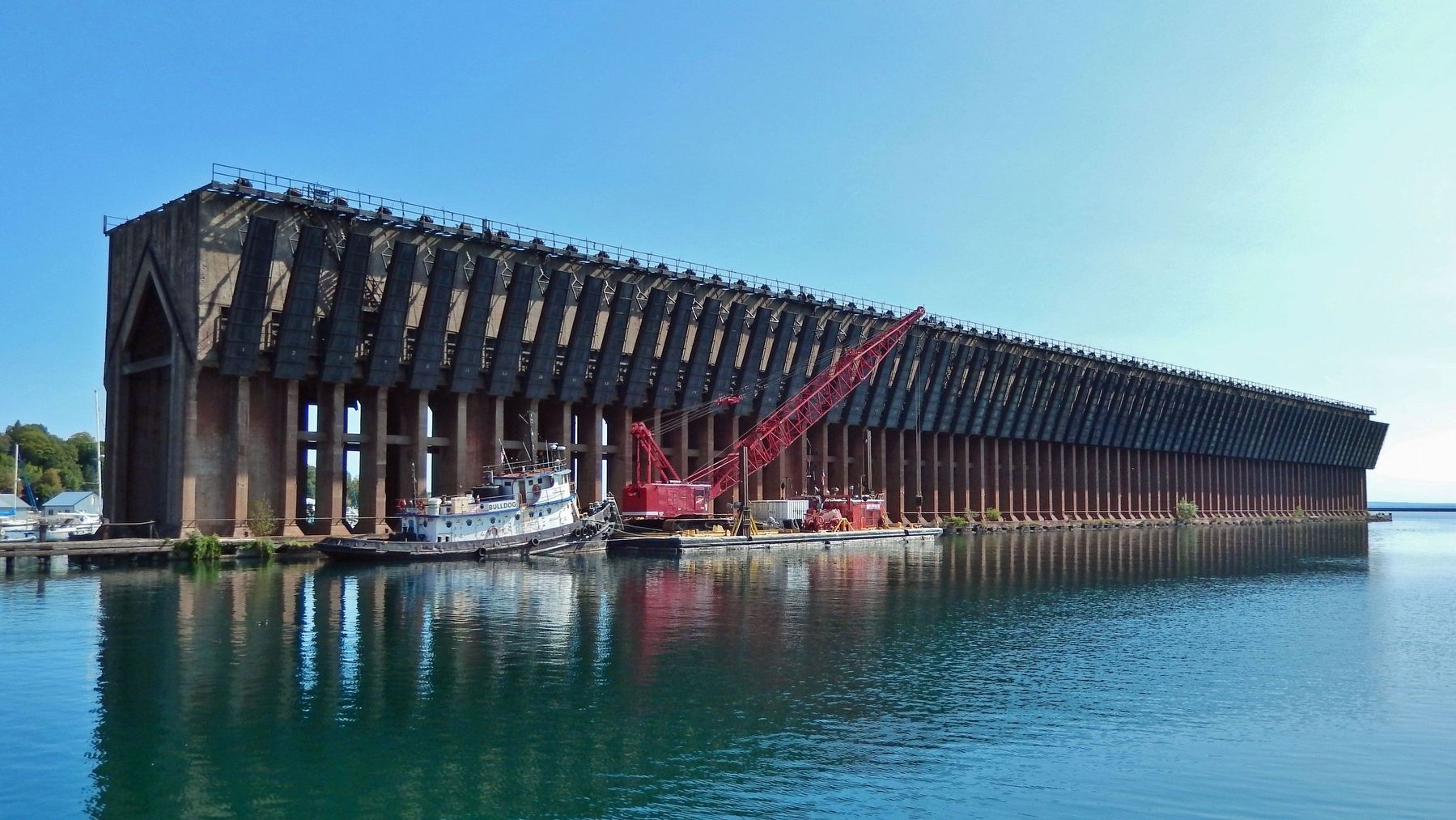
The large concrete dock that still stands, was built in 1931. It was constructed for the Duluth, South Shore and Atlantic Railroad (later to become the Soo Line). The first load of 10,103 tons of iron ore came from the Ford Motor Company's Blueberry Mine west of Ishpeming. The loading took 92 minutes.
With fewer mining companies using the dock, it became economically obsolete and closed in 1971.
A working pocket dock is located at Marquette's Presque Isle Harbor, north of here. Ore freighters can be seen loading iron ore pellets at this dock.
Erected by Iron Ore Heritage Trail.
Topics. This historical marker is listed in these topic lists: Architecture • Industry & Commerce • Railroads & Streetcars • Waterways & Vessels. A significant historical year for this entry is 1857.
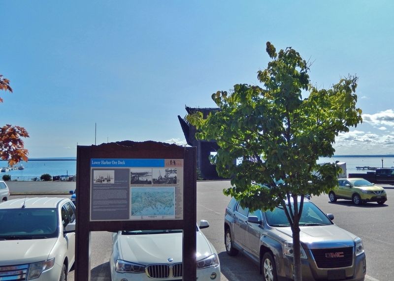
Location. 46° 32.502′ N, 87° 23.528′ W. Marker is in Marquette, Michigan, in Marquette County. It is in Marquette Township. Marker is on South Lakeshore Boulevard just north of East Spring Street, on the right when traveling north. Marker is located beside the sidewalk, overlooking the Lower Harbor Ore Dock to the east. Touch for map. Marker is at or near this postal address: 301 South Lakeshore Boulevard, Marquette MI 49855, United States of America. Touch for directions.
Other nearby markers. At least 8 other markers are within walking distance of this marker. Marquette's Fire Bell (about 500 feet away, measured in a direct line); Marquette Fire Department (about 500 feet away); First Steam Railroad in Upper Peninsula (about 700 feet away); Jacques Marquette (about 700 feet away); Janzen House (about 800 feet away); Marquette County Courthouse (approx. 0.2 miles away); World War II "Silent Service" Memorial (approx. ¼ mile away); Bishop Baraga House (approx. 0.4 miles away). Touch for a list and map of all markers in Marquette.
Also see . . .
1. A Brief History of the Lower Harbor Ore Dock.
Marquette’s Lower Harbor Ore Dock was constructed for loading iron ore from nearby mines’ rail cars onto ore boats for further transport. With railway tracks along the top, rail cars would bottom dump (gravity feed) ore into “pockets." Each pocket’s hinged chute lowered to drop the ore into the hold of a ship moored adjacent to the dock. The pockets are wider at the top than the bottom; the chutes are steel and project out over the water at a slight angle from the sides of the dock. The dormant structure is currently inaccessible to the public.(Submitted on February 15, 2023, by Cosmos Mariner of Cape Canaveral, Florida.)
2. Lower Harbor Ore Dock.
Marquette had the nation’s first ore dock built exclusively for iron back in the mid-1800s, and the ore dock that has become synonymous with Marquette in the lower harbor was built in 1931. It was still used until the 1970s when its use was discontinued, making the Upper Harbor (or Presque Isle) Ore Dock the only operating dock in Michigan. Although the Lower Harbor Ore Dock has not been used since it was shuttered in 1971, some citizens have a plan for its revitalization. The Friends of the Ore Dock have been working to turn the almost a century old landmark into a sort of a public park using private investment funds.(Submitted on February 15, 2023, by Cosmos Mariner of Cape Canaveral, Florida.)
3. Marquette's Lower Harbor Ore Dock closer to revitalization.
The Friends of the Ore Dock BotEco Center group plans to build a walkway out to a new public space, being built on top of and around the ore dock. The Friends of the Ore Dock call this a generational project to revitalize the Marquette landmark.(Submitted on February 15, 2023, by Cosmos Mariner of Cape Canaveral, Florida.)
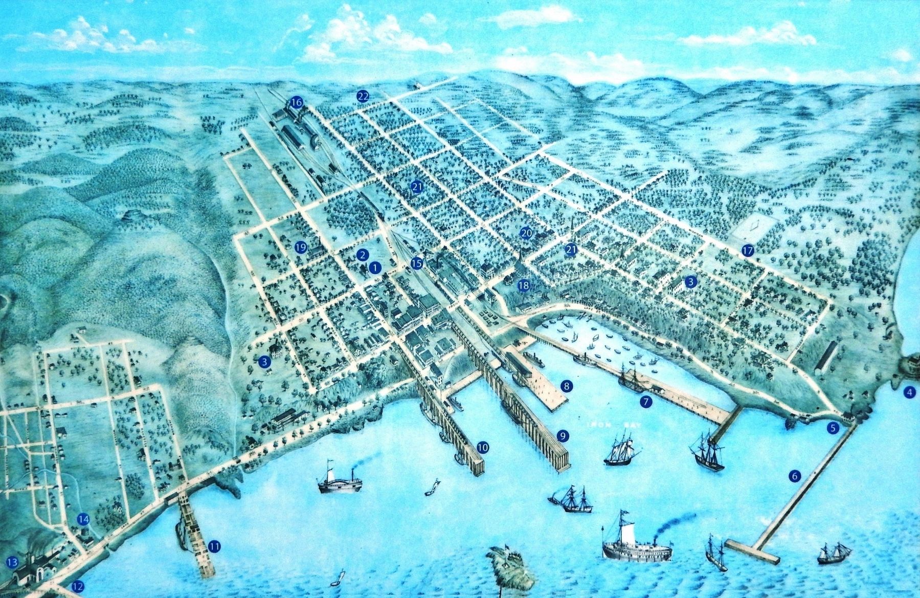
Courtesy Marquette Regional History Center, 1871
5. Marker detail: Birds Eye View of Marquette • 1871
1-Courthouse • 2-Jail • 3-Schoolhouse • 4-Lighthouse • 5-Waterworks • 6-Breakwater • 7-Jackson Dock • 8-R.R. Merchandise Dock •
9-R.R. Ore Dock • 10-Cleveland Iron Company Dock • 11-Harlow's Dock • 12-Rolling Mill Dock • 13-Marquette Pacific Rolling Mill & Furnace •
14-Gas Works • 15-Marquette & Ontonagon Depot • 16-M & O.R.R. Shops • 17-First City Baseball Club Grounds • 18-Presbyterian Church •
19-Catholic Church • 20-Baptist Church • 21-Methodist Church • 22-Cemetery
Credits. This page was last revised on February 15, 2023. It was originally submitted on February 14, 2023, by Cosmos Mariner of Cape Canaveral, Florida. This page has been viewed 207 times since then and 37 times this year. Photos: 1, 2, 3, 4, 5, 6, 7, 8. submitted on February 15, 2023, by Cosmos Mariner of Cape Canaveral, Florida.
