Moon Township in Coraopolis in Allegheny County, Pennsylvania — The American Northeast (Mid-Atlantic)
Carnot
The Crossroads
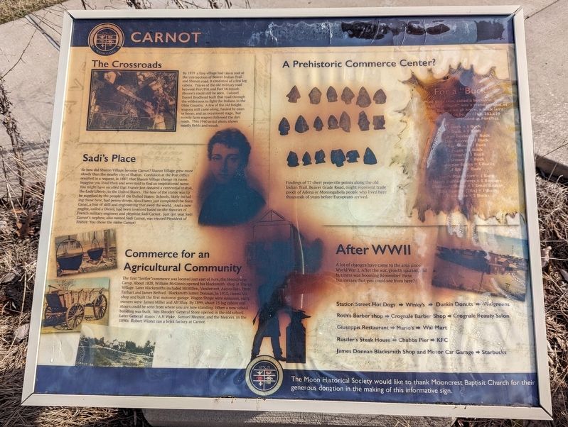
By 1819 a tiny village had taken root at the intersection of Beaver Indian Trail and Sharon road. It consisted of a few log cabins. Traces of old military road between Fort Pitt and Fort McIntosh (Beaver) could still be seen. Colonel Daniel Brodhead built that road through the wilderness to fight the Indians in the Ohio Country. A few of the old freight wagons still came along, hauled by oxen or horse, and and occasional stage, but mostly farm wagons followed the dirt roads. This 1940 aerial photo shows mostly fields and woods.
middle left
Sadi's Place
So how did Sharon Village become Carnot? Sharon Village grew more slowly than the nearby city of Sharon. Confusion at the Post Office resulted in a request, in 1887, that Sharon Village change its name. Imagine you lived then and were told to find an inspirational name. You might have recalled that France just donated a centennial statue, the Lady Liberty, to the United States. Schools, likely including those here, had penny drives. Also France just completed the Suez Canal, a feat of skill and engineering that awed the world. And a new engine, called a Diesel, had been invented based on the theories of French military engineer and physicist Sadi Carnot. Just last year Sadi Carnot's nephew, also named Sadi Carnot, was elected President of France. You chose the name Carnot!
bottom left
Commerce fo an Agricultural Community
The first "Settler" commerce was located just east of here, the Meek Sugar Camp. About 1828, William McGinnis opened his blacksmith shop at Sharon Village. Later blacksmiths included McMillen, Vandervort, Aaron Beer, Peter Earhart and James Belford. Blacksmith James Donnan, in 1932, closed his shop and built the first motorcar garage. Wagon Shops were common, early owners were James Miller and Alf Shay. By 1899, about 15 log cabins and stores could be seen from where you are now standing. When a new school building was built, Mrs. Shrodes' General Store opened in the old school. Later General stores: A H Syke, Samuel Meanor, and the Mercers. In the 1890s Robert Winter ran a brick factory at Carnot.
top center
A Prehistoric Commerce Center?
Findings of 77 chert projectile points along the old Indian Trail, Beaver Grade Road, might represent trade goods of Adena or Monongahela people who lived here thousands of years before Europeans arrived.
top right
For a "Buck"
Make deer skin, called a buckskin and eventually a "buck" was a standard unit of trade. But, as we all know, a buck isn't what it used to be. In 1767, 282,629 deerhides were traded at Fort Pitt.
2 Does - 1 Buck
1 Large Beaver = 1 Buck
2 Doe Beaver = 1 Buck
6 Raccoons = 1 Buck
4 Foxes = 1 Buck
2 Fishers = 1 Buck
2 Otters = 1 Buck
3 Summer Bucks = 2 Bucks
1 Elk = 1 Buck
Men's Plain Shirt = 1 Buck
Men's Ruffled Shirts = 2 Beavers
Children's Shoes = 1 Small Beaver
Gun Powder (1 lbs) = 1 Buck
Tin Kettle = 2 Bucks
bottom right
After WWII
A lot of changes have come to the area since World War 2. After the war, growth spurted, and business was booming Remember these businesses that you could see from here?
Station Street Hot Dogs Winky's Dunkin Donuts Walgreens
Roth's Barber Shop Crognale Barber Shop Crognale Beauty Salon
Giuseppis Restaurant Mario's Wal-Mart
Rustler's Steak House Chubbs Pier KFC
James Donnan Blacksmith Shop and Motor Car Garage Starbucks
Erected by Moon Historical Society and Mooncrest Baptist Church.
Topics. This historical marker is listed in these topic lists: Industry & Commerce • Native Americans • Settlements & Settlers. A significant historical year for this entry is 1819.
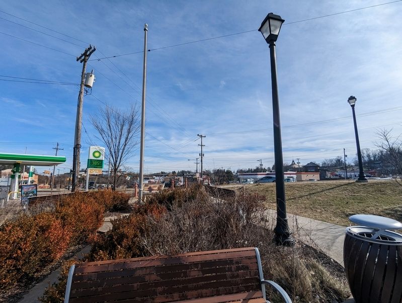
Location. 40° 30.997′ N, 80° 13.329′ W. Marker is in Coraopolis, Pennsylvania, in Allegheny County . It is in Moon Township. Marker can be reached from University Boulevard south of Brodhead Road. Located in a small park near the BP station. Touch for map. Marker is in this post office area: Coraopolis PA 15108, United States of America. Touch for directions.
Other nearby markers. At least 8 other markers are within 3 miles of this marker, measured as the crow flies. Joshua Meeks (approx. 0.7 miles away); Moon Township September 11th Memorial (approx. 1.1 miles away); Robin Hill Park (approx. 1.3 miles away); Hyeholde (approx. 1.3 miles away); Mooncrest (approx. 1.7 miles away); This Memorial is Dedicated to (approx. 2.3 miles away); Down The Ohio (approx. 2.3 miles away); The Pittsburgh, Fort Wayne and Chicago Station (approx. 2.3 miles away). Touch for a list and map of all markers in Coraopolis.
Also see . . . Nicolas Lιonard Sadi Carnot. Wikipedia article (Submitted on February 14, 2023, by Mike Wintermantel of Pittsburgh, Pennsylvania.)
Credits. This page was last revised on February 14, 2023. It was originally submitted on February 14, 2023, by Mike Wintermantel of Pittsburgh, Pennsylvania. This page has been viewed 169 times since then and 54 times this year. Photos: 1, 2. submitted on February 14, 2023, by Mike Wintermantel of Pittsburgh, Pennsylvania.

