
Odessa in Pasco County, Florida — The American South (South Atlantic)
Odessa
Photographed by Tim Fillmon, April 21, 2013
1. Odessa Marker
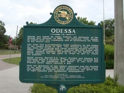
The town had approximately 2000 residents at the height of the timber boom in 1917. The Mueller & Lutz sawmills and later the Dowling and Lyons sawmills thrived until the 1920s. The combined output reached 180,000 board feet daily. Sawmill magnate WH Dowling had the wheels of his Buick adapted for the rails in order to get to Tampa for supplies.
Pasco County Sheriff B.D. "Bart" Sturkie and Deputy H.E. Whitfield ended a shootout in 1915 when they returned fire and killed the instigator, Will Hyatt. It was said that Sturkie never again carried a gun.
With the depletion of the timber resources and the burning of the mills, citrus trees were planted. In recent years, due largely to freezes, citrus production has given way to light industry and residential development.
Erected 2002 by The Pasco Board of County Commissioners and The Pasco County Historical Preservation Committee.
Topics. This historical marker is listed
this page online
Location. Marker has been reported missing. It was located near 28° 10.957′ N, 82° 34.677′ W. Marker was in Odessa, Florida, in Pasco County. It was on Chesapeake Drive 0.1 miles south of Park Colony Drive, on the right when traveling south. Marker is in front of the Odessa Community Center in Odessa Community Park. Touch for map. Marker was at or near this postal address: 1627 Chesapeake Drive, Odessa FL 33556, United States of America. Touch for directions.

Regionally, this marker was on Florida’s Gulf Coast and on Tampa Bay. It was also in the American South and on the Gulf Coast. Globally, it was in the North Atlantic Region, North America, a Gulf of Mexico state, the Western Hemisphere, the Western World, and the Anglosphere. Historically, it found itself in what was once New Spain, the territory of the Mississippian Culture, one of the Confederate States of America, and the Antebellum South.
Other nearby markers. At least 8 other markers are within 8 miles of this location, measured as the crow flies: Isaac Washington Hudson Sr.
Photographed by Dave W, February 18, 2023
2. Odessa Marker
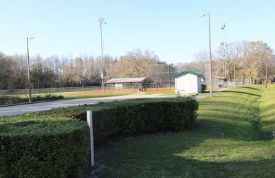
Pole can be seen without marker attached.
Credits. This page was last revised on February 22, 2023. It was originally submitted on August 14, 2013, by Tim Fillmon of Webster, Florida. This page has been viewed 1,350 times since then and 76 times this year. Last updated on February 19, 2023, by Dave W of Co, Colorado. Photos: 1. submitted on August 14, 2013, by Tim Fillmon of Webster, Florida. 2. submitted on February 19, 2023, by Dave W of Co, Colorado. • Bill Pfingsten was the editor who published this page.
Editor’s want-list for this marker. Wide shot of marker and its surroundings. • Can you help?
