Central Business District in Kalamazoo in Kalamazoo County, Michigan — The American Midwest (Great Lakes)
The Heart of a New Town
Written and Compiled by Sharon R. Ferraro,
City of Kalamazoo Historic Preservation Coordinator in 2019
1800's - The Four Squares
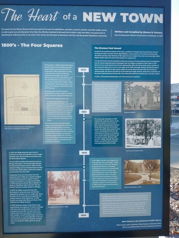
The Bronson Park Mound
Located in the southwest quadrant of the park, a prehistoric hemispherical mound had been formed by American Indian ancestors whose tribal affiliations remain unknown. The mound was historically described as having a base diameter of fifty-eight feet and a height of four feet, nine inches high. While slightly smaller today, the mound still maintains the original form.
It is the best-known mound remaining in Kalamazoo County and various histories report investigations into the mound, beginning almost immediately after the Village was platted in 1832, when E. Lakin Brown & Cyrus Lovell opened it and found nothing inside. When the jail was built nearby, a portion of the mound was dug out for a use as a root cellar. In the 1850s, Alexander Sheldon opened the mound, found nothing, and placed a time capsule within the mound. About 100 years later, the mound was disturbed again, this time by the Director of the Kalamazoo Public Museum, Alexis Praus, and Parks and Recreation Superintendent, Nicholas Kik, who replaced the 1850 time capsule with a new time capsule.
In 2019, a Ground Penetrating Radar scan of the mound was completed.
1830
On November 1, 1830, Stephen Richardson and his brother-in-law Titus Bronson each bought eighty acres of land from the U.S. Government. Today's Rose Street, running north and south, was the dividing line between the two eighty-acre parcels. Bronson's parcel was on Rose Street's east side and Richardson's parcel was on the west. The two platted their Village in 1831, and Richardson's land became home to the famous "Four Squares” as identified on the 1831 Plat map.
As Kalamazoo's very first economic development incentive, those four squares were set aside for public and religious use. The plat map notations read in part:
The Public Square, Jail Square and Academy Square are 16 rods square. The above streets and squares are appropriated for the use and benefit of the County. The Church Square is Sixteen rods square and is appropriated to the four first religious denominations who may form societies in the foregoing Town and erect buildings thereon one fourth to the benefit of each society.
The 1831 plat map shows the marked squares bounded by what are now known as West Michigan Avenue, South Rose, West South, and South Park Streets with Academy Street and Church Street dividing the parcels. The economic development incentive worked. Within the next three years, the Michigan Territorial government located the Kalamazoo County seat and Land office in Bronson.
Within a decade, all four squares were at least partially developed. A wooden courthouse was built in 1838 in the northeast square. Church Square on the northwest was fully populated by 1852 with Baptist, Methodist, Episcopal, and Congregational houses of worship. The County built a log cabin jail in the southwest square near the mound. In the southeast square, a two-story wooden framed academy was built as a branch of the new University of Michigan.
1850
The County jail's demolition in 1845 rendered the southwest square vacant, with the exception of the mound. In 1847, with the abandonment of Church Street between the Jail and Academy squares, the public began using the term "park", even though the land was still unimproved and used as a cow pasture. Some citizens urged the County to sell the land for revenue. Between 1847 and 1853, Village Marshall, Alexander Sheldon, fenced the park's perimeter and graded and graveled its walks.
1870
In 1854, the Village leased the park from the County for ten years, but only after a series of legal questions were answered about ownership of the Jail and Academy Squares.
The year 1856 was filled with important events in Bronson Park history. The County finally obtained the title from Richardson's heirs in 1856 and after asking the Village to have Academy Square vacated of its decrepit 1838 building, citizens just picked it up and moved it into the street.
Looking back from the 21st century, the most important event in 1856 was a speech on August 27th by Abraham Lincoln in support of John C. Fremont for President. Local attorney Hezehiah G. Wells invited the unknown Illinois legislator to speak at a Republican rally in the park. This was Lincoln's only known public address in Michigan.
In 1864, the Village renewed its lease with the County for ninety-nine years and formally dedicated the property's use as a public park. Since that time, the 3.6 acre park has occupied the two southern squares of the original four. In 1876, the park was named after Bronson in honor of his settlement and Village founding.
In 1878, landscape designer Adam Oliver's park improvements were approved. To improve drainage, wells were sunk and filled with stone and walks excavated and sand-filled. The open areas were leveled and seeded, trees planted, water and gas lines installed, a central fountain begun, lamp posts erected, and so on. Concrete sidewalks on the east and south park perimeter, the fountain, and other items were finished in 1880, paid for by private funds.
In the 1880s, the park's use changed, and some activities were made illegal - riding or driving over any of the park, throwing things into the fountain, and animals inside the fence around the fountain were all prohibited. In just a few years, the park emerged from a place where large gatherings had been held, to one that was more formal and statelier. As Carol Knauss noted in her Bronson Park history "The days of barbeque and wild speech- making were gone.” On Decoration Day in 1880, speech-making was restricted to Court House Square.
By 1884, however, that trend had reversed. Kalamazooans were proud of their park and wanted to again use it to gather as they had before. By July 4th of that year, people gathered there again in large numbers to celebrate. Between 1890 and the turn of the century, Bronson Park was well-used and had become more like a formal, European park. William Oliver, its gardener at that time, planted multiple garden beds and added large flowerpots in addition to other repairs and upgrades. In 1900, a new speakers' pavilion and bandstand was erected in the northeast corner of the park and commemorative monuments and markers began to appear.
Erected by Library Local History Room and City of Kalamazoo Records.
Topics. This historical marker is listed in these topic lists: Architecture • Parks & Recreational Areas • Settlements & Settlers. A significant historical date for this entry is July 4, 2019.
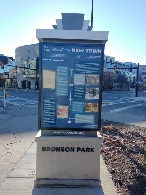
Location. 42° 17.395′ N, 85° 35.098′ W. Marker is in Kalamazoo, Michigan, in Kalamazoo County. It is in the Central Business District. Marker is on South Rose Street, on the right when traveling south. Touch for map. Marker is at or near this postal address: 200 S Rose St, Kalamazoo MI 49007, United States of America. Touch for directions.
Other nearby markers. At least 8 other markers are within walking distance of this marker. U.S. Ten Inch Columbiad (here, next to this marker); Presented To The City Of Kalamazoo (within shouting distance of this marker); Lincoln's August 1856 Speech in Kalamazoo (within shouting distance of this marker); This Liberty Pole (within shouting distance of this marker); Kalamazoo Vietnam War Memorial (within shouting distance of this marker); Kalamazoo 9/11 Memorial (within shouting distance of this marker); Lucinda Hinsdale Stone (within shouting distance of this marker); 35th Anniversary (within shouting distance of this marker). Touch for a list and map of all markers in Kalamazoo.
Credits. This page was last revised on February 26, 2023. It was originally submitted on February 19, 2023, by Craig Doda of Napoleon, Ohio. This page has been viewed 74 times since then and 20 times this year. Photos: 1, 2. submitted on February 19, 2023, by Craig Doda of Napoleon, Ohio. • J. Makali Bruton was the editor who published this page.

