Warwick Township in Lititz in Lancaster County, Pennsylvania — The American Northeast (Mid-Atlantic)
Oil Pumping Station
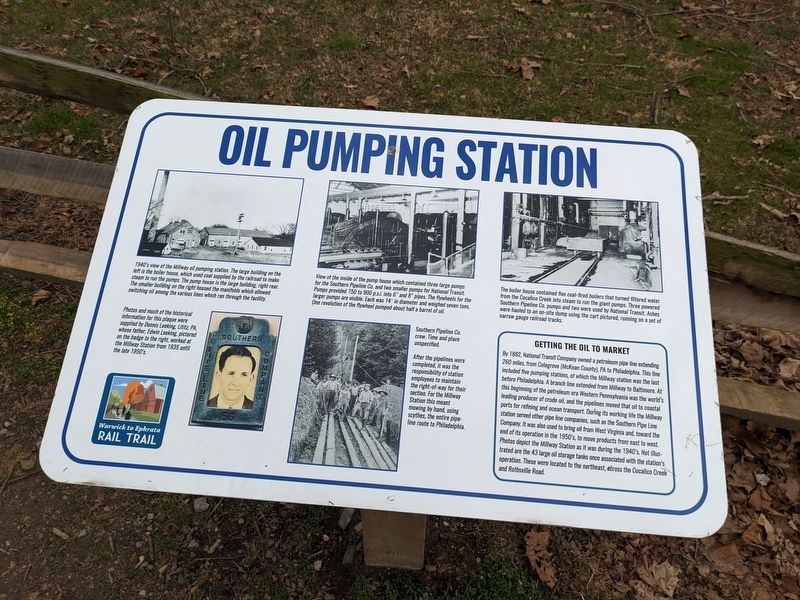
View of the inside of the pump house which contained three large pumps for the Southern Pipeline Co. and two smaller pumps for National Transit. Pumps provided 750 to 900 p.s.i. into 6" and 8" pipes. The flywheels for the larger pumps are visible. Each was 14' in diameter and weighed seven tons. One revolution of the flywheel pumped about half a barrel of oil.
The boiler house contained five coal-fired boilers that turned filtered water from the Cocalico Creek into steam to run the giant pumps. Three powered Southern Pipeline Co pumps and two were used by National Transit. Ashes were hauled to an on-site dump using the cart pictured, running on a set of narrow gauge railroad tracks.
Getting the oil to market
By 1882 National Transit Company owned a petroleum pipe line extending 260 miles, from Colegrove (McKean County), PA to Philadelphia. This line included five pumping stations, of which the Millway station was the last before Philadelphia. A branch line extended from Millway to Baltimore. At this beginning of the petroleum era Western Pennsylvania was the world's leading producer of crude oil, and the pipelines moved that oil to coastal ports for refining and ocean transport. During its working life the Millway station served other pipe line companies, such as the Southern Pipe Line Company. It was also used to bring oil from West Virginia and, toward the end of its operation in the 1950's, to move products from east to west Photos depict the Millway Station as it was during the 1940's. Not illustrated are the 43 large oil storage tanks once associated with the station's operation. These were located to the northeast, across the Cocalico Creek and Rothsville Road.
Southern Pipeline Co. crew. Time and place unspecified. After the pipelines were completed, it was the responsibility of station employees to maintain the right-of-way for their section. For the Millway Station this meant mowing by hand, using scythes, the entire pipe-line route to Philadelphia.
Photos and much of the historical information for this plaque were supplied by Dennis Leeking, Lititz, PA, whose father, Edwin Leeking, pictured on the badge to the right, worked at the Millway Station from 1935 until the late 1950's.
Erected by Warwick to Ephrata Rail trail.
Topics. This historical marker is listed in this topic list: Industry & Commerce.
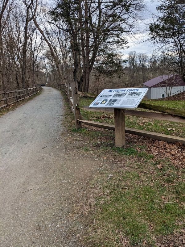
Location. 40° 9.468′ N, 76° 13.669′ W. Marker is in Lititz, Pennsylvania, in Lancaster County. It is in Warwick Township. Marker can be reached from Warwick to Ephrata Rail Trail, 0.1 miles east of Rothsville Road. Shirley Lane runs parallel to the rail trail at this location and the marker is close to and can be accessed near 10 Shirley Lane. Touch for map. Marker is at or near this postal address: 10 Shirley Ln, Lititz PA 17543, United States of America. Touch for directions.
Other nearby markers. At least 8 other markers are within 2 miles of this marker, measured as the crow flies. Keller's Mill Bridge (approx. half a mile away); Millway Village (approx. half a mile away); Erb's Covered Bridge (approx. 1.1 miles away); Cpl. Gerald L. Habecker (approx. 1.2 miles away); In Honor of (approx. 1.3 miles away); This section of Main Street (approx. 1.3 miles away); Philip Roth Cemetery (approx. 1.4 miles away); Rothsville (approx. 1.6 miles away). Touch for a list and map of all markers in Lititz.
Credits. This page was last revised on February 22, 2023. It was originally submitted on February 20, 2023, by William Pope of Marietta, Pennsylvania. This page has been viewed 220 times since then and 68 times this year. Photos: 1, 2. submitted on February 20, 2023, by William Pope of Marietta, Pennsylvania. • Bill Pfingsten was the editor who published this page.

