New London in New London County, Connecticut — The American Northeast (New England)
Coastal Hazard Areas
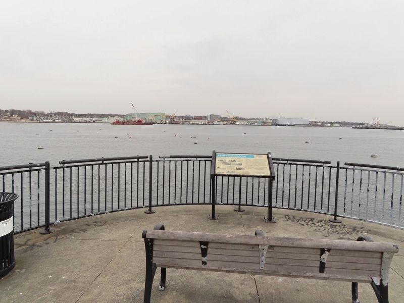
New London Waterfront Park
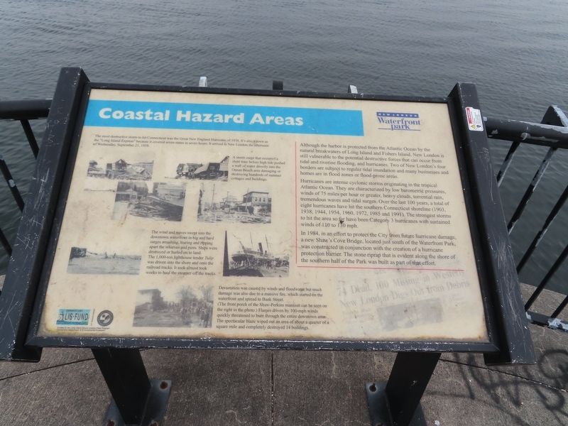
Although the harbor is protected from the Atlantic Ocean by the natural breakwaters of Long Island and Fishers Island, New London is still vulnerable to the potential destructive forces that can occur from tidal and riverine flooding, and hurricanes. Two of New London's four borders are subject to regular tidal inundation and many businesses and homes are in flood zones or flood-prone areas.
Hurricanes are intense cyclonic storms originating in the tropical Atlantic Ocean. They are characterized by low barometric pressures, winds of 75 miles per hour or greater, heavy clouds, torrential rain, tremendous waves and tidal surges. Over the last 100 years, a total of eight hurricanes have hit the southern Connecticut shoreline (1903, 1938, 1944, 1954, 1960, 1972, 1985 and 1991). The strongest storms to hit the area so far have been Category 3 hurricanes with sustained winds of 110 to 130 mph.
In 1984, in an effort to protect the City from future hurricane damage, a new Shaw's Cove Bridge, located just south of the Waterfront Park, was constructed in conjunction with the creation of a hurricane protection barrier. The stone riprap that is evident along the shore of the southern half of the Park was built as part of that effort.
( photo captions )
— The most destructive storm to hit Connecticut was the Great New England Hurricane of 1938. It's also known as the "Long Island Express" because it covered seven states in seven hours. It arrived in New London the afternoon of Wednesday, September 21, 1938.
— A storm surge that occurred a short time before high tide pushed a wall of water directly into the Ocean Beach area damaging or destroying hundreds of summer cottages and buildings.
— The wind and waves swept into the downtown waterfront in big and hard surges smashing, tearing and ripping apart the wharves and piers. Ships were destroyed or hurled on to land. The 1,000-ton lighthouse tender Tulip was driven into the shore and onto the railroad tracks. It took almost took weeks to haul the steamer off the tracks.
— Devastation was caused by winds and floodwater but much damage was also due to a massive fire, which started on the waterfront and spread to Bank Street. (The front porch of the Shaw-Perkins mansion can be seen on the right in the photo.) Flames driven by 100-mph winds quickly threatened to burn through the entire downtown area. The spectacular blaze wiped out an area of about a quarter of a square mile and completely destroyed 14 buildings.
Topics. This historical marker is listed in these topic lists: Industry & Commerce • Waterways & Vessels. A significant historical date for this entry is September 21, 1938.
Location. 41° 21.05′ N, 72° 5.749′ W. Marker is in New London, Connecticut, in New London County. Marker can be reached from S Water Street east of Bank Street Connector, on the right when traveling east. Touch for map. Marker is in this post office area: New London CT 06320, United States of America. Touch for directions.
Other nearby markers. At least 8 other markers are within walking distance of this marker. Changing Shoreline (about 400 feet away, measured in a direct line); 194 Bank Street (about 400 feet away); New London Harbor (about 400 feet away); 181 Bank Street (about 500 feet away); First Step to Freedom (about 500 feet away); "Do you want to be slave or free?" (about 500 feet away); Honor Roll (about 500 feet away); New London Whalemen (about 600 feet away). Touch for a list and map of all markers in New London.
Also see . . . 1938 New England hurricane (Wikipedia). (Submitted on February 26, 2023, by Michael Herrick of Southbury, Connecticut.)
Credits. This page was last revised on February 26, 2023. It was originally submitted on February 26, 2023, by Michael Herrick of Southbury, Connecticut. This page has been viewed 51 times since then and 6 times this year. Photos: 1, 2. submitted on February 26, 2023, by Michael Herrick of Southbury, Connecticut.

