
Middlesex Township near Carlisle in Cumberland County, Pennsylvania — The American Northeast (Mid-Atlantic)
Utah Beach
Liberation Pointe
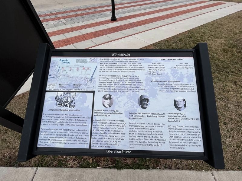
Over 21,000 men of the 4th U.S. Infantry Division (ID), with elements of the 90th Infantry Division and the 4th Mechanized Cavalry Group, stormed Utah Beach. Utah Beach was divided into three sectors: "Tare," "Uncle," and "Victor." The mission of the 4th ID was to secure the beach and the four major causeways that led into the towns to link up with the 82nd and 101st Airborne Divisions.
Paratroopers dropped inland through the night and secured key positions. U.S. Navy shelling of German defenses, followed by Army Air Forced bombings, were successful as well. The 4th ID was to secure the beach and the four major causeways that led into the towns to link u with the 82nd and 101st Airborne Divisions.
Paratroopers dropped inland through the night and secured key positions. U.S. Navy shelling of German defenses, followed by Army Air Forces bombings, were successful as well. The 4th ID landed two thirds of a mile from their planned zone in a less defended area, allowing them to advance four miles inland, securing roads and working with the airborne divisions. The Americans landed 23,500 troops onto Utah Beach with 200
this page online
Utah Combatant Forces Allied Units
4th Infantry Division • 90th Infantry Division • 4th Cavalry Regiment • U.S. Navy • U.S. Coast Guard
Axis Units
91st Infantry Division • 919th Grenadier Regiment
"We will start the war from right here."
Brigadier General Theodore Roosevelt, Jr., 57
Asst. Commander, 4th U.S. Infantry Division
- upon learning that his Soldiers landed almost a mile from their target on Utah Beach
Captain E. Briner Ashway, 22,
556th Quartermaster Railhead Co.,
Mechanicsburg, PA
Ashway led his quartermaster troops onto Utah Beach and inland to manage vital supplies. In preparation for D-Day, Ashway was part of Exercise Tiger on April 28, 1944. His boat was severely damaged, and he suffered major head trauma. He returned a few weeks later to land on Utah. After D-Day, Ashway was attached to the 3rd Army and General Patton's history making advance across Europe.
Brigadier Gen. Theodore Roosevelt, Jr., 57
Asst. Commander, - 4th Infantry Division,
Oyster Bay, NY
General Roosevelt, Jr. realized quickly that the troops landed over a mile from their target. His quick thinking and confident
Dennis Shryock, 21,
Explosives Specialist,
Naval Combatant Demolition Unit 136,
Springfield, IL
U.S. Navy Gunner's Mate First Class Dennis Sryock, a member of one of thirty-four demolition teams sent to Europe, was one of the first men on Utah Beach. Despite the intense fire, his unit worked obstacle to obstacle, lacing each with sixty pounds of explosives and clearing the way for the allies to land.
They developed their own words that even other native speakers would not understand: a submarine was an iron fish, a bomber was a pregnant bird, and a tank was a turtle. Their code was never broken, and the Code Talkers were credited with saving numerous American and Allied lives. While some of the Code Talkers were wounded, all of them returned home.
[Caption:]
The greatest invasion in history relied on an intricate multipart attack. A prolonged aerial bombardment in the weeks leading up to D-day was followed by further air attacks on German positions in the early hours of June 6. Beginning around 0500 hours, Navy guns again hammered the Germans; the amphibious landings followed. In addition, some 24,000 men made airborne landings in Normandy, either by parachuting or landing in gliders.
Topics and series. This historical marker is listed in these topic lists: Air & Space • Communications • Indigenous Peoples and Communities • War, World II. In addition, it is included in the Medal of Honor Recipients series list. A significant historical date for this entry is April 28, 1944.
Location. 40° 12.439′ N, 77° 9.604′ W. Marker is near Carlisle, Pennsylvania, in Cumberland County. It is in Middlesex Township. It is on Soldiers Drive south of Army Heritage Drive, on the right when traveling east. Touch for map. Marker is at or near this postal address: 950 Soldiers Dr, Carlisle PA 17013, United States of America. Touch for directions.

Regionally, this marker is in South-Central Pennsylvania and in Greater Harrisburg. It is also in the American Northeast, in the Mid-Atlantic, in Appalachia, and specifically in Northern Appalachia. Globally, it is in North America, the Western Hemisphere, the Western World, and the Anglosphere. Historically, it finds itself in what was once the Haudenosaunee (Iroquois) Confederacy and also one of the original Thirteen Colonies.
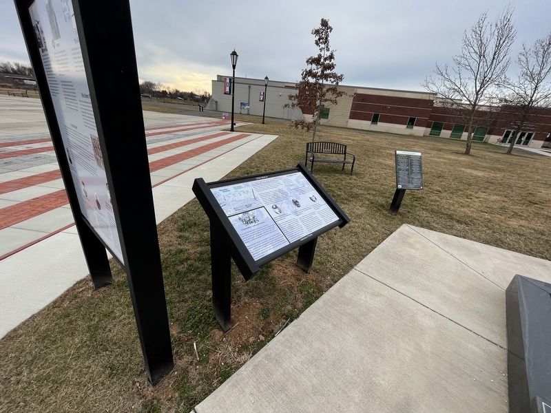
Other nearby markers. At least 8 other markers are within walking distance of this marker: Ranger and Airborne Operations (here, next to this marker); Omaha Beach (here, next to this marker); Operation Overlord (here, next to this marker); Gold Beach (here, next to this marker); Sword Beach (here, next to this marker); Juno Beach (here, next to this marker); Corporal John D. LaWall (a few steps from this marker); Private First Class Willard Dominick (a few steps from this marker). Touch for a list and map of all markers in Carlisle.
Credits. This page was last revised on February 28, 2023. It was originally submitted on February 28, 2023, by Devry Becker Jones of Washington, District of Columbia. This page has been viewed 395 times since then and 14 times this year. Photos: 1, 2. submitted on February 28, 2023, by Devry Becker Jones of Washington, District of Columbia.
