Near Afton in Washington County, Minnesota — The American Midwest (Upper Plains)
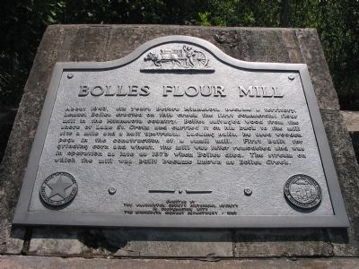
Bolles Flour Mill
Erected by the Washington County Historical Society in cooperation with the Minnesota Highway Department · 1959
Erected 1959 by the Washington County Historical Society in cooperation with the Minnesota Highway Department.
Topics. This historical marker is listed in this topic list: Industry & Commerce. A significant historical year for this entry is 1843.
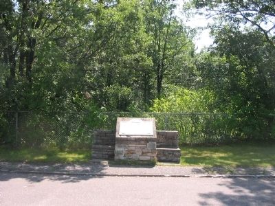
Location. 44° 54.533′ N, 92° 46.843′ W. Marker is near Afton, Minnesota, in Washington County. Marker is on Saint Croix Trail North (County Highway 18 / 21) 0.3 miles north of Stagecoach Trail South (County Highway 21), on the right when traveling north. Marker is at a highway pull-off. Touch for map. Marker is in this post office area: Afton MN 55001, United States of America. Touch for directions.
Other nearby markers. At least 8 other markers are within 8 miles of this marker, measured as the crow flies. The St. Croix River Valley / Welcome to Minnesota (approx. 3.6 miles away); In the Summer of 1910 (approx. 4.7 miles away in Wisconsin); Hudson Toll Bridge (approx. 4.7 miles away in Wisconsin); 112 Walnut Street (approx. 4.7 miles away in Wisconsin); Louis Massey (approx. 5.2 miles away in Wisconsin); Kinnickinnic State Park (approx. 5˝ miles away in Wisconsin); German Settlement (approx. 7.4 miles away in Wisconsin); Bicentennial Monument (approx. 7.7 miles away).
Credits. This page was last revised on June 16, 2016. It was originally submitted on August 17, 2009, by Keith L of Wisconsin Rapids, Wisconsin. This page has been viewed 1,425 times since then and 52 times this year. Photos: 1, 2. submitted on August 17, 2009, by Keith L of Wisconsin Rapids, Wisconsin. • Craig Swain was the editor who published this page.

