Vergennes Township in Lowell in Kent County, Michigan — The American Midwest (Great Lakes)
Native Americans
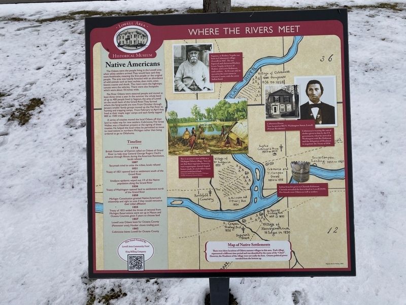
Where The Rivers Meet
Flat River Odawa were seasonal people and moved at least three times a year. In the summer the whole band of up to 400 people lived in Segwun, the area of Lowell on the south bank of the Grand River. They farmed where the fairgrounds are now, From October through January smaller family groups moved up the Flat River to hunting and trapping camps. From February to April they lived at their maple sugar camps and each family tapped 800 to 1500 trees.
A series of treaties moved the local Odawa off their land to make way for new settlers. Cobmoosa, The Great Walker, was a Headman present at the signing of these treaties. He helped the local tribes be permitted to move to reservations in northern Michigan rather than being ordered to go to Oklahoma.
Timeline
1778
British Governor of Detroit called on Odawa of Grand River to help stop General George Rogers Clark's advance through Illinois during the American Revolution, locals refused
1807
Tecumseh tried to unite the tribes, locals refused
1821
Treaty of 1821 opened land to settlement south of the Grand River
1835
Smallpox epidemic wiped out 1/3 of the Native population along the Grand River
1836
Treaty of Washington opened land to settlement north of the Grand River
1850
Michigan Constitution granted Native American's citizenship and right to vote if they would renounce their tribal affiliation
1855
Treaty of 1855 ended the threat of removal from Michigan; Reservations were set up in Mason and Oceana Counties, given 5 years to choose land
1857
Lowell area Odawa leave for Oceana County (Pentwater area), Hooker closes trading post
1862
Cobmoosa leaves Lowell for Oceana County
Segonse, or Rodney Negake was born in Cobmoosa’s village (Lowell) in 1847. He was baptized and christened Rodney Lewis Negake in honor of Rodney and Lewis Robinson, early settlers. At 10 years old, he moved to the reservation on Oceana Count with the entire Indian band.
This is an artist’s view of life in a Michigan Odawa village. You can see that their wigwams (houses) were wagonogans, domed shaped houses made of a red willow frame covered with birch bark.
Cobmoosa
House Now located at 803 N. Washington Street, Lowell. (Private Residence)
Cobmoosa is wearing the suit of clothes given to him by the US government, when he arrived in Washington with Rix Robinson and the delegation of Headmen to negotiate the Treaty of 1836.
Indian bracelet given to Clarinda Robinson. Clarinda attended the first school in Lowell (1838). Her friends were Odawa as well as settlers.
Map of Native Settlements
There were three locations of Odawa summer villages in this area. Each village represented a different time period and was identified by the name of the "Chief". However, the Headmen of the village were not really the boss. Ottawa political power traveled from the bottom up.
Erected by Lowell Area Historical Museum.
Topics. This historical marker is listed in these topic lists: Native Americans • Settlements & Settlers. A significant historical year for this entry is 1500.
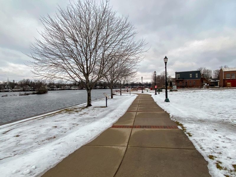
Location. 42° 56.151′ N, 85° 20.312′ W. Marker is in Lowell, Michigan, in Kent County. It is in Vergennes Township. Marker can be reached from North Monroe Street near Avery Street. The marker is on the riverwalk west of the Kent District Library. Touch for map. Marker is at or near this postal address: 200 North Monroe Street, Lowell MI 49331, United States of America. Touch for directions.
Other nearby markers. At least 8 other markers are within walking distance of this marker . Fur Traders (a few steps from this marker); Lumbering (within shouting distance of this marker); Early Settlers (about 300 feet away, measured in a direct line); Welcome to Lowell (about 400 feet away); On The Bridge (about 500 feet away); Lowell Veterans Memorial (about 600 feet away); Waterpower (about 600 feet away); Lowell Area Veterans Memorial (about 600 feet away). Touch for a list and map of all markers in Lowell.
Credits. This page was last revised on March 6, 2023. It was originally submitted on March 4, 2023, by J.T. Lambrou of New Boston, Michigan. This page has been viewed 216 times since then and 109 times this year. Photos: 1, 2. submitted on March 4, 2023, by J.T. Lambrou of New Boston, Michigan. • J. Makali Bruton was the editor who published this page.

