Warm Springs in Bath County, Virginia — The American South (Mid-Atlantic)
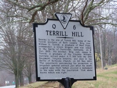
Terrill Hill
Erected 2004 by Department of Historic Resources. (Marker Number Q-6.)
Topics and series. This historical marker is listed in this topic list: War, US Civil. In addition, it is included in the Virginia Department of Historic Resources (DHR) series list. A significant historical date for this entry is May 30, 1864.
Location. 38° 3.182′ N, 79° 46.833′ W. Marker is in Warm Springs, Virginia, in Bath County. Marker is on U.S. 220. Touch for map. Marker is in this post office area: Warm Springs VA 24484, United States of America. Touch for directions.
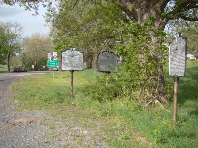
Other nearby markers. At least 8 other markers are within walking distance of this marker. Early Bath County Courthouses (here, next to this marker); The Rev. Dr. William H. Sheppard (here, next to this marker); Warm Springs Baths (within shouting distance of this marker); Mary Johnston (approx. half a mile away); Overshoot Wheel (approx. 0.6 miles away); Waterwheel Restaurant Building (approx. 0.6 miles away); The Dinwiddie Mantle (approx. 0.6 miles away); Bath County Historical Society Building (approx. 0.7 miles away). Touch for a list and map of all markers in Warm Springs.
Also see . . . William R. Terrill. Wikipedia biography of William. (Submitted on August 18, 2009, by Craig Swain of Leesburg, Virginia.)
Credits. This page was last revised on December 24, 2019. It was originally submitted on August 17, 2009, by Bill Pfingsten of Bel Air, Maryland. This page has been viewed 1,319 times since then and 30 times this year. Photos: 1. submitted on August 17, 2009, by Bill Pfingsten of Bel Air, Maryland. 2. submitted on May 4, 2010, by J. J. Prats of Powell, Ohio.

