Cape Canaveral in Brevard County, Florida — The American South (South Atlantic)
Cape Canaveral Light Station
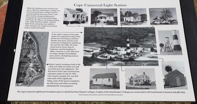
When the Lighthouse was moved to this site in 1894, the Head Keeper's cottage, the First Assistant Keeper's cottage, and one storage building were also moved. Soon after another storage building and a cottage for the Second Assistant Keeper were built. By 1900, an oil storage building and a stable had been added. Until the water tower and pump were added in 1950, rainwater was caught and stored in cisterns under the houses.
To the right is a layout of the Light Station as it appeared in about 1965. By this time, the Keepers and their families were gone, and the Coast Guard was managing the Lighthouse. Up until the mid 1960s, the Coast Guard and US Army Corps of Engineers used the buildings as offices. However, in 1967, they were no longer needed. The buildings were used in a firefighting exercise and burned down.
Historic launch complexes built in the 1950s and 1960s are within one-half to 8 miles from the Lighthouse. The first launch from Cape Canaveral was a Bumper rocket on July 24, 1950 from Launch Complex 3/4, one-half mile north of the Lighthouse. Today, some of the launch complexes are still active and others are being refurbished for new programs.
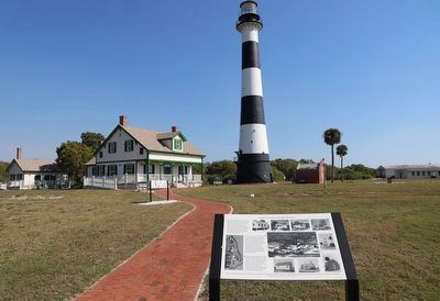
The Cape Canaveral Lighthouse Foundation plans to rebuild the three Keepers' cottages. A replica of the Head Keeper's Cottage was constructed in 2019 and houses a museum and gift shop.
Erected by Florida Lighthouse Association.
Topics. This historical marker is listed in these topic lists: Air & Space • Architecture • Settlements & Settlers • Waterways & Vessels. A significant historical year for this entry is 1894.
Location. 28° 27.593′ N, 80° 32.634′ W. Marker is in Cape Canaveral, Florida, in Brevard County. Marker is on Lighthouse Road north of Control Tower Road, on the left when traveling north. Touch for map. Marker is in this post office area: Cape Canaveral FL 32920, United States of America. Touch for directions.
Other nearby markers. At least 8 other markers are within 2 miles of this marker, measured as the crow flies. Early Cape Life (a few steps from this marker); Cape Canaveral Lighthouse (within shouting distance of this marker); Cape Canaveral's Native Americans (about 300 feet away, measured in a direct line); a different marker also named Cape Canaveral Lighthouse (about 400 feet away); Launch Site of America's First Satellite, Explorer I / The Space Race Begins (approx. 2 miles away); Cape Canaveral Air Force Station (approx. 2 miles away); First United States Space Launch (approx. 2 miles away); Launch Complex 26 (approx. 2 miles away). Touch for a list and map of all markers in Cape Canaveral.
Also see . . . Cape Canaveral Lighthouse. (Submitted on March 5, 2023.)
Credits. This page was last revised on March 5, 2023. It was originally submitted on March 5, 2023, by Dave W of Co, Colorado. This page has been viewed 93 times since then and 15 times this year. Photos: 1, 2. submitted on March 5, 2023, by Dave W of Co, Colorado. • Bernard Fisher was the editor who published this page.

