Bracknell in Berkshire, England, United Kingdom — Northwestern Europe (the British Isles)
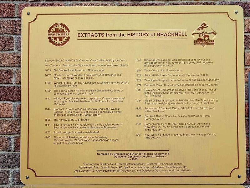
Extracts From The History Of Bracknell
Photographed by Stephen Palmer, February 19, 2023
1. Extracts From The History Of Bracknell Marker
Between 200 BC and 40 AD: 'Caesar's Camp' hillfort built by the Celts.
10th Century: 'Braccan Heal' first mentioned, in an Anglo-Saxon charter
1463 Old Bracknell mentioned in a Goring charter.
1607 Norden's map of Windsor Forest shows Old Bracknell and New Bracknell as separate places.
1759 Windsor Forest Tumpike Act passed, leading to improved access to Bracknell by road.
1760 The original South Hill Park mansion built and thirty acres of common land enclosed for its park.
1813 Windsor Forest Inclosure Act passed: the Crown surrendered forest rights. Bracknell had been in the Forest for more than 700 years.
1847 Bracknell: a small village on the main road to the West of England, a long narrow street occupied principally by small shopkeepers. Population 700 (Directory).
1856 The railway came to Bracknell.
1864 Easthampstead Park mansion built on the ancient estate of Easthampstead Park by the 4th Marquis of Downsnire.
1870 A cattle and poultry market established.
1900 The local brickmaking industry was flourishing. Thomas Lawrence's brickworks had reached an annual output of 12 million
this page online
1949 Bracknell Development Corporation set up to lay out and develop Bracknell New Town on 1870 acres (757 hectares), for a population of 25,000.
1957 Town Centre: first 19 new shops.
1973 South Hill Park Arts Centre opened. Population 38,000.
1973 Twinning oath signed between Bracknell and Opladen/Germany.
1974 Bracknell Parish Council re-designated Bracknell Town Council.
1982 Development Corporation dissolved and transfer of its houses to the District Council completed. (In all the Corporation built 13,117 houses).
1984 Parish of Easthampstead north of the Nine Mile Ride (including Easthampstead Park) absorbed into the Parish of Bracknell
1986 Population of Bracknell District 90,670 of which 51,070 lived in the New Town
1988 Bracknell District Council re-designated Bracknell Forest Borough Council.
1990 Borough population 97.200, about 57,000 of them in the New Town. 37,000 dwellings in the Borough, half of them in the New Town.
1991 H.M. Queen Elizabeth II opened Bracknell's Heritage Centre, "The Look Out"
Erected 1993.
Topics. This historical marker is listed in
Photographed by Stephen Palmer, February 19, 2023
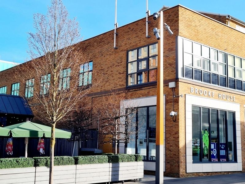
2. Marker on the side of Brooke House
Location. 51° 24.899′ N, 0° 45.01′ W. Marker is in Bracknell, England, in Berkshire. It can be reached from High Street. The marker is on the side of Brooke House facing the Bull pub. Touch for map. Marker is at or near this postal address: 54 High Street, Bracknell, England RG12 1LL, United Kingdom. Touch for directions.

Regionally, this marker is in the Greater South East. Globally, it is on the Atlantic Ocean, in the North Atlantic Region, in Europe, in Atlantic Europe, on one of the British Isles, in the Western World, and in the Anglosphere. Historically, it finds itself in what was once the Roman Empire.
Other nearby markers. At least 8 other markers are within 3 kilometers of this marker, measured as the crow flies: Bracknell and District War Memorial (within shouting distance of this marker); Royal National Lifeboat Institution (approx. 0.3 kilometers away); Edmund's Green Orchard (approx. 1.4 kilometers away); Goddard Way (approx. 1.6 kilometers away); Lily Hill Park (approx. 1.6 kilometers away); Welcome to Lily Hill Park
Photographed by Stephen Palmer, February 19, 2023
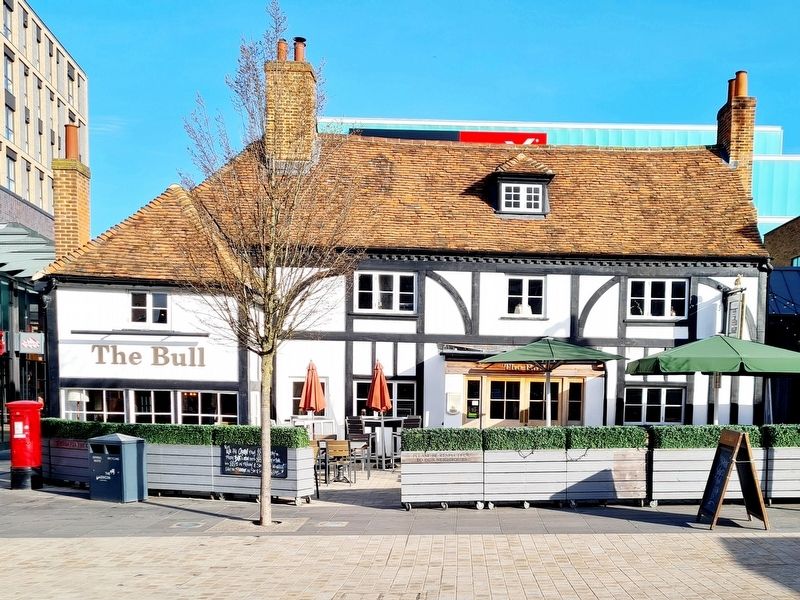
3. The Bull Pub in Bracknell
It's origins are as a 14th century Hall House with 16th, 19th and 20th century additions.
Photographed by Stephen Palmer, February 19, 2023
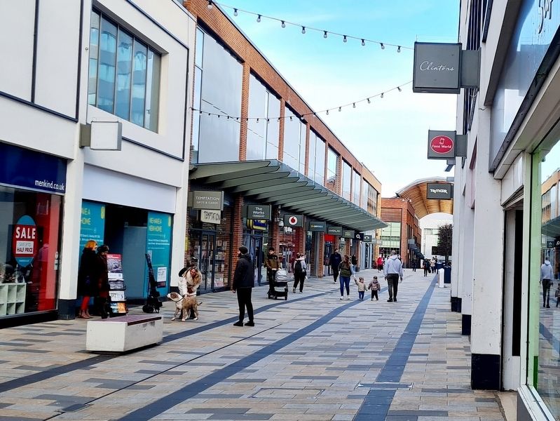
4. Bracknell in 2023
Credits. This page was last revised on March 5, 2023. It was originally submitted on March 5, 2023, by Stephen Palmer of Ascot, England. This page has been viewed 572 times since then and 39 times this year. Photos: 1, 2, 3, 4. submitted on March 5, 2023, by Stephen Palmer of Ascot, England. • Andrew Ruppenstein was the editor who published this page.
