Near Cameron in Le Flore County, Oklahoma — The American South (West South Central)
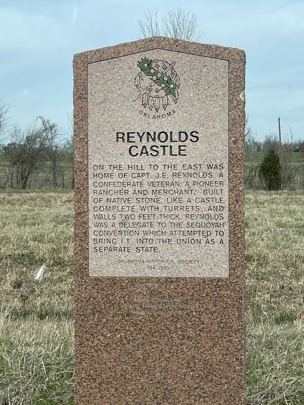
Reynolds Castle
Erected 1995 by Oklahoma Historical Society. (Marker Number 194.)
Topics. This historical marker is listed in this topic list: Notable Buildings.
Location. 35° 9.24′ N, 94° 30.972′ W. Marker is near Cameron, Oklahoma, in Le Flore County. Marker is on Oklahoma Route 112, 0.4 miles north of Old Highway 112, on the left when traveling north. Touch for map. Marker is in this post office area: Cameron OK 74932, United States of America. Touch for directions.
Other nearby markers. At least 8 other markers are within 16 miles of this marker, measured as the crow flies. Battle of Backbone Mountain (approx. 3.7 miles away); Chief Mosholatubbee (approx. 4.2 miles away); Fort Coffee (approx. 7˝ miles away); Choctaw Agency (approx. 7˝ miles away); Skullyville (approx. 7.9 miles away); a different marker also named Skullyville (approx. 8 miles away); Battle of Massard Prairie (approx. 13.3 miles away in Arkansas); Howe War Memorial (approx. 15.6 miles away).
Also see . . . Oklahoma's Historic Castle - [Archived Explore Southern History website]. (Submitted on March 21, 2023.)
Credits. This page was last revised on March 21, 2023. It was originally submitted on March 6, 2023, by Nancy Dougherty of Biwabik, Minnesota. This page has been viewed 139 times since then and 37 times this year. Photo 1. submitted on March 6, 2023, by Nancy Dougherty of Biwabik, Minnesota. • J. Makali Bruton was the editor who published this page.
Editor’s want-list for this marker. • A wide view photo of the marker and the surrounding area together in context. • Can you help?
