Bellevue in Campbell County, Kentucky — The American South (East South Central)
Toll House
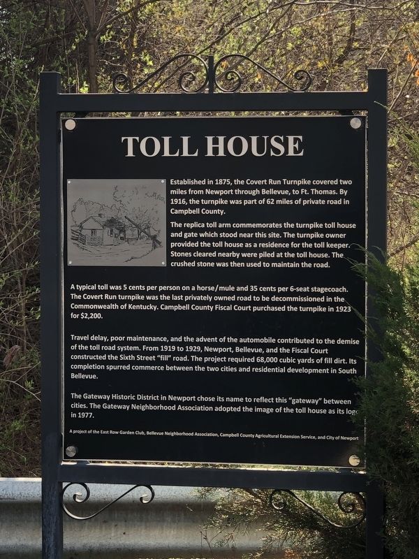
The replica toll arm commemorates the turnpike toll house and gate which stood near this site. The turnpike owner provided the toll house as a residence for the toll keeper. Stones cleared nearby were piled at the toll house. The crushed stone was then used to maintain the road.
A typical toll was 5 cents per person on a horse/mule and 35 cents per 6-seat stagecoach. The Covert Run turnpike was the last privately owned road to be decommissioned in the Commonwealth of Kentucky. Campbell County Fiscal Court purchased the turnpike in 1923 for $2,200.
Travel delay, poor maintenance, and the advent of the automobile contributed to the demise of the toll road system. From 1919 to 1929, Newport, Bellevue, and the Fiscal Court constructed the Sixth Street "fill" road. The project required 68,000 cubic yards of fill dirt. Its completion spurred commerce between the two cities and residential development in South Bellevue.
The Gateway Historic District in Newport chose its name to reflect this "gateway" between cities. The Gateway Neighborhood Association adopted the image of the toll house as its logo in 1977.
Erected by East Row Garden Club • Bellevue Neighborhood Association • Campbell County Agricultural Extension Service • City of Newport.
Topics. This historical marker is listed in these topic lists: Industry & Commerce • Roads & Vehicles. A significant historical year for this entry is 1875.
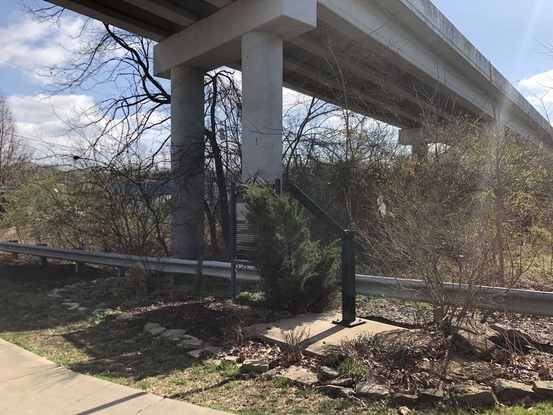
Location. 39° 5.82′ N, 84° 29.015′ W. Marker is in Bellevue, Kentucky, in Campbell County. Marker is on East 6th Street west of Riviera Drive, on the left when traveling west. Marker is underneath and between the Interstate 475 overpass and an elevated exit ramp. Touch for map. Marker is in this post office area: Bellevue KY 41073, United States of America. Touch for directions.
Other nearby markers. At least 8 other markers are within walking distance of this marker. B.H. Kroger House (approx. 0.4 miles away); John Fick House (approx. 0.4 miles away); Robert Howat House (approx. 0.4 miles away); Bellevue, Kentucky (approx. 0.4 miles away); General James Taylor Home (approx. half a mile away); Bellevue Landmark (approx. half a mile away); “H-Bomb” Ferguson (approx. half a mile away); 315 3rd Street (approx. half a mile away). Touch for a list and map of all markers in Bellevue.
Regarding Toll House. Excerpt from The Encyclopedia of Northern Kentucky (Paul A. Tenkotte and James C. Claypool, eds.):
By the late 19th century, farmers were demanding free access to the population centers, and as automobile use began and increased, drivers called for elimination of the tollgates. Judge Albert Seaton Berry vowed to make the roads free; the Newport Business Men's Club also backed the free-road movement. In response, the Kentucky legislature eventually authorized counties to purchase the turnpikes and eliminate the tolls, but county budgets often prevented doing so. Reactions ranged from fund-raising drives to help the county buy the toll roads to destruction of tollgates by masked men and threats against tollgate keepers. By 1916 there were only 60 miles of road on which tolls were still being collected in Campbell Co. Many of the turnpike companies had lost their charters for failure to maintain the roads, and the roads themselves were forfeited. Other turnpike owners merely abandoned their roads to the county. The remaining 60 miles were appraised, and on August 16, 1916, four turnpikes were purchased by the county for their estimated values: Licking Turnpike plus Ripple Creek Turnpike, $17,000; Old State Road Turnpike, $7,750; and Twelve Mile Turnpike, $19,300. … Finally, on December 18, 1923, the Covert Run Turnpike, the last toll road in the county, was purchased for $2,500, only $900 more than the 1916 estimated value. Thus ended the 100-year turnpike era in Campbell Co.
Credits. This page was last revised on March 8, 2023. It was originally submitted on March 8, 2023, by Duane and Tracy Marsteller of Murfreesboro, Tennessee. This page has been viewed 150 times since then and 43 times this year. Photos: 1, 2. submitted on March 8, 2023, by Duane and Tracy Marsteller of Murfreesboro, Tennessee.

