Cape Canaveral in Brevard County, Florida — The American South (South Atlantic)
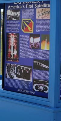
Explorer I
America's First Satellite
— 31 January 1958 —
The effort to launch Explorer I was led by the U.S. Army Ballistic Missile Agency (ABMA). Military personnel assigned to the ABMA from 1956 to approximately 1965 wore this patch on the left shoulder of their uniforms. Each color in the patch represents the combat arms of the Infantry (blue), Artillery (red), and Armor (yellow). The missile represents the Ordnance Corps, and the lightning strikes stand for the Signal Corps.
A modified Army Redstone missile, often referred to as a Jupiter-C (but more correctly as a Juno I), served as the launch vehicle for Explorer I. Standing 68-feet tall and just under 6-feet in diameter, the converted Intermediate Range Ballistic Missile produced 86,000 pounds of thrust at liftoff by burning liquid oxygen and Hydyne, (a mixture of hydrazine and other fuels), in its first stage. Three upper stages were composed of small solid propellant rockets. Shown above undergoing checkouts in a hangar, the booster had the letters “UL” painted on its side as a numbering code based on numbers assigned to the letters in the word Huntsville. The “UL” represents the number 29.
The Explorer I satellite was composed of a scaled down 4th stage rocket motor that remained attached to the forward payload section. The satellite measured 80-inches long and 6-inches in diameter. It weighed just 30.8 pounds, of which 10.13 pounds was scientific instrumentation. Onboard the satellite were instruments to study temperature, micrometeorite impacts, and a special Geiger counter package to measure the intensity of cosmic radiation. Two radio transmitters, a high-powered (60 milliwatts at 108.3 megacycles), and a low-power unit (10 milliwatts at 108 megacycles) sent data from the satellite to receiving stations on the ground.
Men behind sealed blast doors and the 2-foot thick walls of the LC26 blockhouse, spent part of their Friday evening on 31 January 1958 counting down the final seconds attempting to bring American into the Space Age. At 10:48 p.m. EST, the ground began to rumble and the surrounding area was bathed in bright light as the rocket carrying America’s first satellite came alive, riding a plume of fire into the sky and into history. Approximately 6 minutes into the flight, the craft reached an orbital speed of more than 17,600 miles per hour. Less that two hours after launch, radio signals from the satellite were received at stations on the West Coast of the United States, providing that it had travelled around indeed in orbit. Officially known as “1958 Alpha,” as it was the first satellite launch in 1958, Explorer I was the third satellite to reach Earth orbit after two Sputnik satellites were launched by the Soviet Union on 4 October and 3 November 1957. The second Sputnik satellite carried a dog named Laika. The photo in the center above is a close up of the Explorer I satellite. Note that this is how it was launched; riding out in the open. The big round “tub” that the satellite is sitting on contained the solid rockets that made up the second and third stages. This tub began to spin a few minutes before launch to dive the satellite stability, much like a bullet spins when it comes out of the gun barrel. The black stripe on the side of the tub made it easier to observe the spin rate. The gantry shown in the photo on the left was moved back out of the way shortly before the launch, which is shown in the photo on the far right.
Data from the Geiger counter Instrument aboard Explorer I proved the theorized existence of regions of charged particles around Earth. These areas became known as the Van Allen Radiation belts, names after James A. Van Allen, who designed the instrument. Explorer I ceased all transmission of data on 23 May 1958 when its batteries dies. The satellite made a fiery reentry over the Pacific Ocean at approximately 5:42 a.m. EST on 31 March 1970 after completing more than 58,000 orbits. Until it reentered, Explorer was the oldest man-made object in space.
Many people around the country worked on various aspects of the Explorer I mission. The photo (above left), shows some of those who were in the Complex 26 blockhouse at the time of the launch standing at the left of the console. Albert Zeiler, Capt. Ballard Small, seated at the console from foreground, Terry Greenfield, C.D. Sweat, Isom “Ike” Rigell, Carl Whiteside, and W.O. “Curly” Chandler, standing behind those at the consoles, Robert “Bob” Moser, and Milt Chambers. The photo on the right is of the more well known participants during a press conference in Washington D.C. after Explorer I had reached orbit; from left to right, Dr. William H. Pickering of the Jet Propulsion Laboratory (JPL), Dr. James A. Van Allen of the University of Iowa, and Dr. Werner von Braun of the Army Ballistic Missile Agency (ABMA).
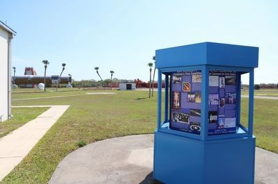
Erected by Cape Canaveral Space Force Museum.
Topics. This historical marker is listed in these topic lists: Air & Space • Exploration • Science & Medicine. A significant historical date for this entry is January 31, 1958.
Location. 28° 26.638′ N, 80° 34.327′ W. Marker is in Cape Canaveral, Florida, in Brevard County. Marker can be reached from Museum Circle south of Lighthouse Road, on the left when traveling south. Touch for map. Marker is at or near this postal address: 191 Museum Cir, Cape Canaveral FL 32920, United States of America. Touch for directions.
Other nearby markers. At least 8 other markers are within walking distance of this marker. Launch Complex 26 (here, next to this marker); Juno II (here, next to this marker); Redstone (here, next to this marker); Jupiter (here, next to this marker); a different marker also named Launch Complex 26 (a few steps from this marker); a different marker also named Launch Complex 26 (within shouting distance of this marker); a different marker also named Launch Complex 26 (within shouting distance of this marker); First United States Space Launch (within shouting distance of this marker). Touch for a list and map of all markers in Cape Canaveral.
Also see . . . Cape Canaveral Space Force Museum. (Submitted on March 16, 2023.)
Credits. This page was last revised on March 16, 2023. It was originally submitted on March 10, 2023, by Dave W of Co, Colorado. This page has been viewed 121 times since then and 15 times this year. Photos: 1, 2. submitted on March 10, 2023, by Dave W of Co, Colorado. • Bernard Fisher was the editor who published this page.

