
Near Cynthiana in Harrison County, Kentucky — The American South (East South Central)
Battle of Keller's Bridge
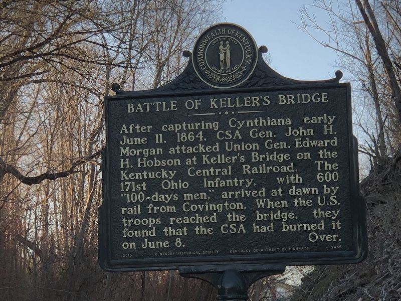
Photographed by Duane and Tracy Marsteller, March 4, 2023
1. Battle of Keller's Bridge Marker, Side One
CSA engaged Hobson on the hills above the A. Keller Rd. Union troops retreated beyond the railroad, which then divided the lines. Hobson surrendered after being trapped in the river bend. This was Morgan’s final victory and was the highlight of his Last Kentucky Raid. Battlefield on National Register of Historic Places, 2002. Over.
Erected 2015 by Kentucky Historical Society • Kentucky Department of Highways. (Marker Number 2455.)
Topics and series. This historical marker is listed in this topic list: War, US Civil. In addition, it is included in the Kentucky Historical Society series list. A significant historical date for this entry is June 11, 1864.
Location. 38° 24.211′ N, 84° 18.868′ W. Marker is near Cynthiana, Kentucky, in Harrison County. It is at the intersection of Williamstown
this page online

Regionally, this marker is in Kentucky’s Outer Bluegrass. It is also in the American South and specifically in the Upper South. Globally, it is in North America, the Western Hemisphere, the Western World, and the Anglosphere. Historically, it finds itself in what was once the territory of the Mississippian Culture and also the Antebellum South.
Other nearby markers. At least 8 other markers are within 2 miles of this marker, measured as the crow flies: Former Site of Banneker High School (approx. 1.1 miles away); The Old Cemetery (approx. 1.2 miles away); The Confederates Here (approx. 1.2 miles away); Old Log Court House (approx. 1.3 miles away); 9/11 20th Anniversary Memorial (approx. 1.3 miles away); Memorial to the September 11, 2001 Attack on America (approx. 1.3 miles away); Harrison County World War II/Korean War Memorial (approx. 1.3 miles away); Korean War Memorial (approx. 1.3 miles away).
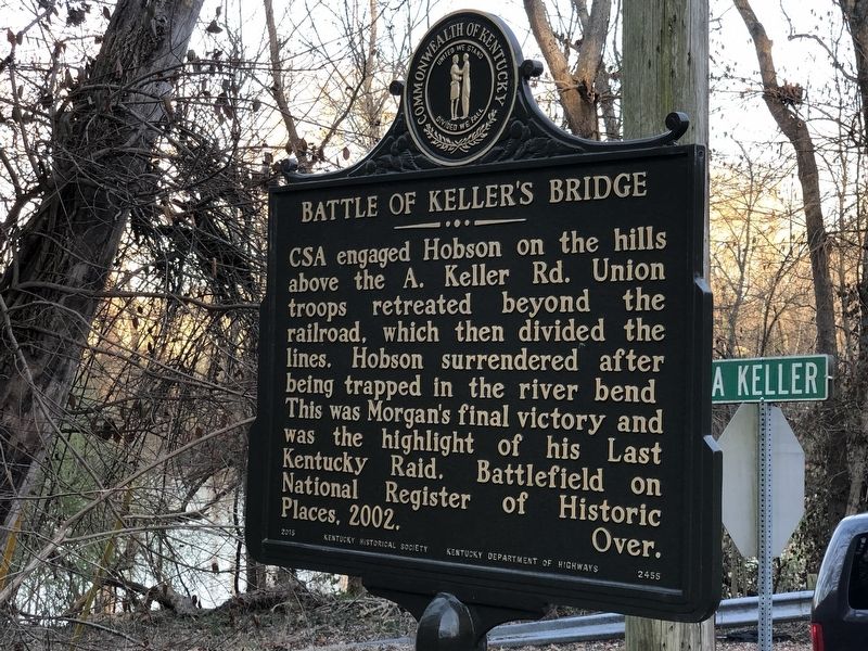
Photographed by Duane and Tracy Marsteller, March 4, 2023
2. Battle of Keller''s Bridge Marker, Side Two
Also see . . .
1. Damned Green Yanks: The 171st Ohio at Keller’s Bridge, Kentucky. The men of the 171st Ohio had expected to spend their 100 days' enlistment guarding prisoners of war, but that changed when Confederate Gen. John Hunt Morgan began raiding northern Kentucky again. (Dan Masters, Emerging Civil War, posted July 17, 2020) (Submitted on March 12, 2023, by Duane and Tracy Marsteller of Murfreesboro, Tennessee.)
2. Second Battle of Cynthiana Battlefield. National Register nomination (PDF) and photographs (separate PDF) submitted for the site, which includes the Keller's Bridge Battlefield. (National Park Service) (Submitted on March 12, 2023, by Duane and Tracy Marsteller of Murfreesboro, Tennessee.)
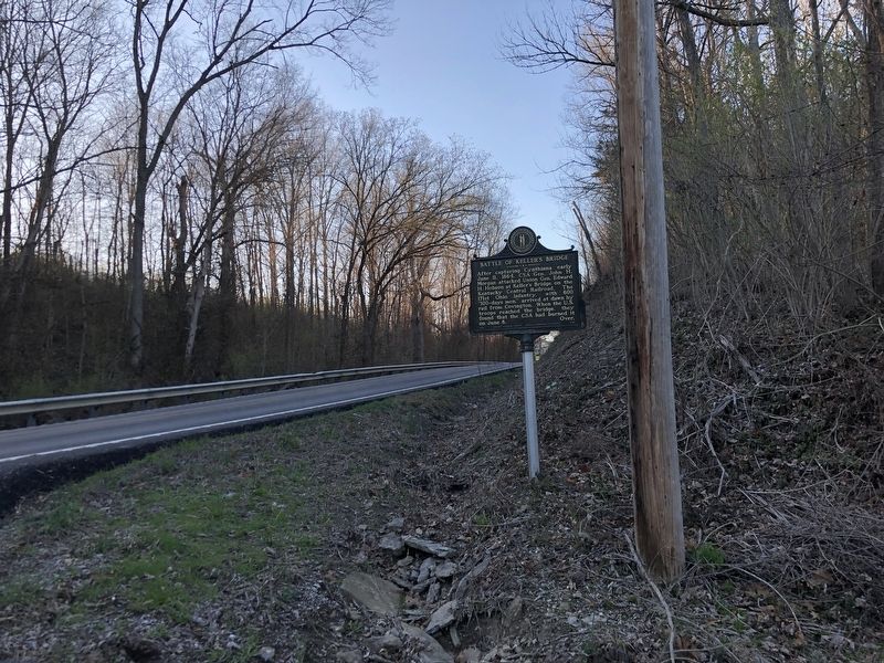
Photographed by Duane and Tracy Marsteller, March 4, 2023
3. Battle of Keller's Bridge Marker
Credits. This page was last revised on March 12, 2023. It was originally submitted on March 12, 2023, by Duane and Tracy Marsteller of Murfreesboro, Tennessee. This page has been viewed 856 times since then and 68 times this year. Photos: 1, 2, 3. submitted on March 12, 2023, by Duane and Tracy Marsteller of Murfreesboro, Tennessee.
