Wawa in Algoma District, Ontario — Central Canada (North America)
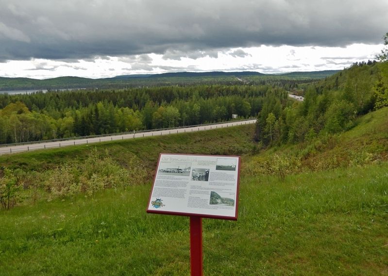
Our TransCanada Link
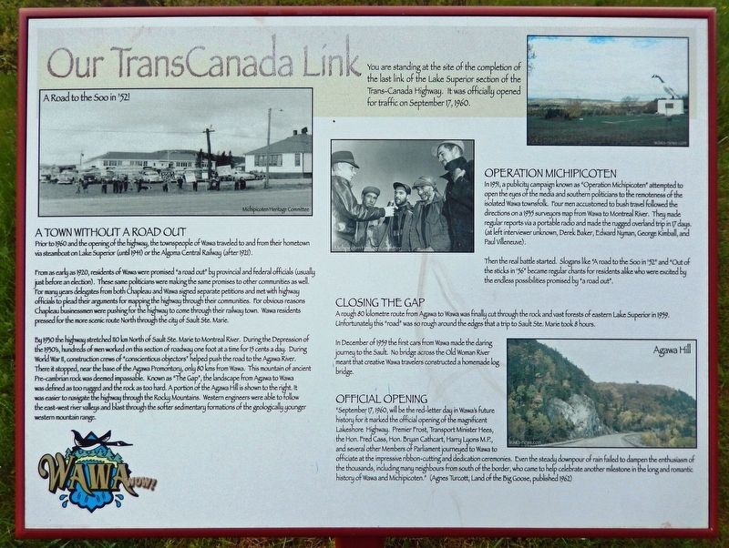
You are standing at the site of the completion of the last link of the Lake Superior section of the Trans-Canada Highway. It was officially opened for traffic on September 17, 1960.
A Town Without a Road Out
Prior to 1960 and the opening of the highway, the townspeople of Wawa traveled to and from their hometown via steamboat on Lake Superior (until 1941) or the Algoma Central Railway (after 1921).
From as early as 1920, residents of Wawa were promised "a road out" by provincial and federal officials (usually just before an election). These same politicians were making the same promises to other communities as well. For many years delegates from both Chapleau and Wawa signed separate petitions and met with highway officials to plead their arguments for mapping the highway through their communities. For obvious reasons Chapleau businessmen were pushing for the highway to come through their railway town. Wawa residents pressed for the more scenic route North through the city of Sault Ste. Marie.
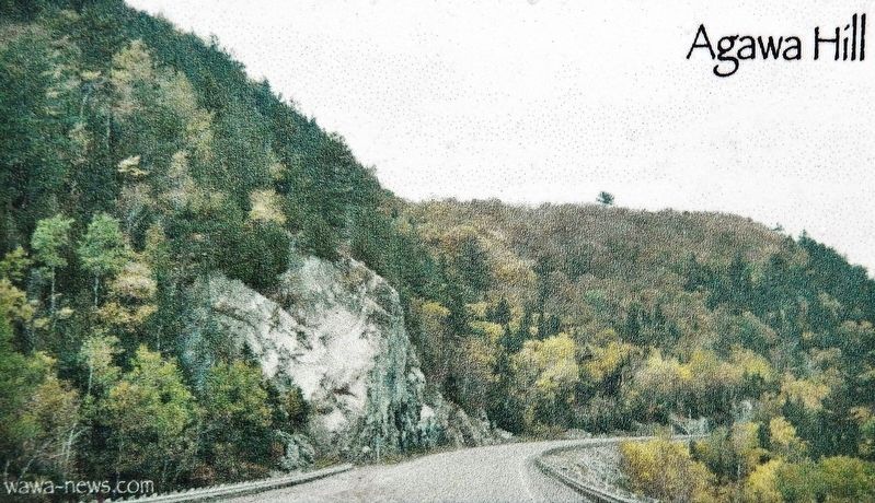
By 1930 the highway stretched 110 km North of Sault Ste. Marie to Montreal River. During the Depression of the 1930's, hundreds of men worked on this section of roadway one foot at a time for 15 cents a day. During World War II, construction crews of "conscientious objectors" helped push the road to the Agawa River. There it stopped, near the base of the Agawa Promontory, only 80 kms from Wawa. This mountain of ancient Pre-cambrian rock was deemed impassable. Known as "The Gap", the landscape from Agawa to Wawa was defined as too rugged and the rock as too hard. A portion of the Agawa Hill is shown to the right. It was easier to navigate the highway through the Rocky Mountains. Western engineers were able to follow the east-west river valleys and blast through the softer sedimentary formations of the geologically younger western mountain range.
Operation Michipicoten
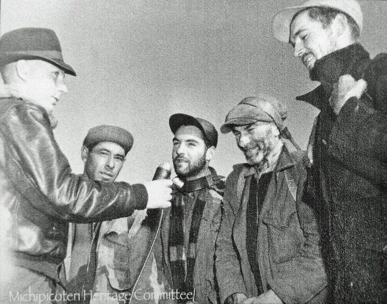
In 1951, a publicity campaign known as "Operation Michipicoten" attempted to open the eyes of the media and southern politicians to the remoteness of the isolated Wawa townsfolk. Four men accustomed to bush travel followed the directions on a 1935 surveyors map from Wawa to Montreal River. They made regular reports via a portable radio and made the rugged overland trip in 17 days. (at left interviewer unknown, Derek Baker, Edward Nyman, George Kimball, and Paul Villeneuve).
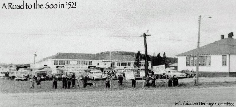
Then the real battle started. Slogans like "A road to the Soo in '52" and "Out of the sticks in '56" became regular chants for residents alike who were excited by the endless possibilities promised by "a road out"
Closing the Gap
A rough 80 kilometre route from Agawa to Wawa was finally cut through the rock and vast forests of eastern Lake Superior in 1959. Unfortunately this "road" was so rough around the edges that a trip to Sault Ste. Marie took 8 hours.
In December of 1959 the first cars from Wawa made the daring journey to the Sault. No bridge across the Old Woman River meant that creative Wawa travelers constructed a homemade log bridge.
Official Opening
”September 17, 1960, will be the red-letter day in Wawa's future history for it marked the official opening of the magnificent Lakeshore Highway. Premier Frost, Transport Minister Hees, the Hon. Fred Cass, Hon. Bryan Cathcart, Harry Lyons M.P., and several other Members of Parliament journeyed to Wawa to officiate at the impressive ribbon-cutting and dedication ceremonies. Even the steady downpour of rain failed to dampen the enthusiasm of the thousands, including many neighbours from south of the border, who came to help celebrate another milestone in the long and romantic history of Wawa and Michipicoten." (Agnes Turcott, Land of the Big Goose, published 1962)
Topics. This historical marker is listed in this topic list: Roads & Vehicles. A significant historical date for this entry is September 17, 1960.
Location. 47° 58.406′ N, 84° 46.989′ W. Marker is in Wawa, Ontario, in Algoma District. Marker can be reached from Mission Road (Provincial
Highway 101) just east of Trans-Canada Highway (Provincial Highway 17), on the left when traveling north. Marker is located at the Wawa Tourist Information Centre. Touch for map. Marker is at or near this postal address: 26 Mission Road, Wawa ON P0S 1K0, Canada. Touch for directions.
Other nearby markers. At least 8 other markers are within walking distance of this marker. Wawa — an unforgettable name (a few steps from this marker); Construction of the Trans-Canada Highway / La Construction de la Route Transcanadienne (a few steps from this marker); Birth of a Legend (a few steps from this marker); Sir James Dunn (within shouting distance of this marker); William Teddy (within shouting distance of this marker); Louise (Niganigijigok) Towab (within shouting distance of this marker); Lady Dunn (within shouting distance of this marker); Alex Ross (within shouting distance of this marker). Touch for a list and map of all markers in Wawa.
Also see . . . Trans-Canada Highway and the Wawa Goose.
Wawa's connection to Sault Ste Marie Ontario was only limited in travel by rail or by steamboat. This final connection along the Eastern shores of Lake Superior was finally complete in 1960 where travellers are now treated to the shores of Lake Superior, or the vast colours of the forest through Lake Superior Provincial park.(Submitted on March 17, 2023, by Cosmos Mariner of Cape Canaveral, Florida.)
Credits. This page was last revised on March 18, 2023. It was originally submitted on March 14, 2023, by Cosmos Mariner of Cape Canaveral, Florida. This page has been viewed 89 times since then and 22 times this year. Photos: 1, 2, 3, 4, 5. submitted on March 17, 2023, by Cosmos Mariner of Cape Canaveral, Florida.
