Amsterdam Oud-West , North Holland, Netherlands — Northwestern Europe
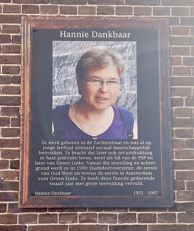
Hannie Dankbaar
Hannie Dankbaar 1952 - 2007
Ze werd geboren in de Zocherstraat en was al op jonge leeftijd intensief sociaal maatschappelijk betrokken. Ze bracht dat later ook tot uitdrukking in haar politieke leven, eerst als lid van de PSP en later van Groen Links. Vanuit die instelling en achter- grond werd ze in 1990 Stadsdeelvoorzitter, de eerste van Oud-West en tevens de eerste in Amsterdam voor Groen Links. Ze heeft deze functie gedurende twaalf jaar met grote toewijding vervuld.
She was born on Zocherstraat and was intensively socially involved at a young age. She later expressed this in her political life, first as a member of the PSP (“Pacifist Socialist Party”) and later of the Groen Links (“Green Left”). From that attitude and background, she became district chairman in 1990, the first of Oud-West and also the first in Amsterdam for the Groen Links. She held this position with great dedication for twelve years.
Erected by Geef Straten Een Gezicht.
Topics and series. This historical marker is listed in these topic lists: Government & Politics • Women. In addition, it is included in the Give Streets a Face / Geef Straten Een Gezicht series list. A significant historical year for this entry is 1952.
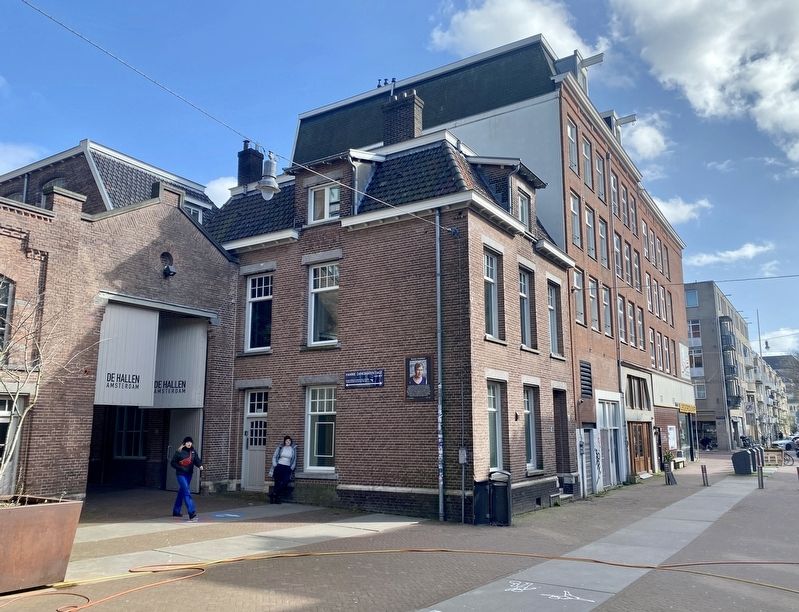
Location. 52° 22.012′ N, 4° 52.161′ E. Marker is in Amsterdam, Noord-Holland (North Holland). It is in Amsterdam Oud-West. Marker is at the intersection of Tollensstraat and Hannie Dankbaarpassage, on the left when traveling south on Tollensstraat. Touch for map. Marker is at or near this postal address: Tollensstraat 61, Amsterdam, Noord-Holland 1053 RS, Netherlands. Touch for directions.
Other nearby markers. At least 8 other markers are within walking distance of this marker. Kwakersstraat (about 150 meters away, measured in a direct line); Dirk van Nimwegen (1904-1969), Verzetsman (Member of the Resistance) (about 210 meters away); Jan Hanzenstraat (approx. 0.3 kilometers away); Gerard Borst (approx. 0.3 kilometers away); Wenslauerstraat / Wenslau Street (approx. 0.3 kilometers away); WG-terrein (compound) (approx. 0.4 kilometers away); Korte Blekersstraat (approx. 0.4 kilometers away); Marius van Bouwdijk Bastiaanse (approx. 0.4 kilometers away). Touch for a list and map of all markers in Amsterdam.
Credits. This page was last revised on December 31, 2023. It was originally submitted on March 15, 2023, by Andrew Ruppenstein of Lamorinda, California. This page has been viewed 296 times since then and 118 times this year. Photos: 1, 2. submitted on March 15, 2023, by Andrew Ruppenstein of Lamorinda, California.

